A front decayed over the Southeast and adjacent Gulf of Mexico in early July. Ernesto formed along the Atlantic
portion, but an elongated low remained over the Gulf of Mexico. On the 5th, a mesoscale low formed south of Louisiana
and moved quickly northeast into the Florida Panhandle very early on July 6th. The system broadened and became
apparent in surface observations across central Georgia on the 7th. The system moved east-northeast across southern
South Carolina entering the Atlantic on the 8th. Paralleling the coast of North Carolina, it became better defined as
it moved east of Cape Hatteras. The system was declared Tropical Storm Fay on the afternoon of the 9th, and then
turned north parallel to the Mid-Atlantic States. As it entrained dry air and took on a less tropical appearance, a
little additional strengthening occurred on the 10th. Weakening thereafter, Fay made landfall near Atlantic City, New
Jersey on the afternoon of the 10th. As it devolved into a low-level swirl, the system weakened on its trek across
eastern New Jersey and eastern New York, becoming a remnant low north of New York City early on the 11th. The low
was eventually absorbed by another low over southeast Canada late on the 11th.
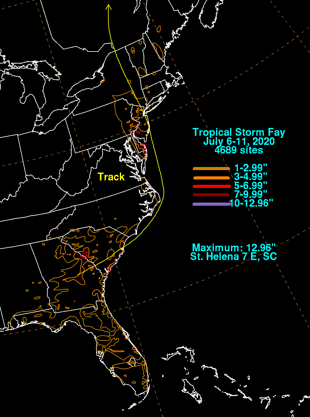
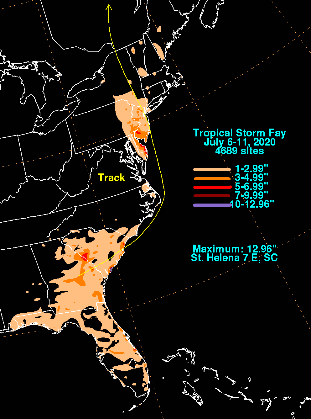
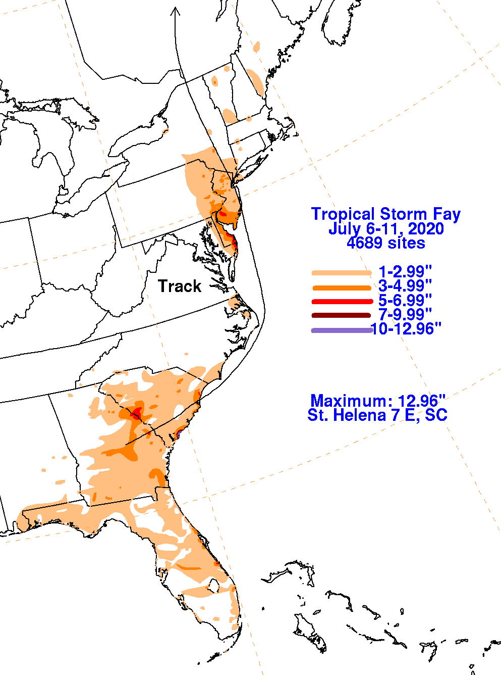
The graphics below show the storm total rainfall for Fay, which used rain gage information from the National Weather
Service River Forecast Centers, Forecast Offices, and CoCoRAHS.
 |
 |
 |