A tropical disturbance formed in the central tropical Atlantic on September 12th, steered by deep layer ridging to the north.
Conditions were marginally favorable for development, so it took until the morning of the 14th for the system to become organized
into a tropical depression, despite westerly vertical wind shear. That evening, the system was upgraded to Tropical Storm Fiona.
Continuing to move west, Fiona crossed the Leeward Islands as a strengthening tropical storm, becoming a hurricane as it approached
Puerto Rico, After making landfall near Punta Tocon on the afternoon of the 18th, and then Boca de Yuma in the Dominican Republic
that night, Fiona took a more definite west-northwest course as it rounded the southwest periphery of the steering ridge, weakened
by an approaching upper level trough. Fiona became a major hurricane north of Hispaniola while turning northwest very early on the
21st. Peaking in intensity late on the 22nd, Fiona then accelerated north- northeast through the western Atlantic, becoming a strong
extratropical cyclone before striking eastern Nova Scotia near Hart Island. For Canada, the reading of 932.7 hPa was the country's
lowest on record, breaking the long standing record of 940.2 hPa set at St. Anthony, Newfoundland on January 21, 1977. The cyclone
subsequently weakened while tracking through eastern Canada.
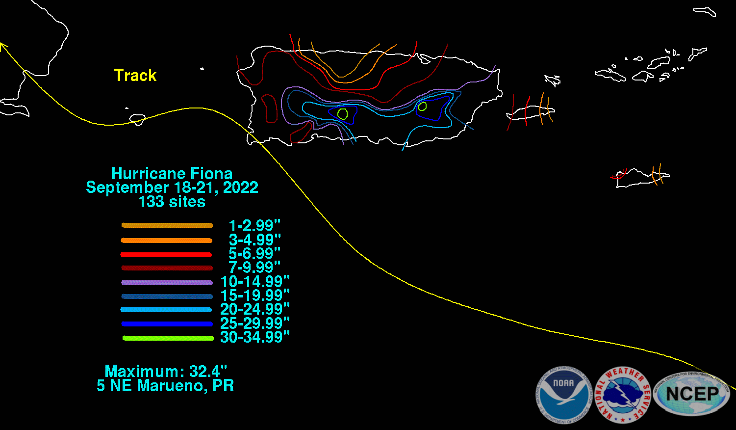
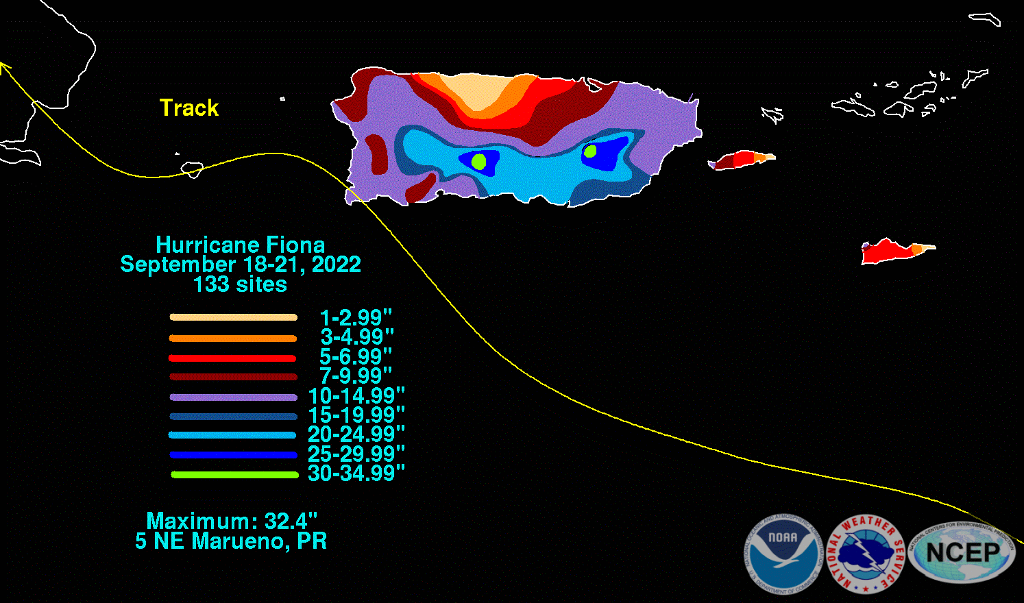
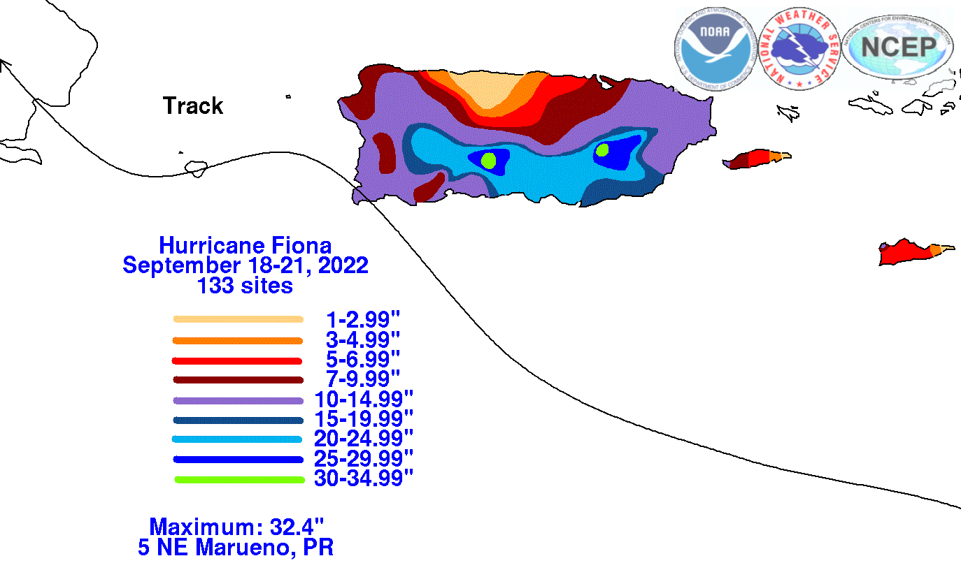
The graphics below show the storm total rainfall for Fiona, which used rain gage information from National Weather Service River Forecast
Centers, National Weather Service Forecast Offices, and CoCoRAHS.
 |
 |
 |