A cold front left the Texas coast on September 4th, entering the
Gulf of Mexico. By the 5th, the
convective band was entirely over the Gulf, lying between Vera Cruz,
Mexico and Tampa, Florida.
The frontal boundary split, leaving the tail end in the western Gulf of
Mexico to organize. By the
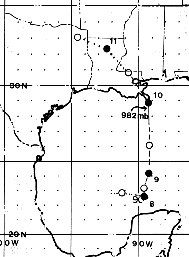
7th, convection organized into a spiral band structure, was deep
convection was transitory. A surface
circulation formed just after midnight on the 7th about 180 nautical
miles northwest of Merida. By
that afternoon, the system developed into a gale center, and the system
was named Tropical Storm
Florence.
Florence drifted eastward on the 7th, following the weakness left by
the old frontal trough, then
became stationary when the Bermuda High strengthened across the
southwest Atlantic. The mean
mid-level trough was located over the lower Mississippi Valley, which
forced a northward movement
to Florence. The cyclone accelerated northward on the 9th, making
landfall over the western Mississippi
Delta just prior to midnight, reaching hurricane status for 12 hours
before landfall. Florence lost all
its deep convection as it passed New Orleans and the west end of
Lake Pontchartrain. The surface
low moved into northeast Texas before dissipating, but the mid-level
center of Florence moved
northeastward through the Midwest. Below is the track of this
cyclone,
provided by the
National Hurricane Center.
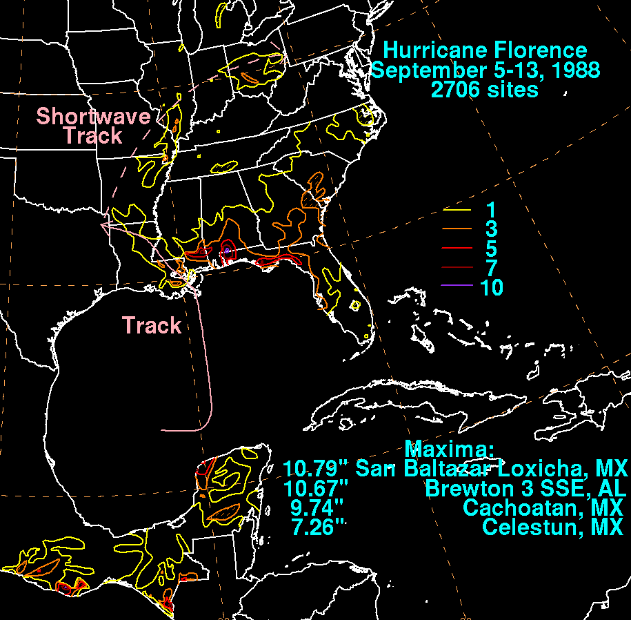
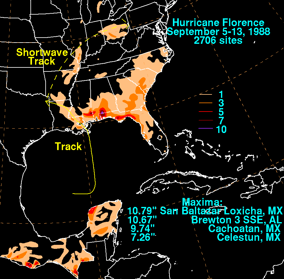
The graphics below show the storm total rainfall for Florence.
Note
the maximum well to the east
of the point of landfall across the western Florida panhandle and
southern Alabama, as well as across
the northwest Yucatan peninsula. Rainfall information was
obtained from both the National Climatic
Data Center in Asheville, North Carolina and the Comision Nacional del
Agua, the parent agency of
Mexico's national weather service.
 |
 |
|