Hurricane Florence - September
13-14, 2006
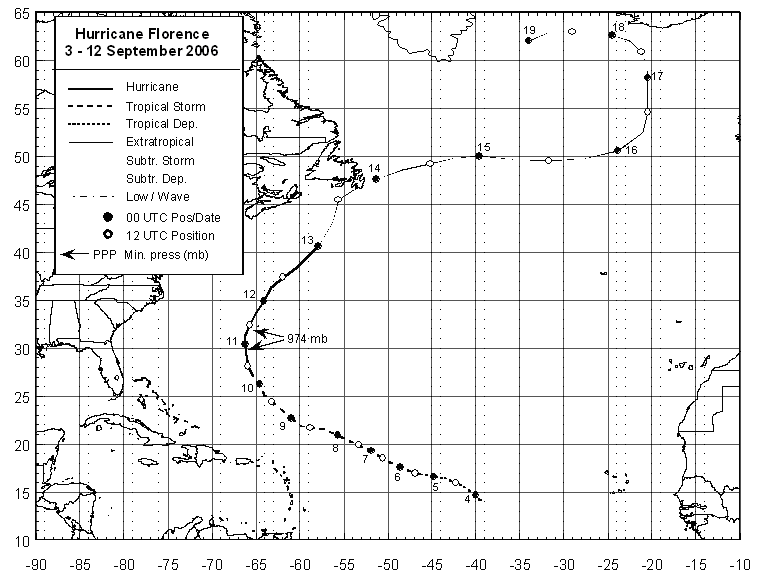
A tropical disturbance passed off the African coat late in August, and became better
organized south of the Cape Verde Islands. On September 3rd, it became a tropical
depression west of the Cape Verde Islands. Southwesterly vertical wind shear led
to slow development, with the system becoming a tropical storm on the 5th and a
hurricane on the 10th southeast of Bermuda. The cyclone moved within 60 miles of
Bermuda, bringing rainfall amounts just over an inch or 25 mm. After bypassing the
isle, strengthening continued as maximum sustained winds reached 90 mph. Slightly
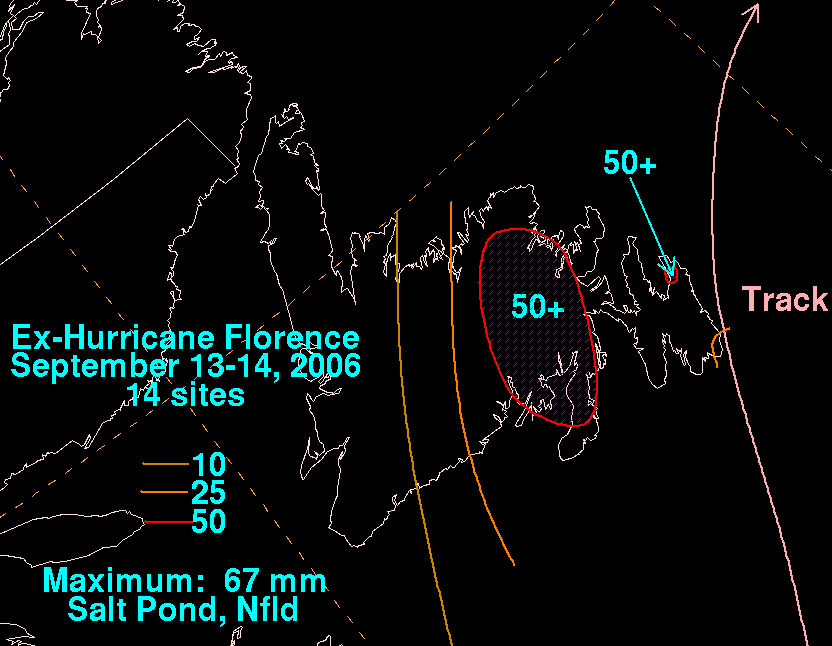
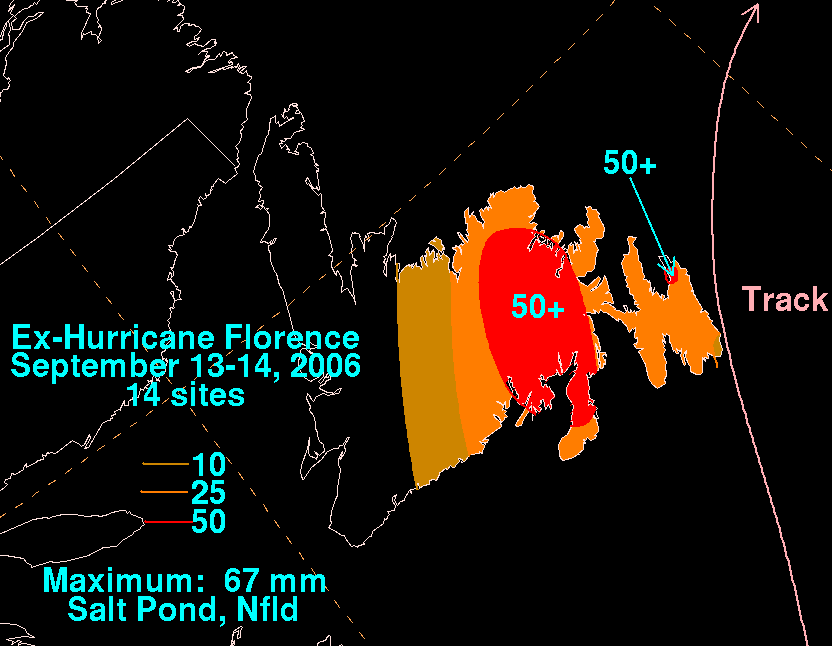
weakening as it became extratropical, Florence restrengthened as it grazed Cape
Race, spreading moderate to heavy rain across Newfoundland as well as high winds.
Below is its track, provided by the National Hurricane Center.
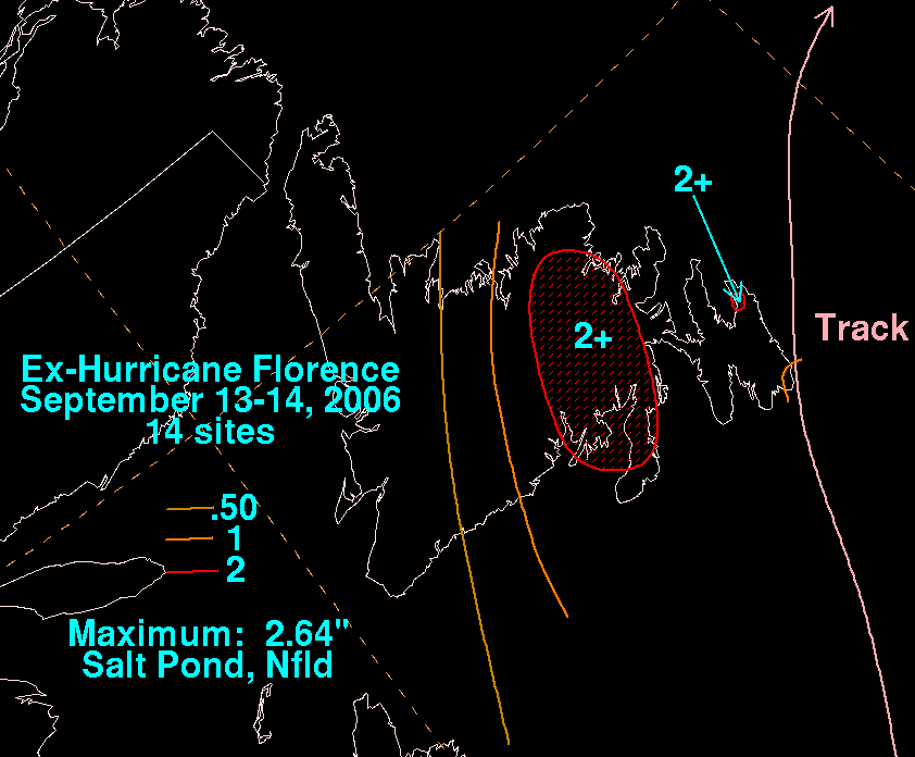
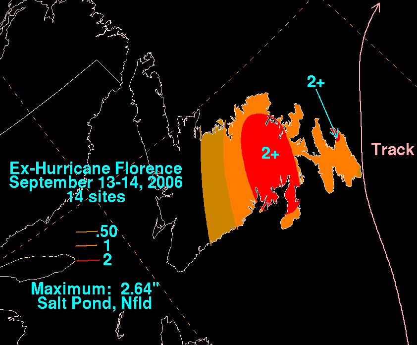
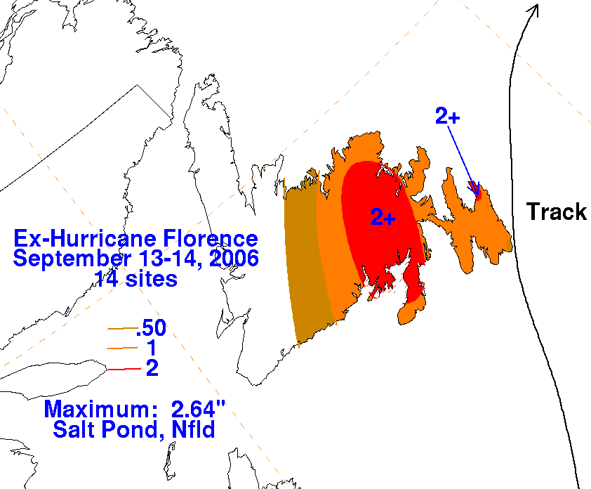
The graphics below show the storm total rainfall for Florence, which used rainfall data
provided by Chris Fogarty of the Canadian Hurricane Center, part of Environment Canada.
