A tropical wave moved off the west coast of Africa on August 30th as an area of low pressure near Senegal. The system
was well organized within a favorable upper level environment and became a tropical depression on the 31st and a tropical
storm on September 1st. While the system struggled with vertical wind shear, it achieved hurricane status on the 4th
and became a major hurricane on the 5th. On the 6th, vertical wind shear increased, and Florence weakened into a
tropical storm on the 7th. Strengthened began again on the 8th due to a more favorable upper level environment,
with Florence regaining hurricane intensity on the 9th. Moving west, Florence reached peak intensity late on the 10th.
The hurricane moved west to west-northwest while remaining a significant hurricane approaching North Carolina. On the 14th,
Florence made landfall near Wrightsville Beach and slowed its forward motion as it turned west to west-southwest, bringing
prolonged heavy rainfall to portions of the Carolinas. Florence weakened after landfall, becoming a tropical storm late
on the 14th and a tropical depression early on the 16th while over South Carolina. The system tracked up the Appalachians
as an elongating area of low pressure on the 17th, turning eastward across southern New England on the 18th and then
the north Atlantic as a frontal wave, dissipating on the 22nd before reaching Europe.
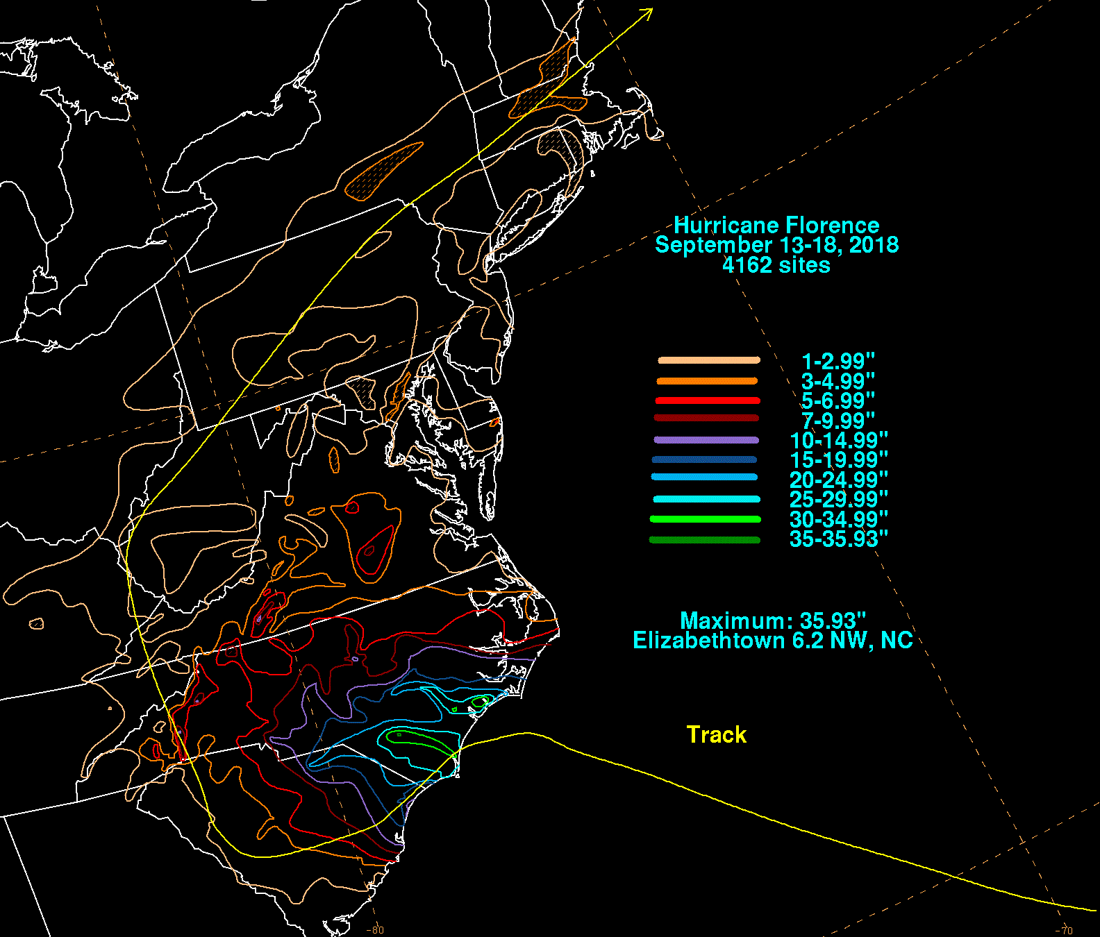
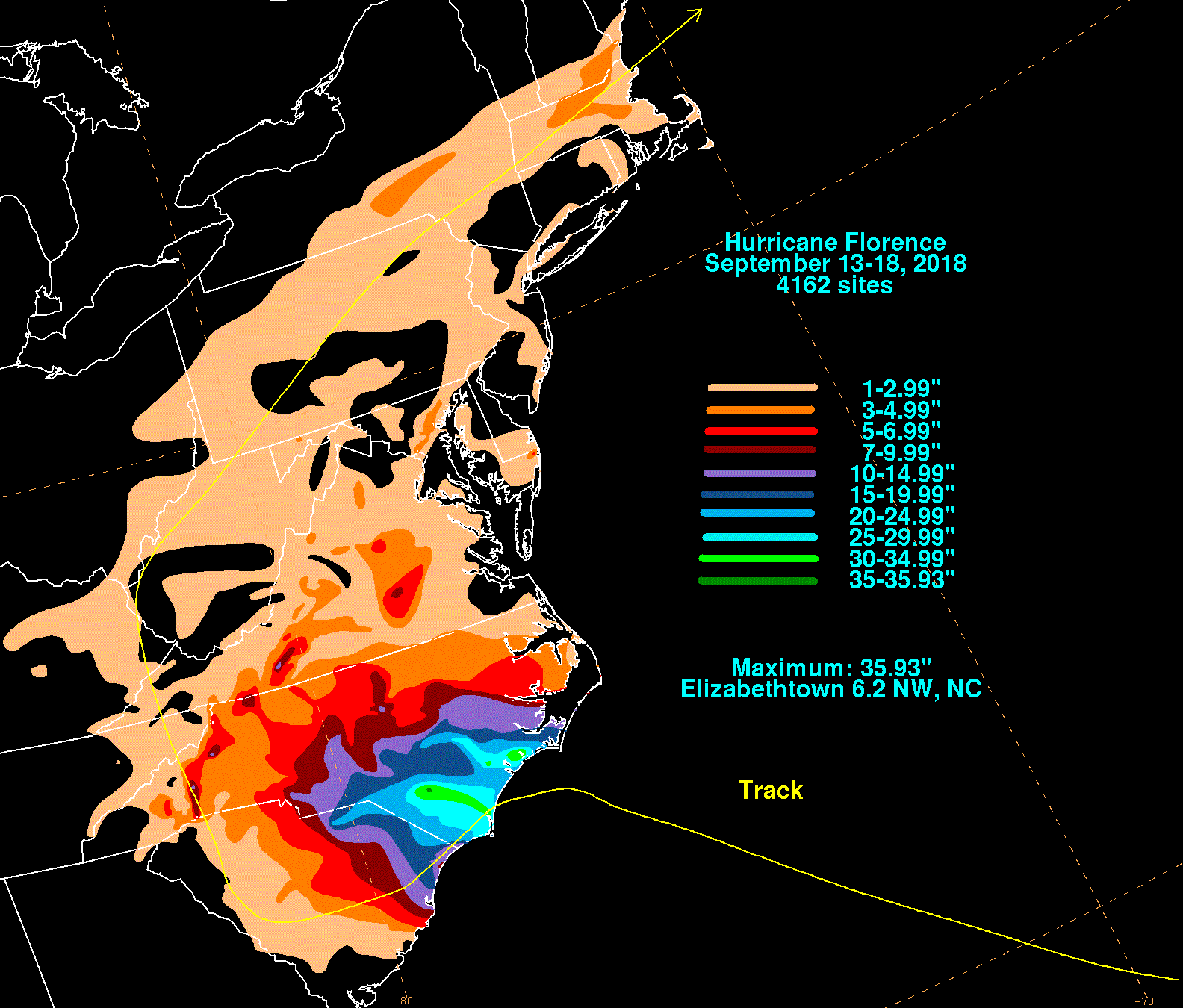
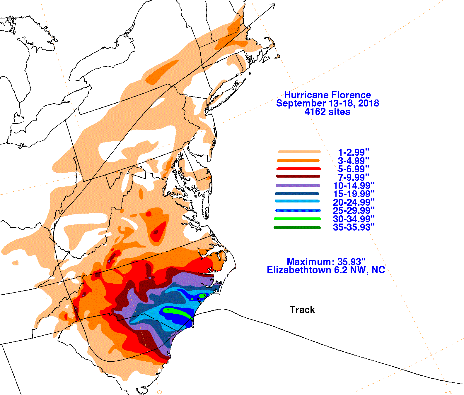
The first three graphics below show the storm total rainfall for Florence, which used rain gage information from the National Weather Service
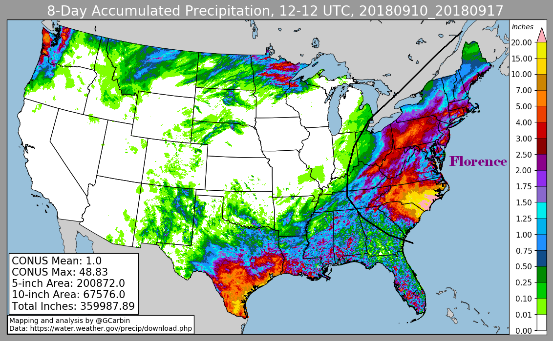
River Forecast Centers, Forecast Offices, and CoCoRAHS. The fourth image includes the official National Weather Service rainfall estimates for
Florence, which includes radar-derived information.
Due to its slow movement, Florence became the wettest known tropical cyclone on record for the Carolinas.
 |
 |
 |
 |