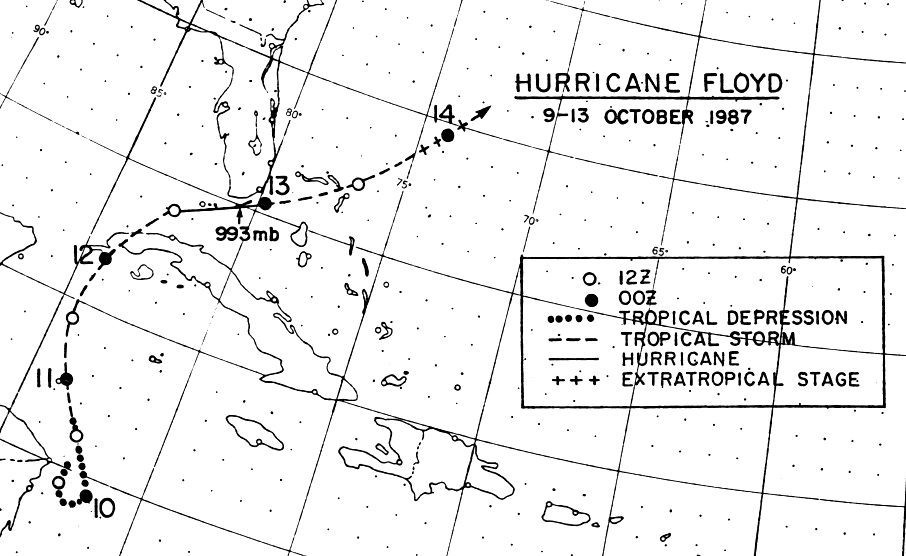
A broad area of low pressure was noted over the Gulf of Honduras on
the
5th of October. Over the next three days, the system drifted
southeast due
to high pressure building to its north. By the 9th, the system
has become well-
defined enough to be classified as a tropical depression. It
continued to make
its anticyclonic loop before moving northward on the 10th as it reached
tropical
storm status.
A front moving through the Gulf of Mexico steered the cyclone into
the southeast
Gulf of Mexico as it strengthened into a hurricane on the
12th. Thereafter, the
interaction between the tropical cyclone and a frontal wave developing
to its north
steered Floyd in a more easterly direction through the Florida
Keys. It quickly
became disorganized, and was absorbed by a large area of low pressure
between
Florida and Bermuda on the 13th. Below is the track of this cyclone,
provided by
the National Hurricane Center.
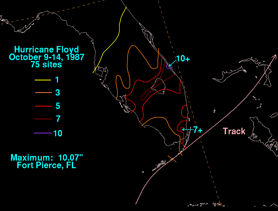
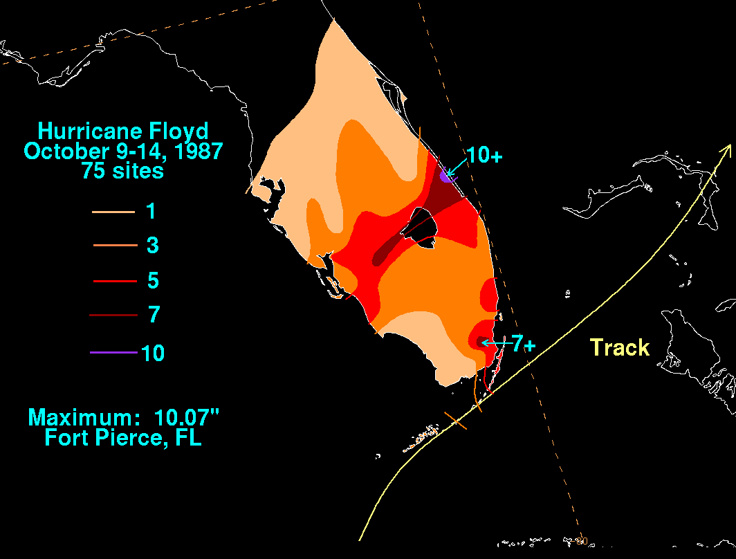
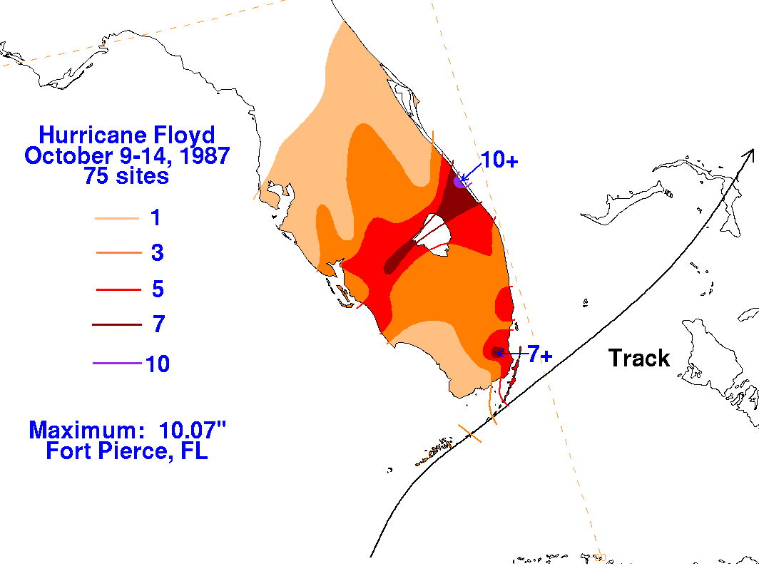
The graphics below show the storm total rainfall for Floyd, using
data provided by the National Climatic Data
Center. Note
the maximum across central Florida, to the left of the track of the
cyclone.
|
|
 |
 |