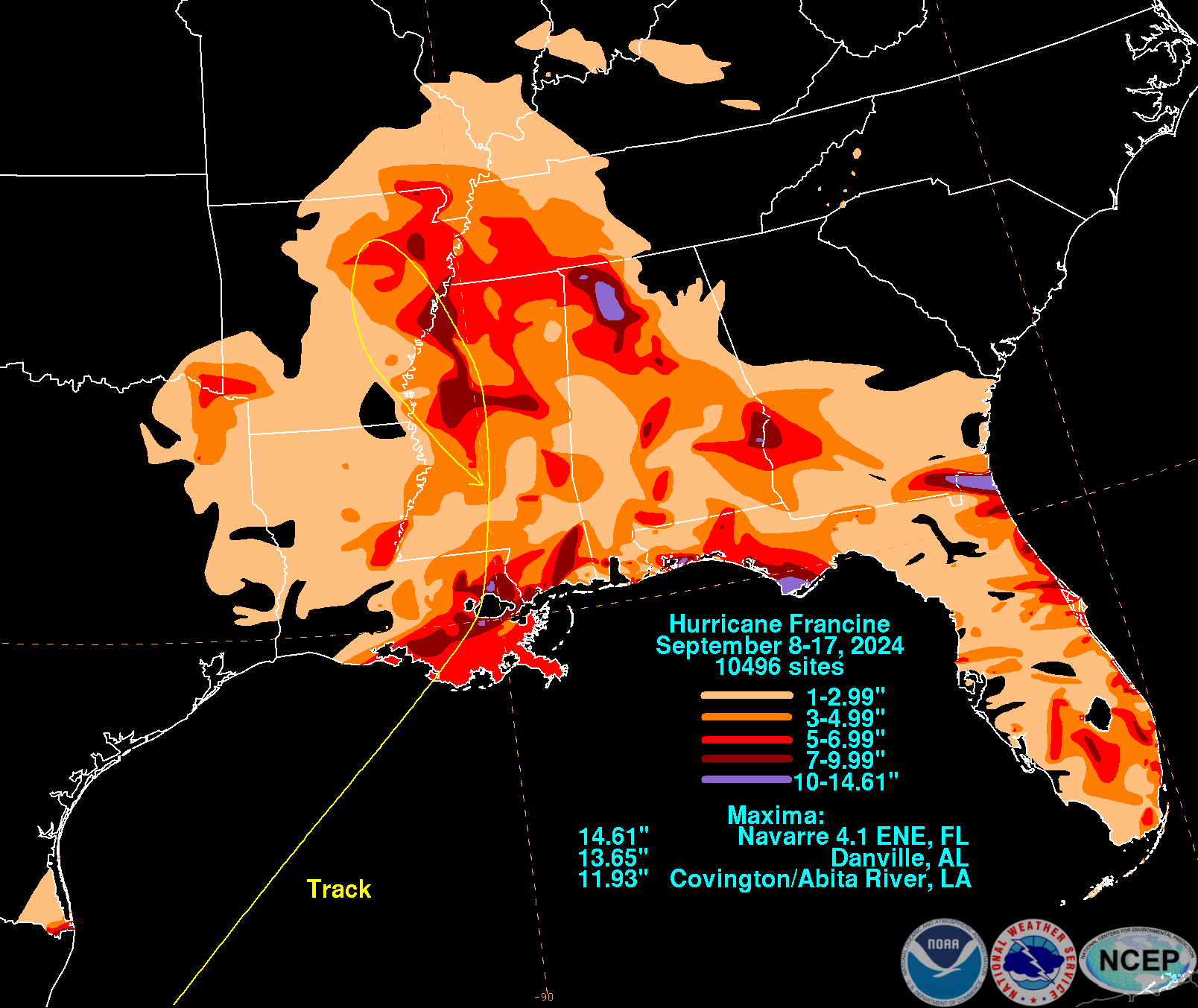
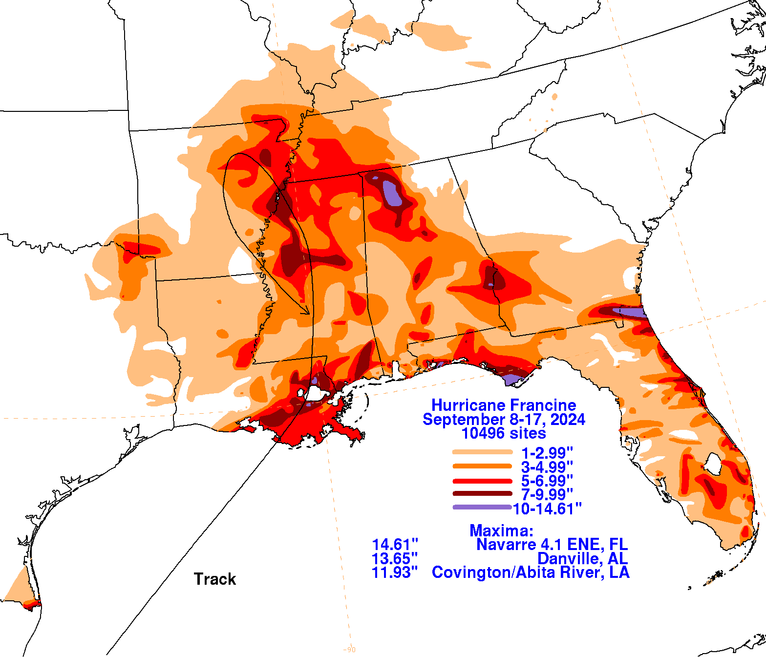
On August 28th, a tropical wave moved across the tropical Atlantic. After a few days, thunderstorms became more organized but this would be short lived. The wave moved uneventfully through the Caribbean Sea over the next week, crossing the Yucatan Peninsula into the Bay of Campeche/southwest Gulf of Mexico. During this crossing, the system gained some organization and a low pressure area formed on September 7th. It then moved north-northwest, in a fujiwara/binary interaction with a convective frontal wave which had previously been pulsing offshore southwest Louisiana and southeast Texas. The two cyclones merged by the morning of the 9th, with the baroclinic zone remaining near the cyclone, with a wedge of cooler/drier air across easternmost Mexico which helped accelerate winds across its western side. The system gained sufficient convective organization to be considered a tropical storm later that morning. Francine initially moved northwest, but that motion became impeded by the denser air mass across southern Texas and eastern Mexico. The cyclone turned northeast, guided by an upper level low to its north and a portion of the subtropical ridge across Florida. Francine never completely shed the front in its vicinity, which caused heavy rain to fall well to its east across Florida within its warm advection pattern. Francine strengthened on approach to Louisiana, becoming a hurricane on the night of the 10th. During the early evening of the 11th, Francine made landfall in Terrebonne Parish. Once convection was stripped away from the center, Francine turned north and co-located with the upper level low, occluding late on the 12th as an extratropical cyclone as it approached Memphis. Making part of a cyclonic loop, Francine moved south through Arkansas on the 13th and Mississippi on the 14th around the west side of its convective triple point low near the coast of the Southeast (which would become designated Potential Tropical Cyclone Eight). Its circulation aloft was slower to spin down, helping to cause heavy rains along the central Gulf Coast through the 16th in the confluence zone between the two systems.
The graphics below show the storm total rainfall for Francine, which used rain gage information from National Weather Service River Forecast Centers, xMACIS2, National Weather Service Forecast Offices, and CoCoRAHS.
 |
 |
 |