A low pressure area was spawned by an upper level low drifting
southwest
across the
Sunshine state on the 10th. The tail end of a cold front moved to the
proximity of this
cyclone due to the tail of an upper trough passing offshore the
Southeast.
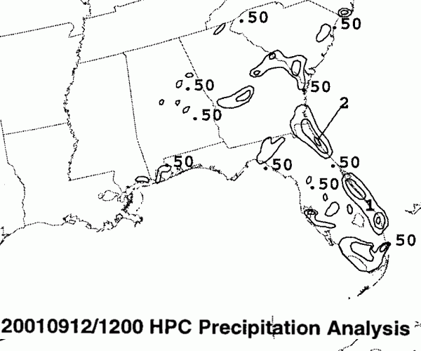
The low then
began slow development, becoming a tropical depression on the 12th
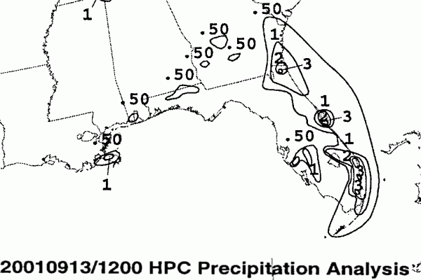
and a tropical
storm on the 13th.
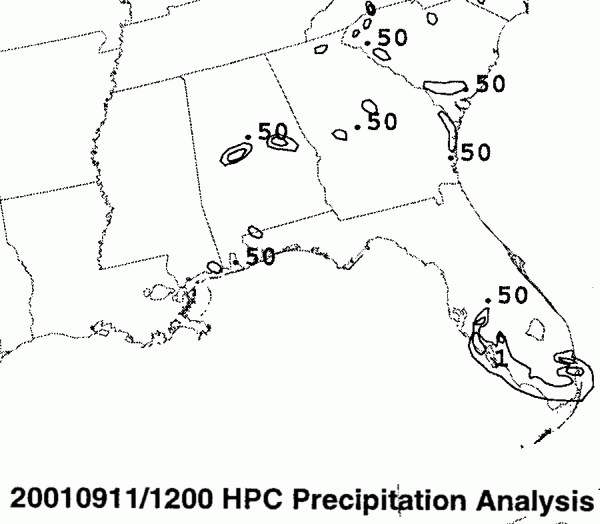
Heavy rains began impacting northern Florida on the 11th and 12th in
the proximity
of the old stationary front draping north of the cyclone...Jacksonville
reported 6.32"
in the 24 hour period ending at 12z on the 13th.
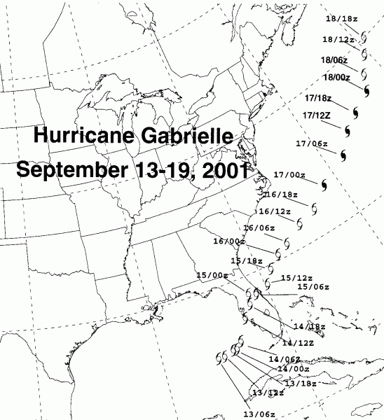
Moving around the northwest periphery of a weak 500 hPa ridge,
Gabrielle
tracked
across Florida on the 14th. As this occurred, a second cold front
and 500 hPa trough
were moving in from the northwest. As it emerged offshore the east
coast early on the
14th, Gabrielle had the appearance of a nearly extratropical cyclone,
with no deep
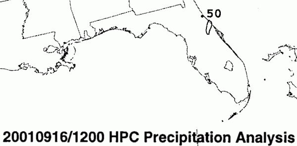
convection. It continued tracking northeast, intermittently
bursting
thunderstorms north
of its center through the 17th before finally becoming fully
nontropical.
Its track lies
below.
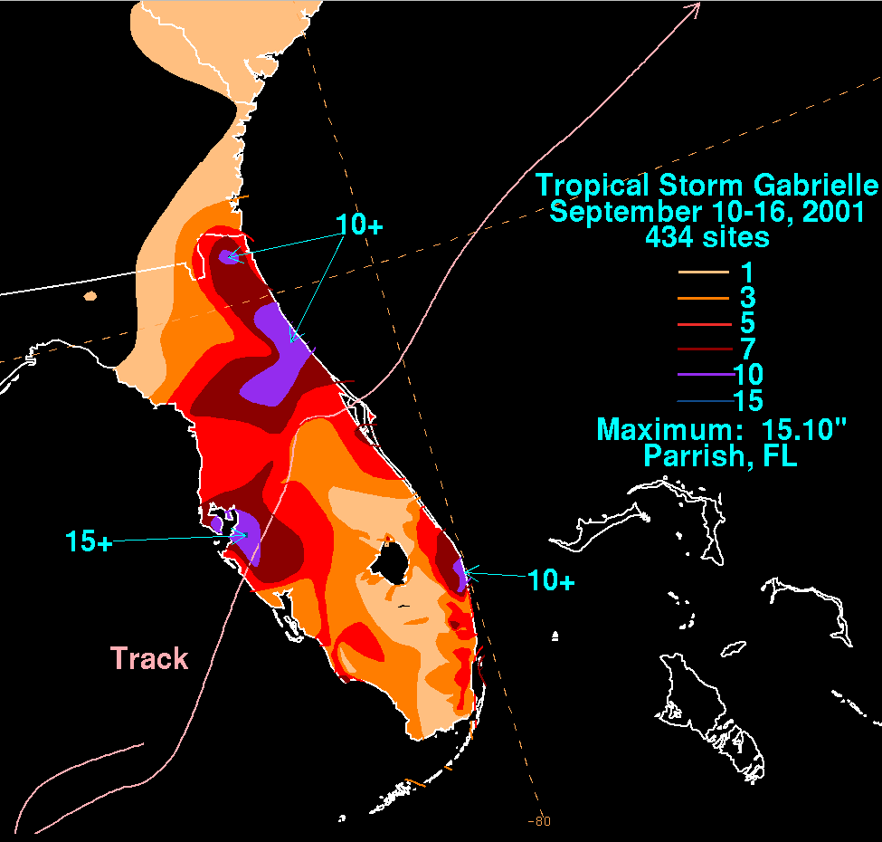
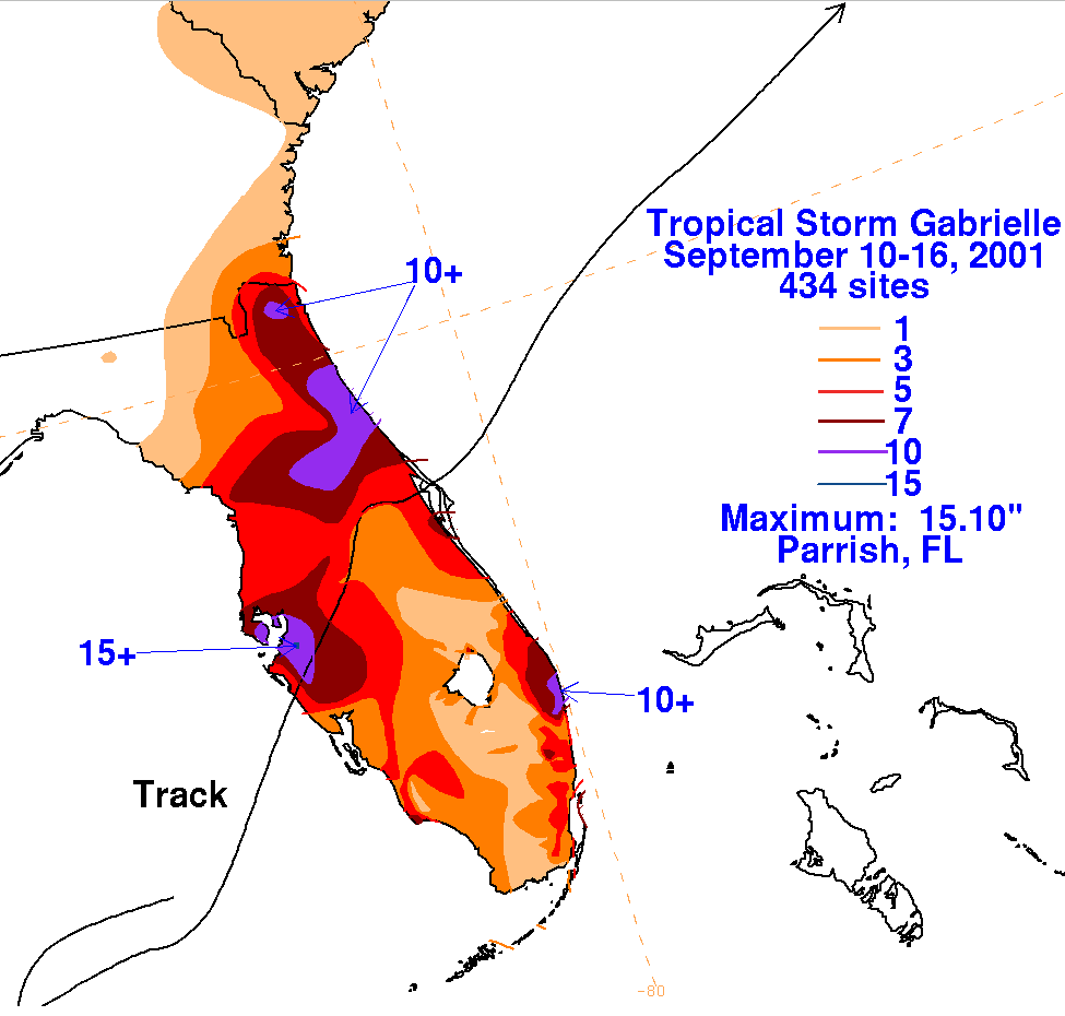
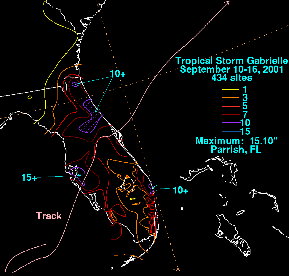
Below are the storm total precipitation maps for Gabrielle, prepared
from South Florida Water Managament
District data and cooperative observer data archived at the National
Climatic Data Center. Note the trio of
maxima
near West Palm Beach,
Tampa, and Jacksonville. Much of the precipitation in Tampa
occurred
as
the center of the cyclone sloshed ashore just south of Tampa Bay.
|
|
 |
 |
Below is the calendar for Daily Precipitation Maps. Note that
the 24-hour periods end
at 12z that morning.