A low formed along a weakening frontal boundary by September 3rd. As it drifted eastward, the system slowly
organized, becoming more tropical in appearance by the 5th. Thereafter, an upper low developed to its west,
increasing wind shear and the low took on a more extratropical character on the 6th. The low began to move
west-northwest, and on the 7th, convection returned to the periphery of the low. By the 8th, the cyclone became
a subtropical storm approaching North Carolina. Later that day, Gabrielle had transitioned into a tropical storm as
its circulation became better defined and convection moved closer to its center. As it approached the coast, thunder-
storm activity shifted south of the center due to northerly vertical wind shear, and the tropical storm made landfall
as an exposed circulation, recurving through eastern sections of the state, soon weakening to a tropical depression
and moving out to sea.
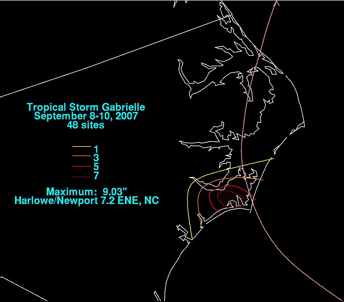
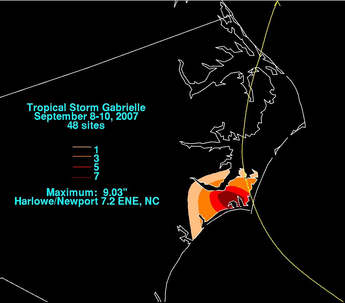
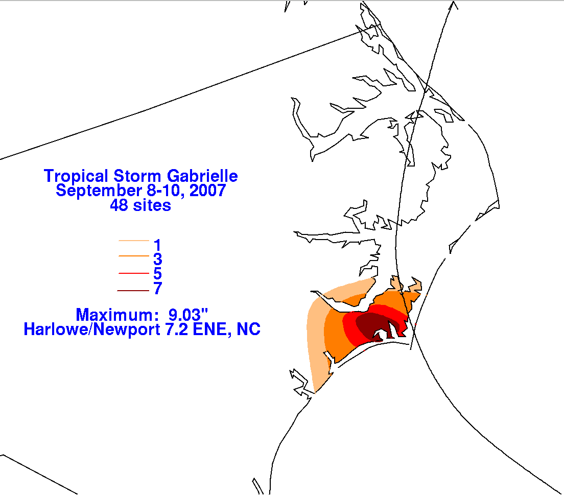
Below are the storm total graphics, prepared with data from the NWS River Forecast Centers and CoCoRAHS.
The bulk of the rainfall from Gabrielle fell from the coastal marshes of North Carolina southward, displaced
south of Gabrielle's center by northerly vertical wind shear.
 |
 |
 |