A tropical wave with an area of low pressure moved offshore western Africa on August 24. By the following day,
convection became more concentrated with the system while approaching the Cape Verde Islands. Its large cyclonic
circulation persisted for a few days while the system tracked westward. A smaller area of low pressure formed on
August 31, which detached from its parent system on September 1. The low became better defined though thunderstorm
activity eluded the system. A tropical wave approached this low from the east, leading to an increase in convection
while the low was south of Puerto Rico. By the afternoon of September 4, the system had become a tropical depression.
The system sheared apart on September 5 near the eastern tip of Hispaniola, and the remnants moved northward. By late on
September 9, the system had reacquired tropical depression status and the system strengthened into a tropical storm
that night to the south of Bermuda. It peaked in strength while near Bermuda on September 10 before moving
northeast into a highly sheared environment the next day. Its center dissipated on the afternoon of September 13.
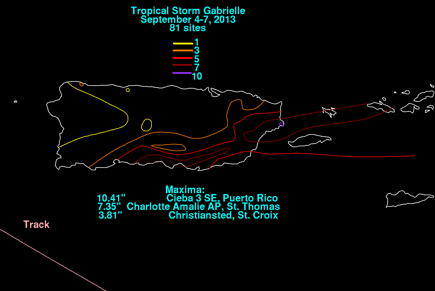
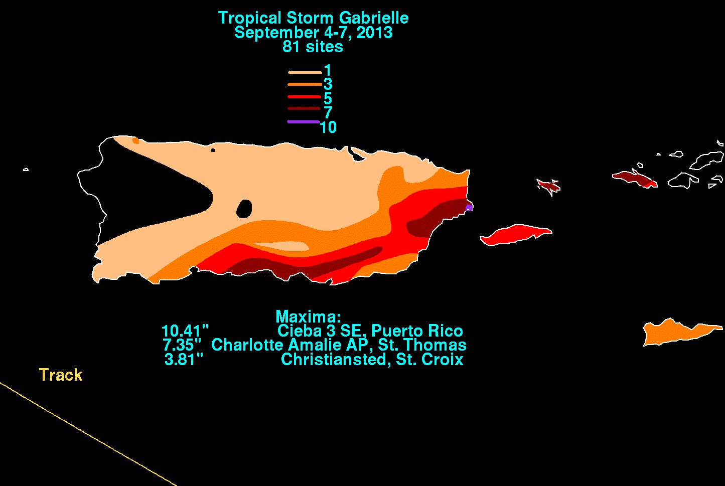
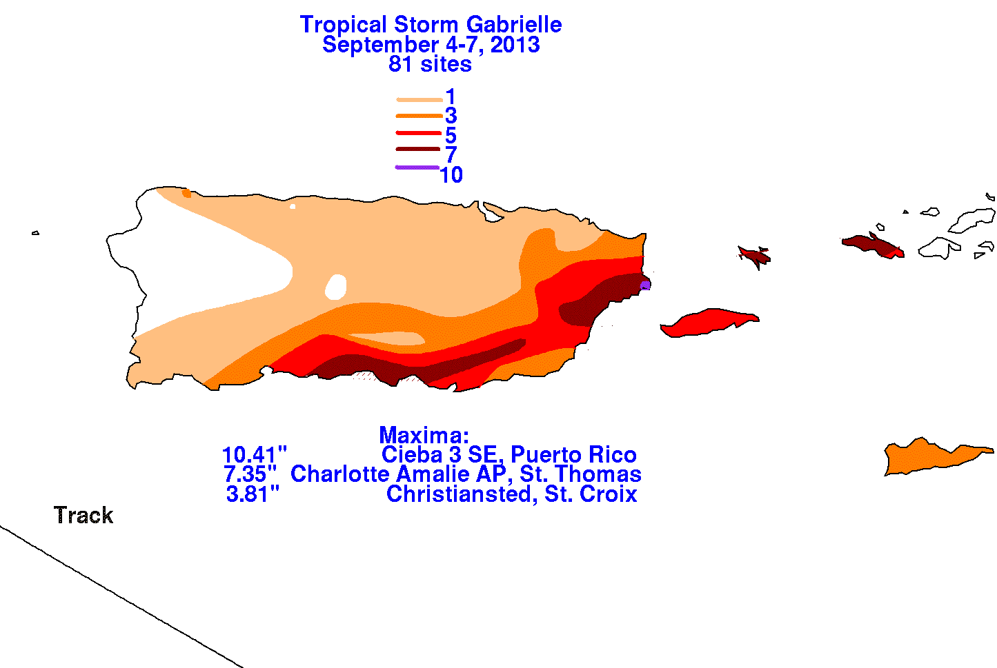
The graphics below show the storm total rainfall for Gabrielle, which used information from the National Weather
Service River Forecast Centers, Forecast Offices, and CoCoRAHS.
 |
 |
 |