The genesis of Gaston can be traced to a cold front that moved off the coast of the Carolinas into the
Atlantic on 22 August, and drifted southward the following day before stalling on 24 August. Surface
observations indicate that a broad low formed along the weakening front on 25 August. Thunderstorm
activity associated with the low remained sporadic and disorganized until late on 26 August, when the
convective activity began to increase and acquire a more banded structure. Early morning visible and
microwave satellite imagery on 27 August suggest that the low had developed into the seventh tropical
depression of the season by that morning, about 115 n mi east-southeast of Charleston, South Carolina.
It is of note that the frontal zone from which Gaston formed also initiated the development of Tropical
Storm Hermine two days later.
Steering currents were very weak
initially and the depression drifted slowly southward. Convective
banding continued to increase on 27 August and the depression
slowly strengthened, becoming a
tropical storm early the next day as it drifted westward about
130 n mi southeast of Charleston.
Strengthening continued on 28 August, and the first
reconnaissance
aircraft to reach the cyclone
found maximum flight level winds of 67 mph early that afternoon.
Early on 29 August steering currents became
better defined, with the development of a mid- to
upper-level ridge
northeast of Gaston and the approach of a mid-latitude trough into
the Appalachians.
This steering pattern allowed the tropical
cyclone to begin moving northwestward toward the South
Carolina
coast, and the forward motion of the cyclone increased from about 3 mph
to 8 mph overnight
on the 28/29 August. Radar and
satellite imagery showed that Gaston continued to get better
organized
as it approached the coast. Doppler radar observations
indicate that Gaston reached hurricane strength
just before it made
landfall near Awendaw, South Carolina, between Charleston and
McClellanville,
mid-morning on 29 August, with maximum sustained winds estimated near
75 mph. The tropical
cyclone then steadily
weakened while moving northward across northeastern South
Carolina.
On the evening of 29 August Gaston weakened to a
tropical depression over northeastern South
Carolina. Gaston then turned north-northeastward ahead of
the trough moving into the
eastern United
States and the cyclone crossed eastern North
Carolina and southeastern Virginia during the day.
Data from the
Chesapeake Light C-MAN site and a ship near the mouth of Chesapeake
Bay
indicated that Gaston had regained tropical storm strength on the
evening of 30 August, while the
center was still inland near
Yorktown, Virginia. Tropical storm force winds at this time were
confined to a small area over water southeast of the center; however,
the primary impact of Gaston
in Virginia was flooding
produced by 6-12 in rains that occurred over about an 8 h
period.
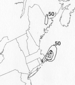
Gaston moved across the southern portion of
Chesapeake Bay and crossed the Delmarva Peninsula
shortly just after midnight on 31 August. The tropical cyclone
then accelerated
northeastward, passing
about 60 n mi south of Nantucket Island,
Massachusetts later that day, as Hermine swung around its
eastern side across southeast Massachusetts. Gaston strengthened
slightly as it
continued to accelerate to
the east-northeast, before becoming
extratropical south of the Canadian Maritimes on the morning of 1
September. The extratropical remnants of Gaston were finally
absorbed by a larger extratropical system
on 3 September about 750
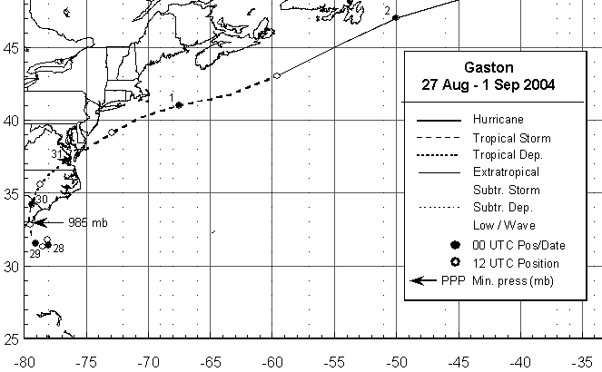
n mi south-southeast of Reykjavik, Iceland. Below is a track of the
cyclone
provided by the National Hurricane Center.
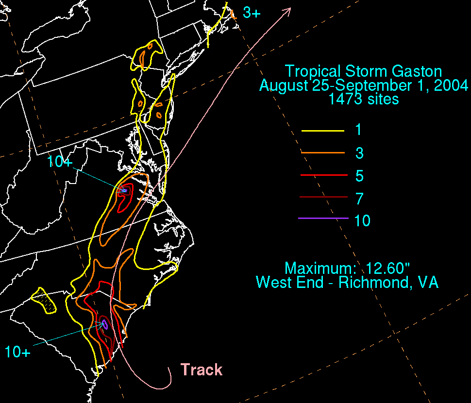
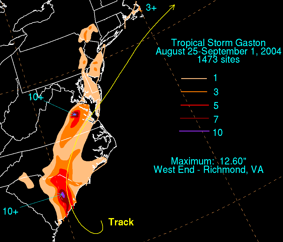
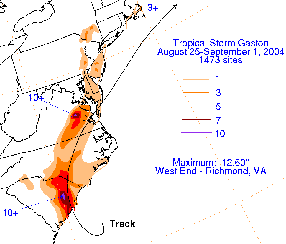
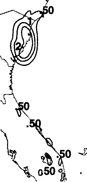
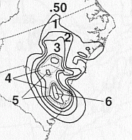
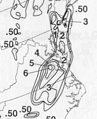
The storm total rainfall map below was constructed using data from
data
provided from NWS River
Forecast Centers, as well as additional reports received
by the
National Hurricane Center.
 |
 |
 |
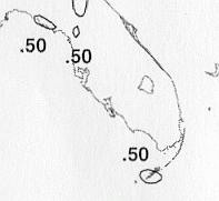
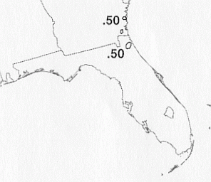
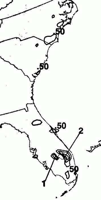
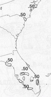
Below are the calendar for Daily Precipitation Maps. Note that the 24-hour periods end at 12z that morning.