An area of disturbed weather moved offshore the western African coast towards the end of August. The system
developed into a tropical depression, and then a tropical storm, on September 1st. An environment of subsidence
and dry air hindered additional development, and Gaston slowly weakened back into a remnant low on the 4th. Over
succeeding days, the system would flare thunderstorm activity but would not regain tropical cyclone status. The low
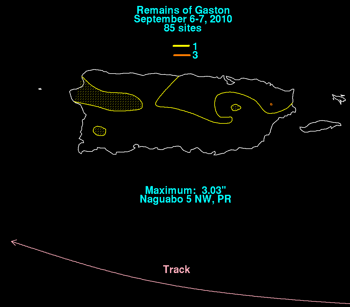
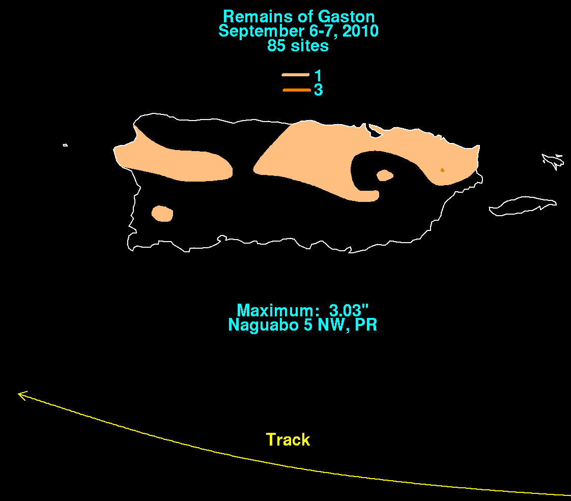
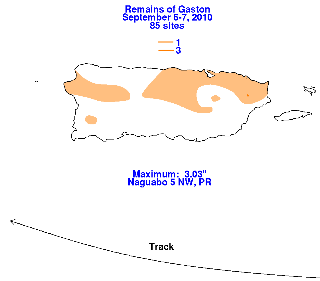
moved into the northeast Caribbean south of Puerto Rico before dissipating as it approached Hispaniola on the 7th.
Below are the associated rainfall graphics for Gaston, using data supplied by the Southeast River Forecast Center in
Peachtree City, Georgia.
 |
 |
 |