An area of cloudiness emerged off Africa on September 1st. By the 4th, the cloudiness had become more
concentrated as it moved westward at 15-20 mph. While 400 miles east of the Leeward Islands, it was designated
a tropical depression late on the 6th. By late on the 7th, the system was upgraded to a tropical storm 100 miles
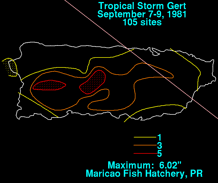
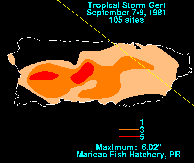
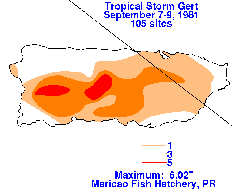
east of Guadeloupe. Late on the 8th, the better defined tropical storm moved across Puerto Rico. Most of the storms/
rain was located southwest of the center across western Puerto Rico and the Dominican Republic as the cyclone
moved by. The system moved through the extreme eastern Bahamas late on the 9th as it recurved to the north, and
the system strengthened into a hurricane on the 10th northeast of the Bahamas. Gert passed 100 miles northwest of
Bermuda on the afternoon of the 12th before accelerating east-northeast. Gert became diffuse in the Azores on
the 15th. Below are the storm total rainfall graphics and track. Rainfall data was provided by the National Climatic
Data Center in Asheville, North Carolina.
 |
 |
 |