A tropical depression formed on September 5th, near an upper level low. The cyclone drifted for 4-5 days
before developing into a tropical storm by the 10th. The cyclone moved east to northeast through the 13th
while strengthening into a category two hurricane. A blocking ridge stopped its eastward motion, but it
took until the 21st before it moved decidedly to the west. On the 23rd, Ginger passed 100 miles south of
Bermuda, bringing seventeen hours of gale force winds. The cyclone drifted southwest between the 24th
and 27th before turning northwest towards the Carolinas. On the morning of the 30th, Ginger finally made
landfall near Morehead City, North Carolina as a category one hurricane. Wandering on a slowly recurving
track while inland, the center did not emerge back into the northern Atlantic until October 3rd, when it
became a frontal wave which subsequently moved east-southeast and weakened.
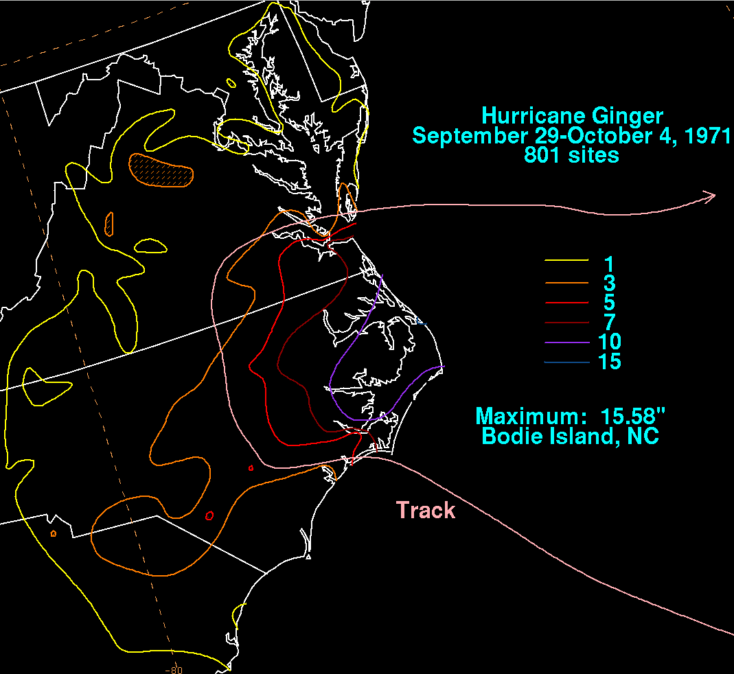
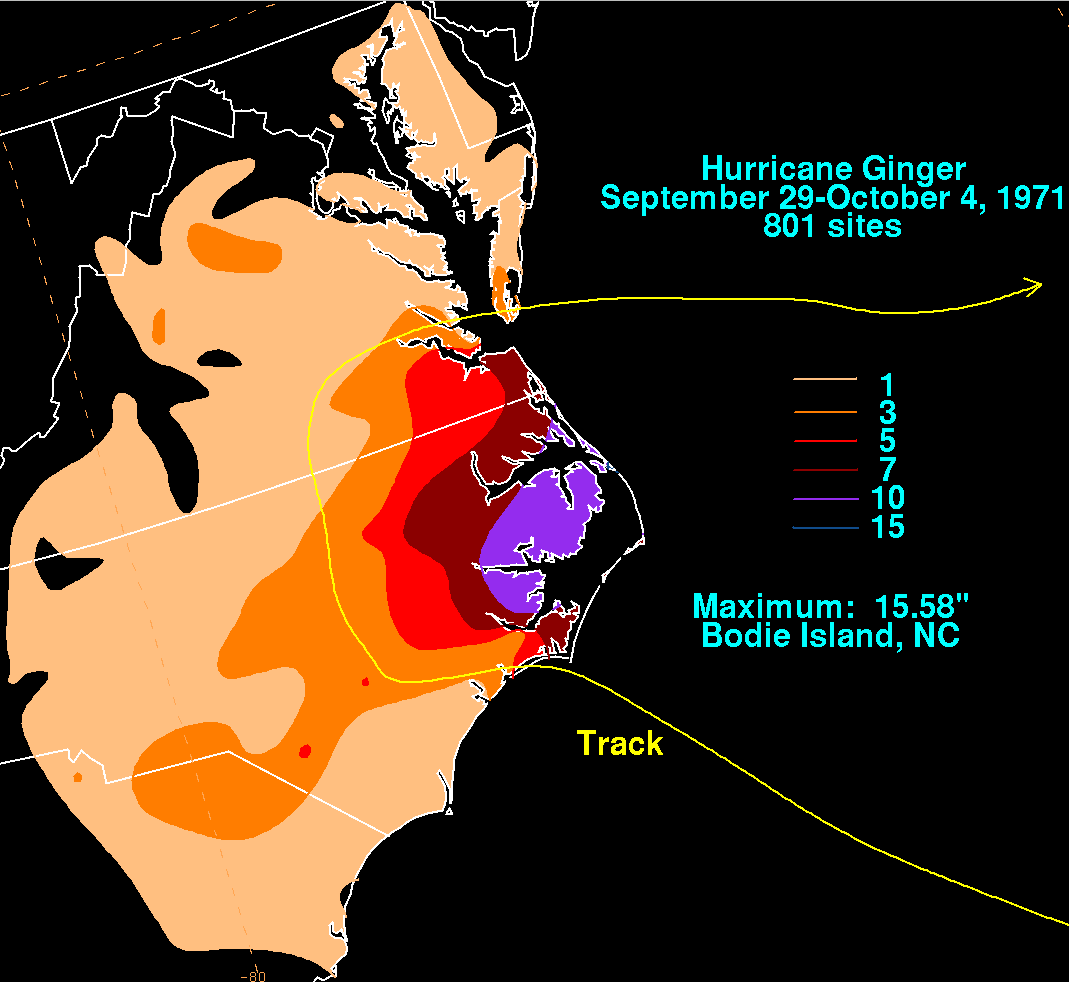
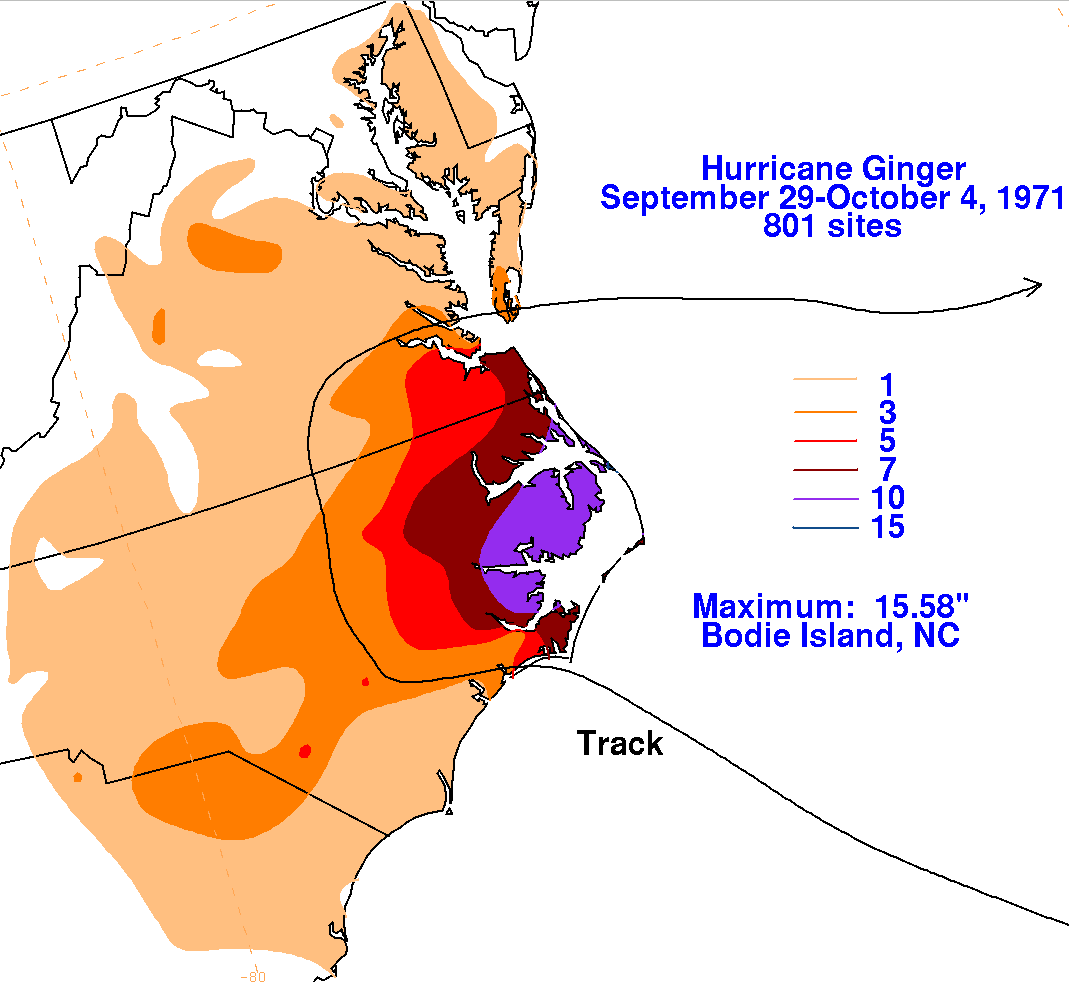
Below is the storm total rainfall graphic and track relating to Ginger. Rainfall data was provided by the National
Climatic Data Center in Asheville, North Carolina. Note that most of the rain fell to the right of its track.
 |
 |
 |