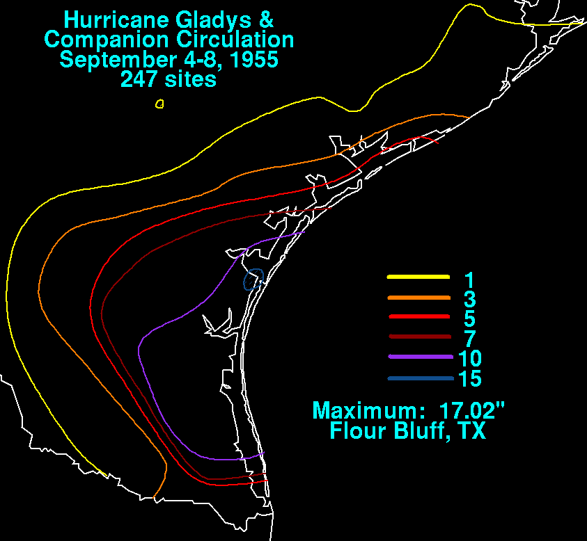
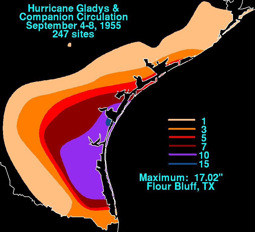
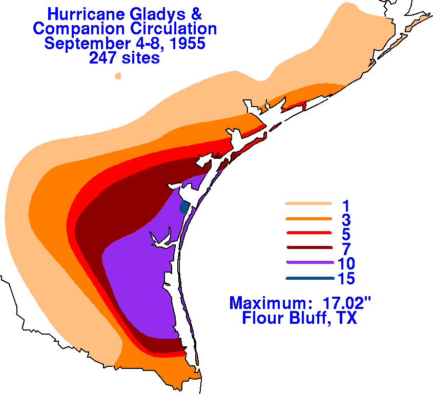
A tropical storm formed in the Bay of Campeche, and moved
northwestward until its point of landfall north
of Tampico, and southward thereafter. At Tampico, a total
of 25 inches of rainfall fell over three days due to
Gladys. Meanwhile, an area of squalls formed offshore the middle
Texas coast on the 5th, moving inland on
the 6th, bringing tropical storm-force winds to the Corpus Christi-Port
O'Conner area. A storm surge of 4.5
feet was witnessed in Oso Bay. This more northerly system may
have been a separate tropical storm in its
own right. The rainfall maps below for Hurricane Gladys was
created using rainfall data from the National
Climatic Data Center in Asheville, North Carolina.
 |
 |
 |