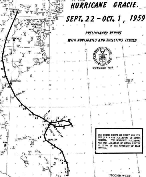
A tropical disturbance formed northeast of the Leeward Island on
September 18th. The system slowly organized,
becoming a tropical depression north of the Greater Antilles on the
20th. The system strengthened rapidly as it
passed by San Salvador in the Bahamas, quickly becoming a hurricane on
the 22nd. The system strengthened
further as it moved northward during the next couple of days. Its
steering weakened on the 24th, with Gracie
edging eastward through the 26th. As a deep layered ridge built
in to its north to northeast, the cyclone turned
to the west-northwest, following a parabolic track into the southern
coast of South Carolina as a major hurricane
late in the morning of the 30th. The system weakened while moving
inland, dropping heavy rainfall near and
east of its track while moving through the western Carolinas and
western Virginias. Below is its track, provided
by the National Hurricane Center.
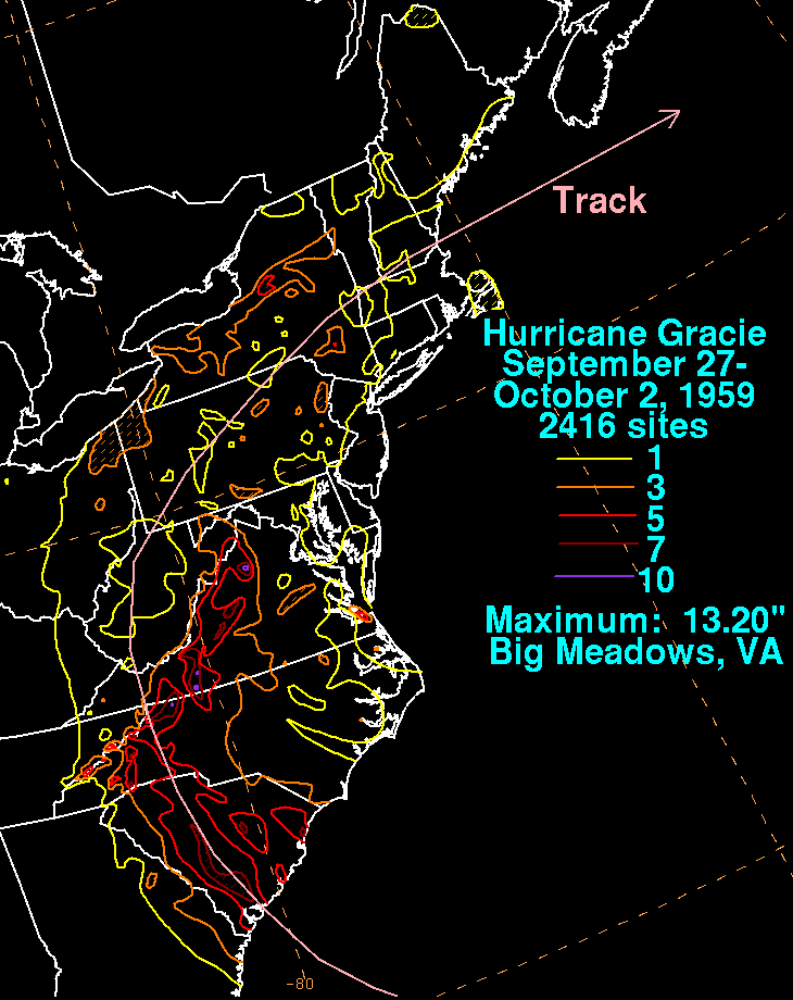
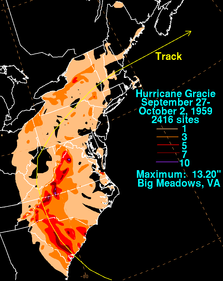
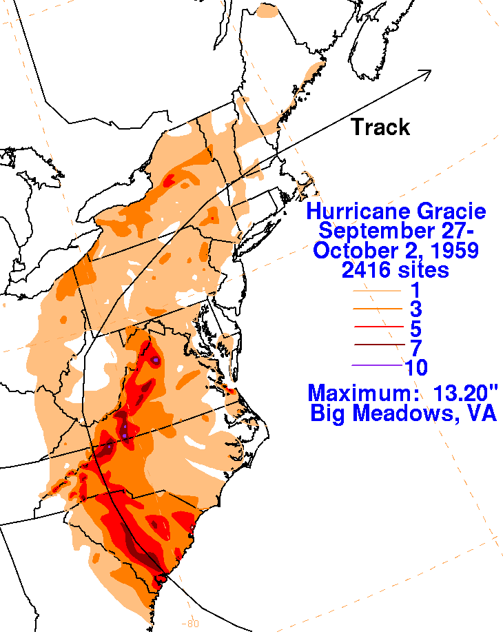
The graphics below show the storm total rainfall from
Gracie. Rainfall data was provided by the National Climatic
Data Center in Asheville, North
Carolina.
 |
 |
 |