A tropical wave emerged from Africa on September 15th. It moved westward at a slow rate of speed until
the 22nd, when the surface high to its north strengthened, causing the wave to accelerate. Cloudiness increased
on the 23rd as the wave interacted with an upper low. The squally weather moved north of the Lesser and Greater
Antilles over the next few days. A surface low formed in the southern Bahamas on the 26th. Strengthening as it
moved westward, it became a tropical storm. By the morning of the 27th, the cyclone began to weaken and its
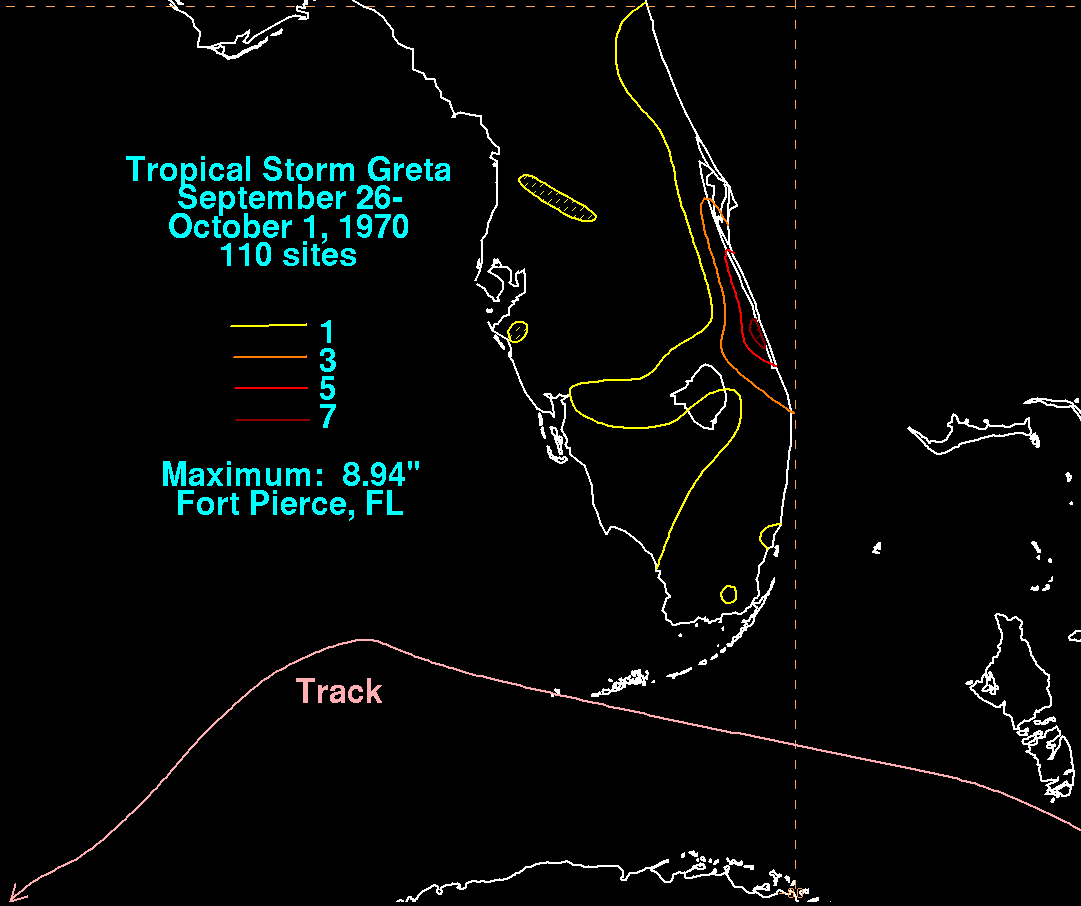
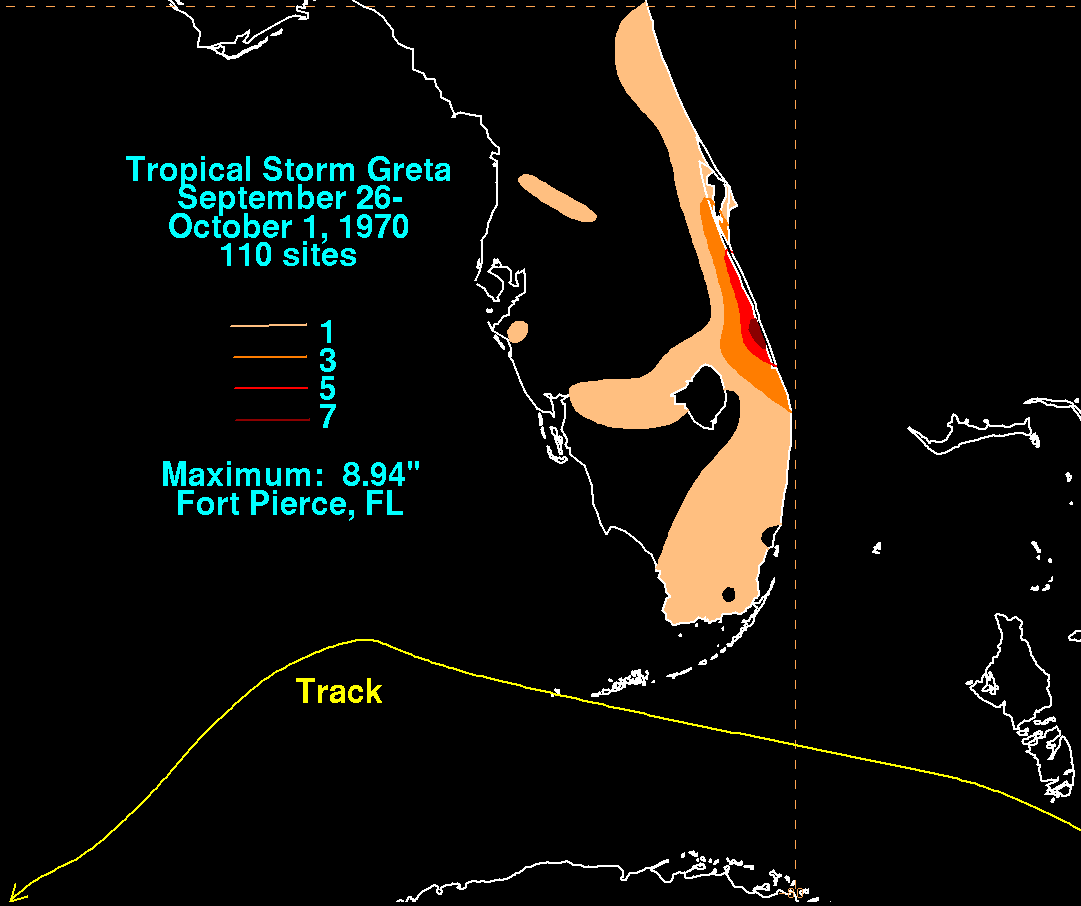
spiral banding became disorganized as it approached the Florida Keys. The graphics below show the storm total
rainfall for Greta. The maximum along the Treasure coast occurred where Greta's moisture intercepted a stationary
front to the north of the cyclone.
|
|
 |
|