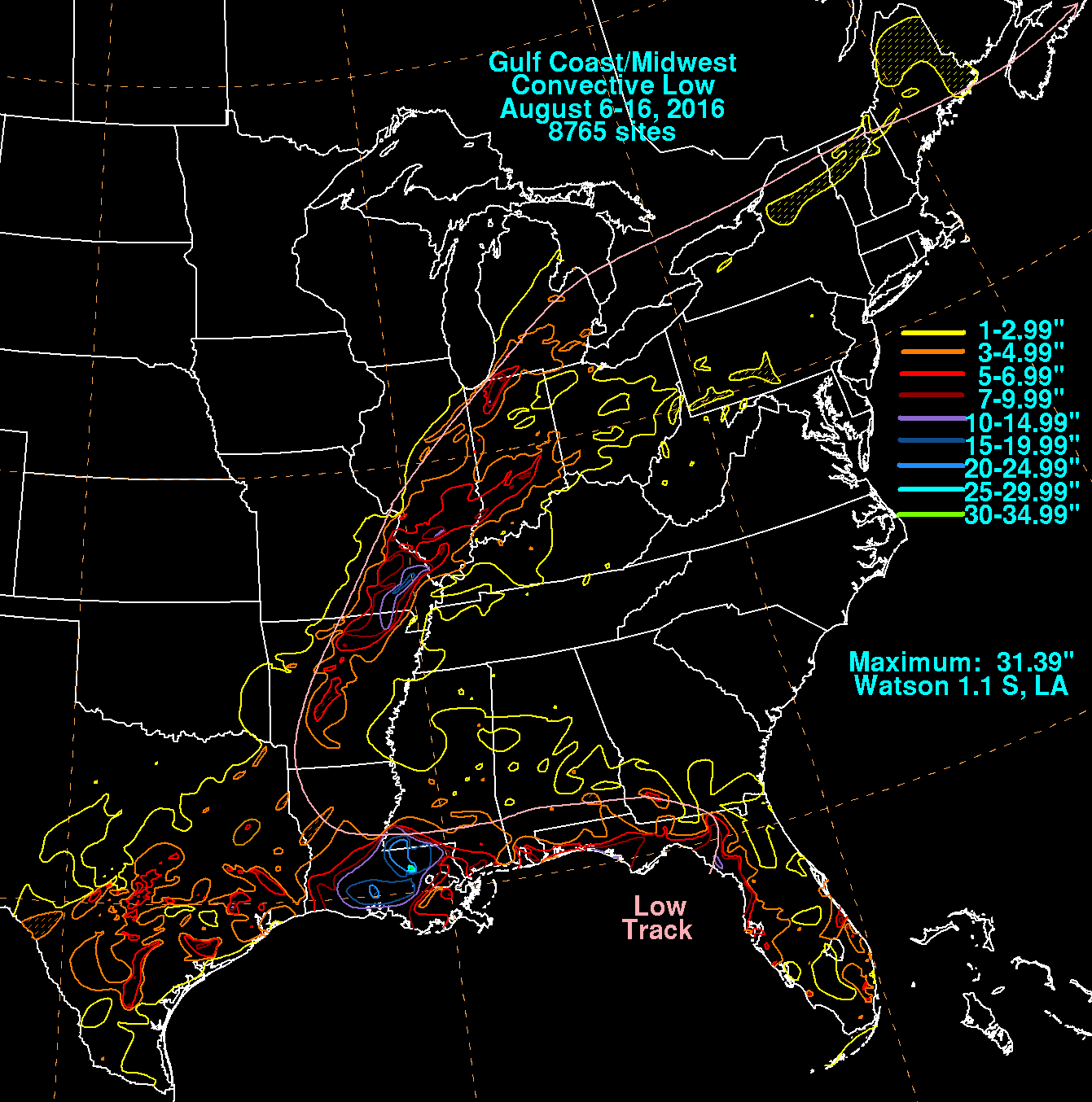
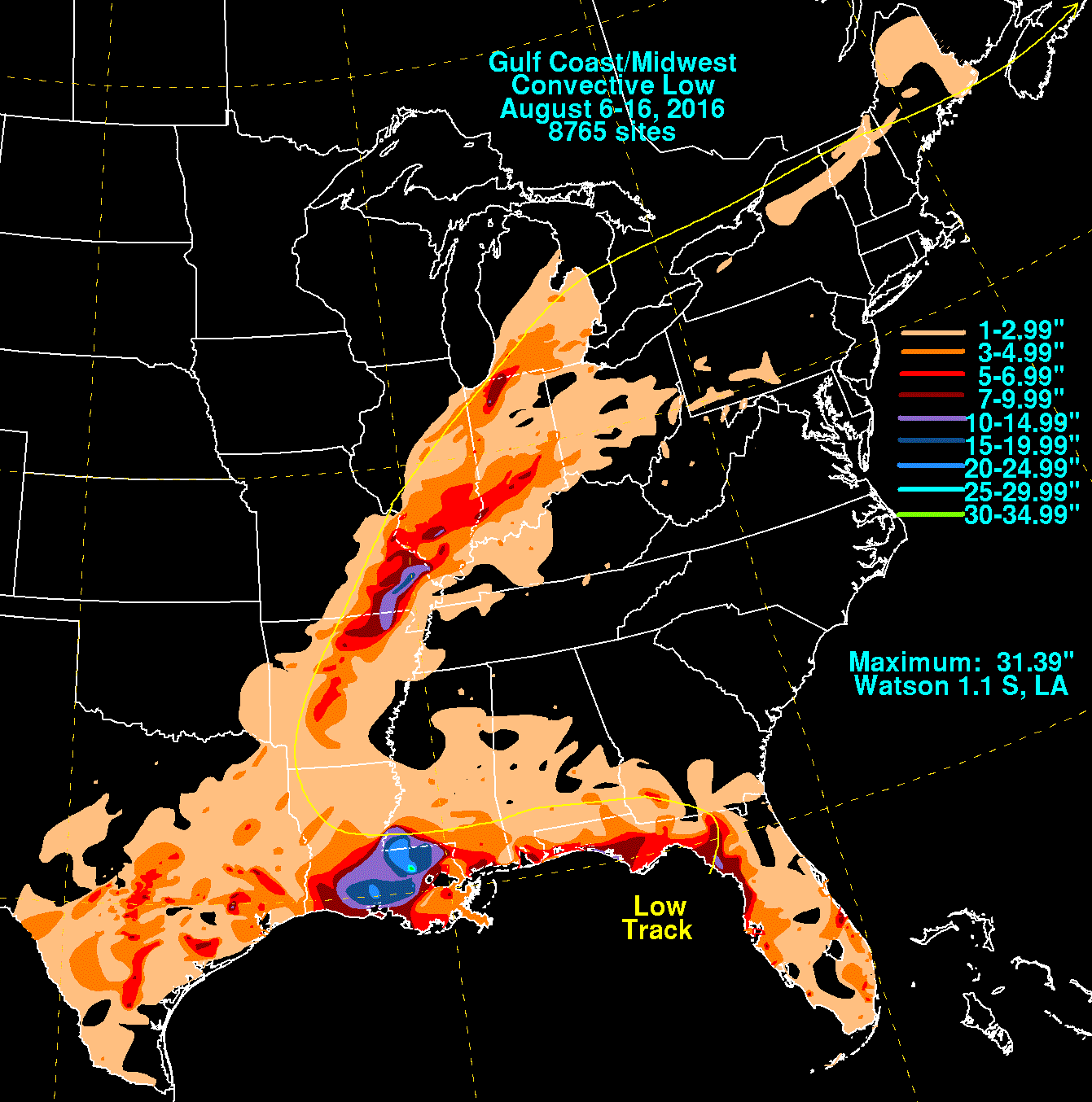
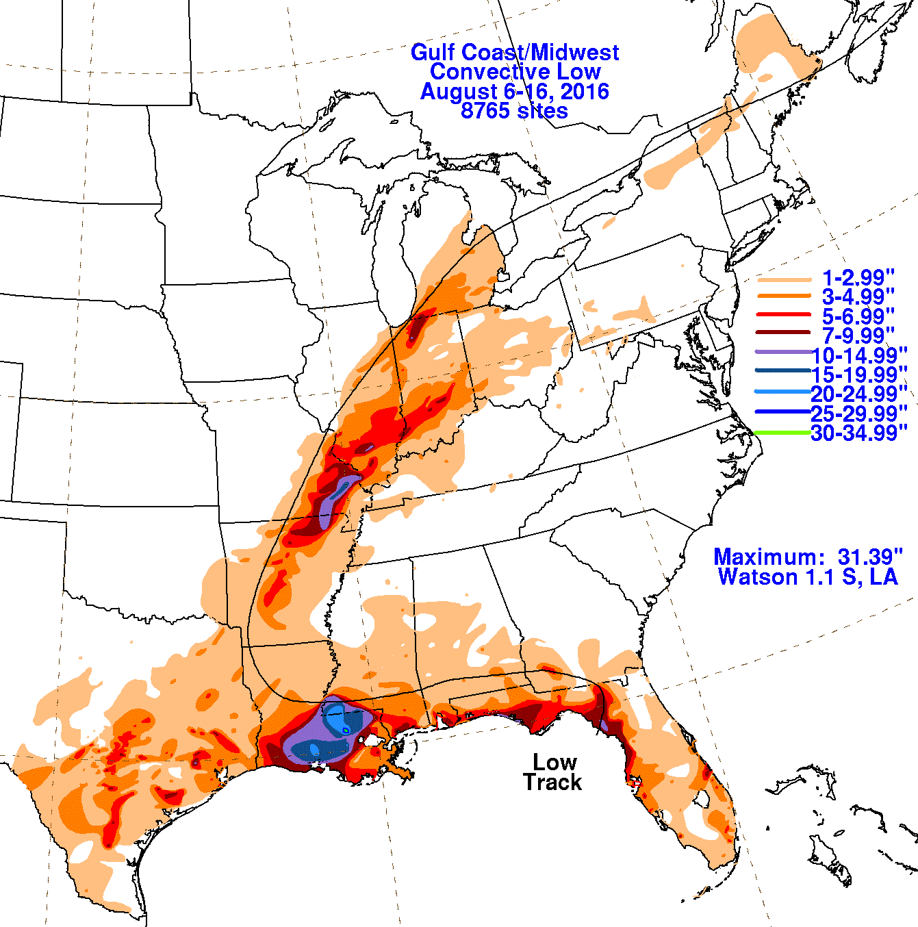
The National Hurricane Center watched a tropical disturbance in the eastern Gulf of Mexico during early August. Eventually, a
surface circulation developed as it moved ashore northwest Florida early on August 7th, with the center moving inland. For much
of its existence it was ill-defined with multiple centers. The system moved across southwest Georgia and southern Alabama by the
8th while retrograding westward just south of a weak stationary front. The front dissipated during the night of the 9th and the
low meandered westward, moving into southern Mississippi by the 11th. The system slowly deepened late on the 11th into the 12th
as the system brought historically heavy rainfall to southwest Mississippi and southeast Louisiana. By the 13th, the low was
drifting across Louisiana, linking up with a stationary front near Shreveport that night. It then recurved northeast while deepening
baroclinically on the 15th. The system moved across the lower peninsula of Michigan and crossed southeast Ontario into northern
New York by the night of the 16th. By the morning of the 17th, the low had moved across New England into Nova Scotia.
The system slowly strengthened as it cross the north Atlantic well southeast of Greenland on the 20th and 21st.
The first three graphics below show the storm total rainfall for the ill-defined convective low, which used rain guage information
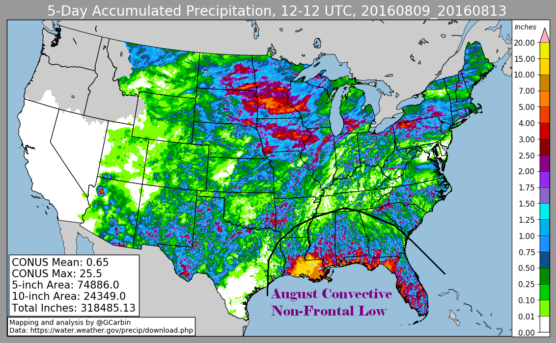
from National Weather Service River Forecast Centers, Forecast Offices, and CoCoRAHS. The fourth graphic is the multi-sensor precipitation
estimate using radar-derived information, covering its period prior to becoming a frontal wave.
 |
 |
 |
 |