An area of showers developed between the Bahamas and Bermuda on 6 September in association with a
developing upper-level trough and a weak surface trough. The upper-level trough amplified over the next
two days in response to upstream ridging enhanced by Tropical Storm Fay over the Gulf of Mexico. As this
occurred, convection increased in both coverage and intensity and the surface trough became better defined.
A broad surface low formed in the system late on the 7th, becoming a subtropical depression by the morning
of the 8th. Later that day, an Air Force Reserve Hurricane Hunter aircraft investigated the cyclone and found
it had become Subtropical Storm Gustav.
Gustav moved erratically west-northwestward on the 9th as it slowly
strengthened. On that day, the cyclone
had a large area of light winds near the center with multiple low-level
cloud swirls. Gustav turned north early
on 10 September as convection became better organized near the center.
Based on this and the development
of a band of strong winds closer to the center, it is estimated that
the cyclone transformed into a tropical
storm during the morning of the 10th. Maximum sustained winds reached
65 mph while the center passed
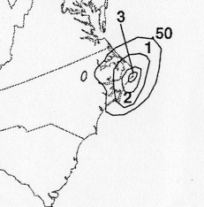
between Cape Hatteras and Diamond Shoals, North Carolina that
afternoon.
Gustav turned northeastward when it reached the Hatteras area, then
accelerated northeastward on 11
September in southwesterly flow caused by low pressure forming
over the New England states and
southeastern Canada. In a complex process similar to that seen in
Hurricane
Michael in 2000,
the tropical cyclone intensified as it gradually began to merge with
or absorb the non-tropical low.
Gustav became the 2002 season's first hurricane on the morning of the
12th and became a category
2 hurricane that afternoon. Thereafter, the cyclone began to weaken,
and Gustav made landfall over
the southern part of Cape Breton, Nova Scotia after midnight on the
12 September as a 90 mph hurricane.
Satellite, surface, and radar data indicated the cyclone was becoming
extratropical as it made a
second landfall over southwestern Newfoundland very early on the 13th.
Gustav lost all tropical
characteristics by morning as it continued northeastward while
decelerating
across Newfoundland. The
remnant extratropical low moved into the Labrador Sea, where it turned
northwestward late on 13
September and dissipated on 15 September. Below is the track
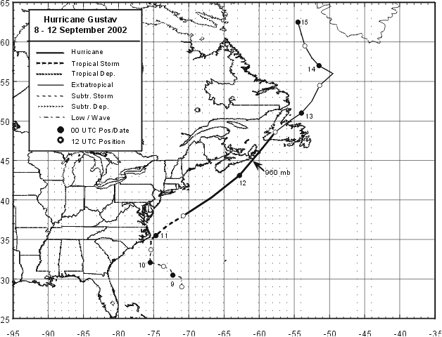
of Gustav, furnished by the
National Hurricane Center.
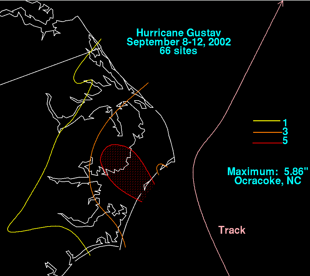
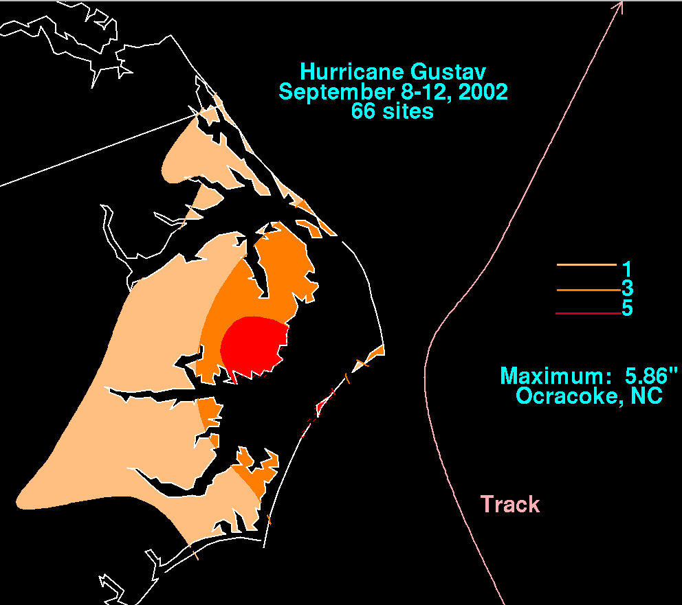
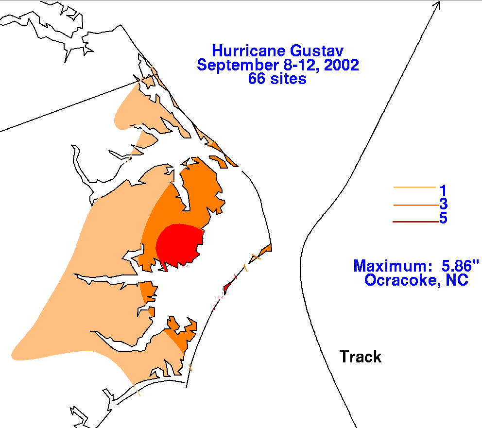
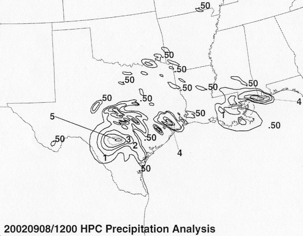
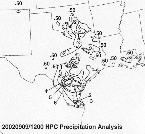
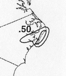
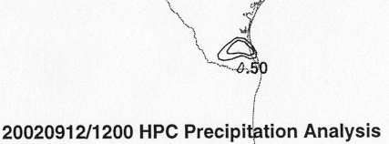
The storm total rainfall maps below were constructed using data from
the
National Climatic Data Center.
 |
 |
 |
Below are the calendar for Daily Precipitation Maps. Note that
the 24-hour periods end
at 12z that morning.