A tropical wave moved across the tropical North Atlantic ocean. It brought squally weather to the Windward
Islands before entering the Caribbean Sea. The system developed due to favorable upper level conditions, and
became Tropical Depression Seven by August 25th, and a tropical storm later that day. While approaching
Hispaniola, strengthening continued and Gustav reached hurricane strength early on the 26th. The cyclone
moved across southwest Haiti before dropping southwest towards Jamaica due to strengthening high pressure
to its north and northwest. The system, then a tropical storm, nearly reached hurricane strength before moving
near Jamaica. Clearing the island, Gustav regained hurricane strength and rapidly intensified into a category
4 hurricane which struck western Cuba on the 30th.
A combination of land interaction with western Cuba and an upper level low to its west kept Gustav on a slow
weakening trend until its final landfall in southeast Louisiana on September 1st. The system slowed to a crawl
across northwest Louisiana and southwest Arkansas on the 2nd and 3rd, dropping heavy rainfall across
east-central Louisiana, Arkansas, and southwest Mississippi. By the 4th, Gustav accelerated north-northeast
and became an extratropical cyclone which moved through Michigan on the morning of the 5th.
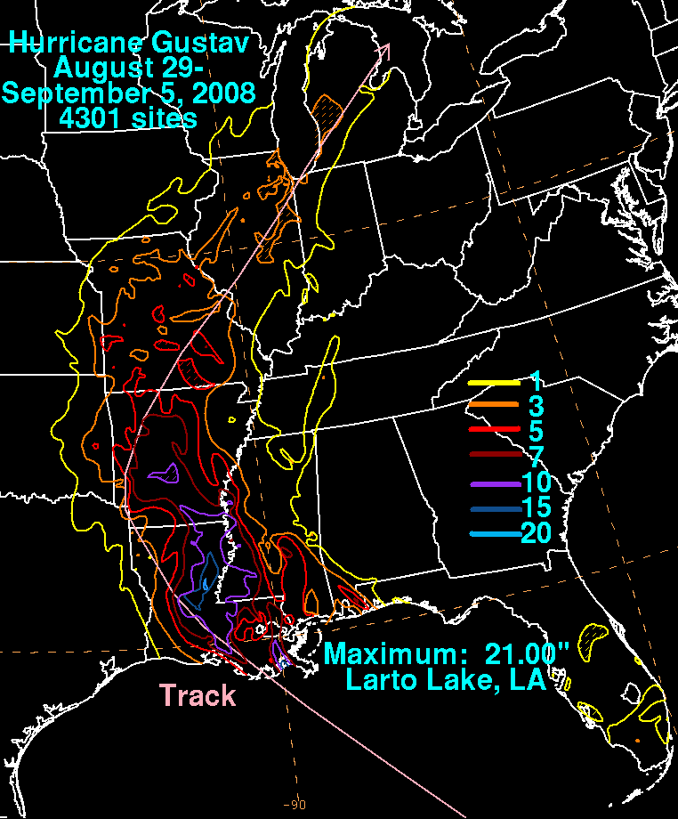
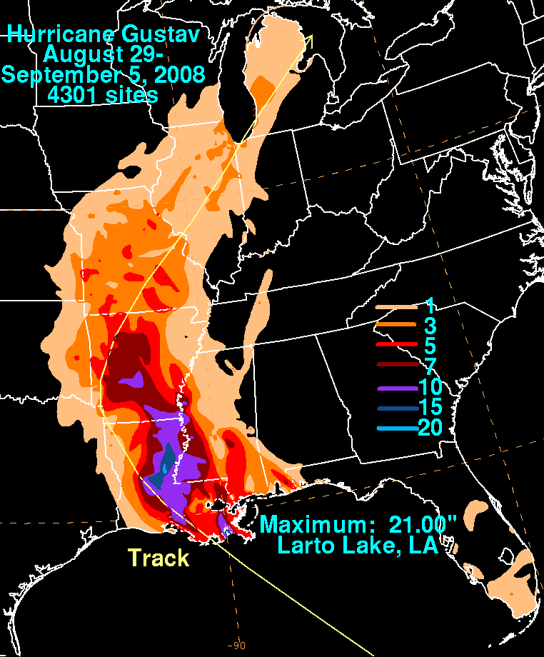
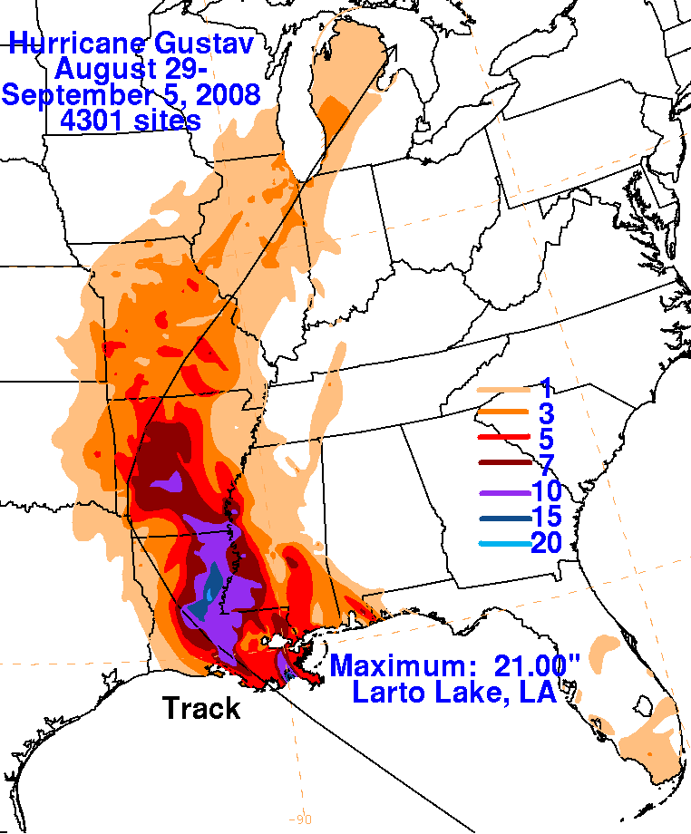
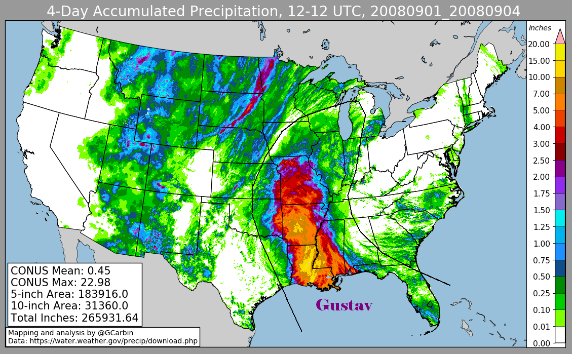
Below are the overall storm total graphics associated with Gustav. Data for the first three was compiled from rain
guage information originating from the National Weather Service River Forecast Centers, a public information statement
from Jackson Mississippi, and CoCoRaHS. The fourth image includes radar-derived information.
 |
 |
 |
 |