Hanna formed in the Gulf of Mexico from a complex interaction of a
tropical
wave, an upper-level low, and
a surface trough. In the days preceding genesis, a broad surface trough
in the wake of Hurricane Gustav
stretched from the western Atlantic across South Florida and into the
central Gulf of Mexico. During this
time a westward-moving tropical wave approached the Yucatan peninsula,
and when the wave reached the
Gulf of Mexico on 10 September a weak 1008-mb low formed on the western
end of the surface trough.
Initially, there was minimal convection associated with the combination
of these two features; however, on
11 September an upper-level short-wave trough over the southern United
States cut off over the central
Gulf of Mexico, and convection began to develop to the east of the
both the upper level low and the tropical
wave/surface low. During the afternoon of the 11th, a reconnaissance
aircraft was able to locate a well-
defined low-level circulation center, and with that the ninth
depression
of the season had formed
about 250 n mi south of Pensacola Florida.
The cyclone initially had some non-tropical characteristics,
including
a westward tilt with height in
association with the upper-low. Despite strong southwesterly shear
and a disorganized convective
structure, the depression became a tropical storm early on the morning
of the 12th, 225 n mi south
of Pensacola. For the first 24 hours after genesis, the low-level
circulation
center rotated counter-
clockwise around the middle and upper-level centers, first moving
northeastward
but turning
to the southwest by late on the 12th. Moving slowly the following day,
Hanna turned to the west
then to the north ahead of an approaching mid-level trough. Hanna
strengthened
and reached its peak
intensity of 60 mph and 1001 mb during the evening of the 13th about
60 n mi south of the mouth of the
Mississippi River. In response to the approaching trough, Hanna
accelerated
northward early on the
14th and its exposed low-level circulation center began to become
deformed
and elongated. With nearly
all the significant weather well to its east, Hanna's center of
circulation
passed over the extreme
southeastern tip of Louisiana then turned to the north-northeast and
made its second landfall near
the Alabama-Mississippi during the morning of the 15th. Hanna moved
northeastward across southern
Alabama and weakened rapidly, dissipating by 1800 UTC 15 September.
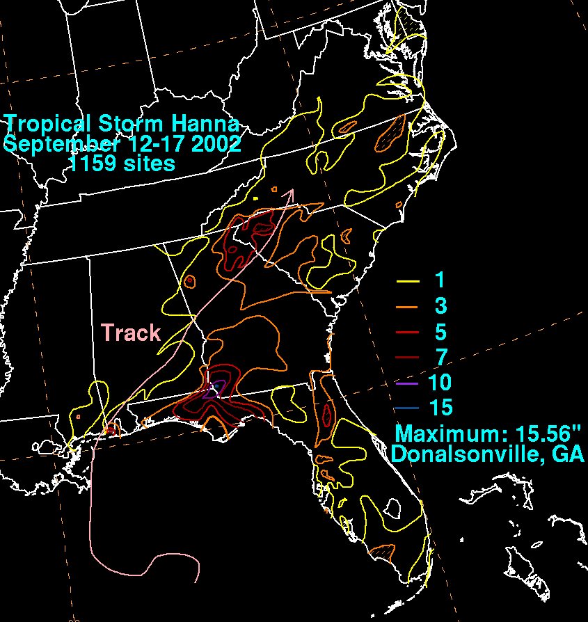
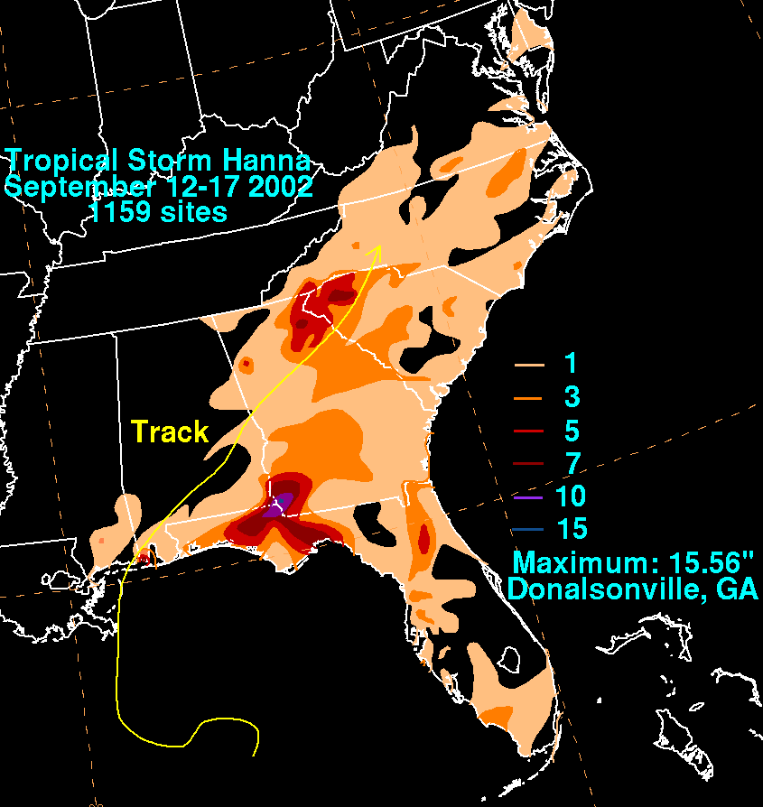
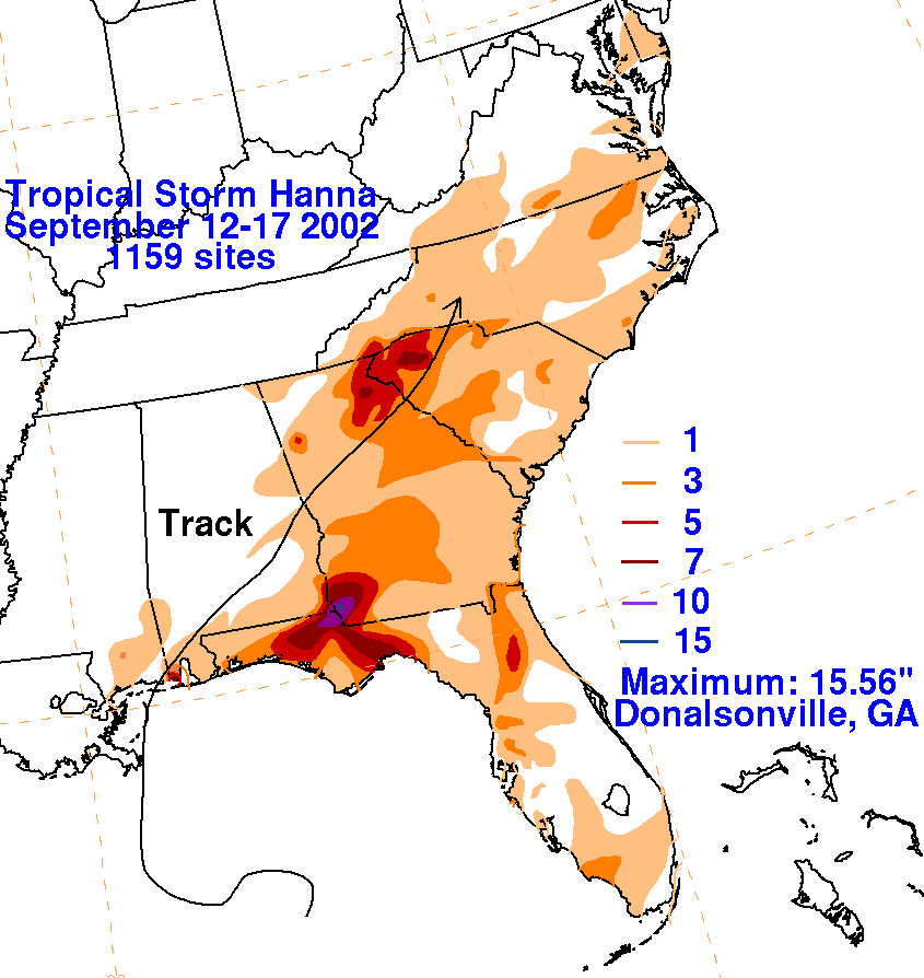
The remnants of the tropical cyclone
then produced heavy rains as they moved rapidly across Georgia and
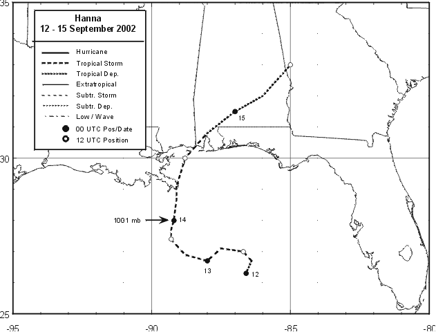
the Carolinas. Below is the track of
Hanna, furnished by the National Hurricane Center.
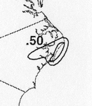
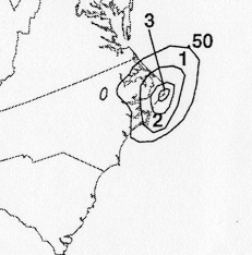
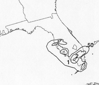
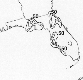
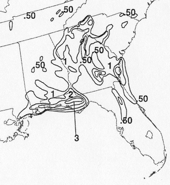
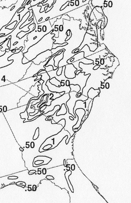
The storm total rainfall maps below were constructed using data from
the
National Climatic Data Center.
 |
 |
 |
Below are the calendar for Daily Precipitation Maps. Note that
the 24-hour periods end
at 12z that morning.