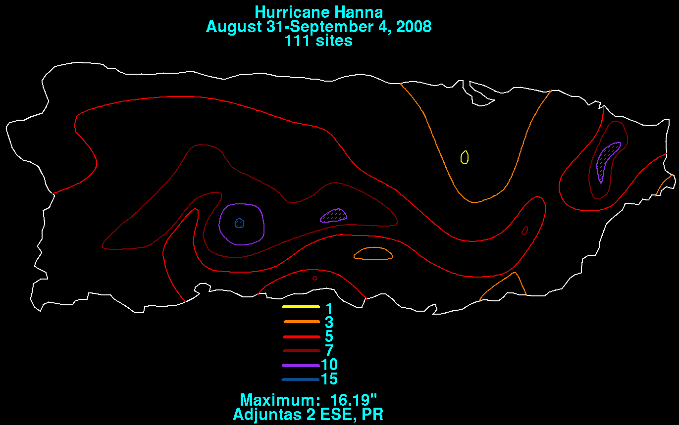
Several days after emerging offshore the coast of Africa, an area of low pressure formed near a tropical wave,
accompanied by significant thunderstorm activity. On August 28, the system became well enough organized to
be classified as Tropical Depression Eight by the National Hurricane Center. Later in the day, the system
continued to develop and became a tropical storm. Experiencing vertical wind shear throughout much of its
existence, the system moved west into the southeastern Bahamas before dropping southward towards Haiti
on the 30th. As it did so, Hanna briefly strengthened into a hurricane. During this time, heavy rains within
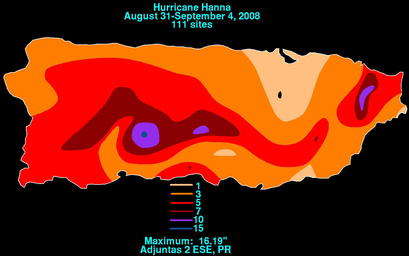
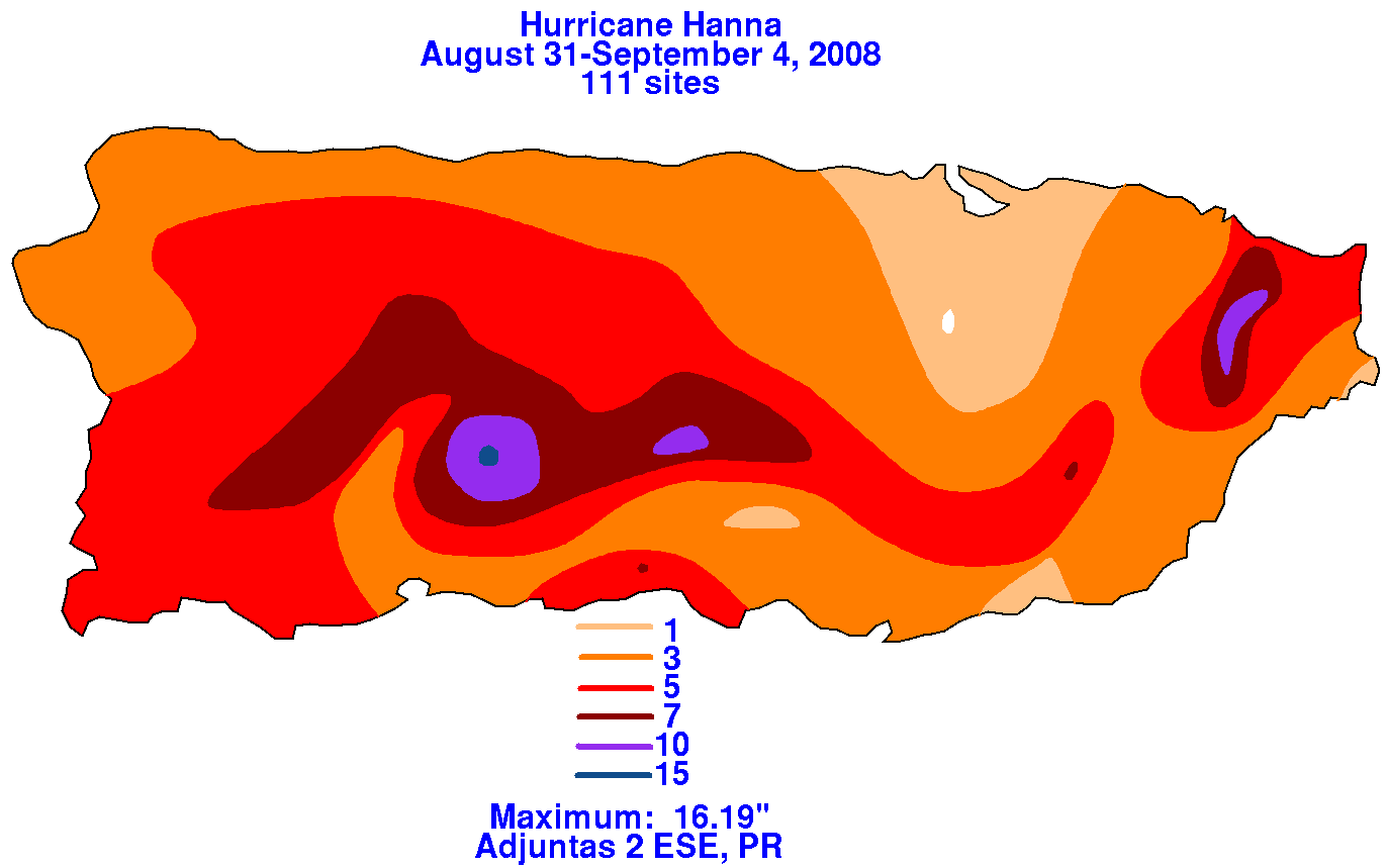
its eastern periphery fell across Hispaniola and Puerto Rico. Below are the storm total rainfall graphics for
Puerto Rico, using data provided by the Southeast River Forecast Center.
 |
 |
 |
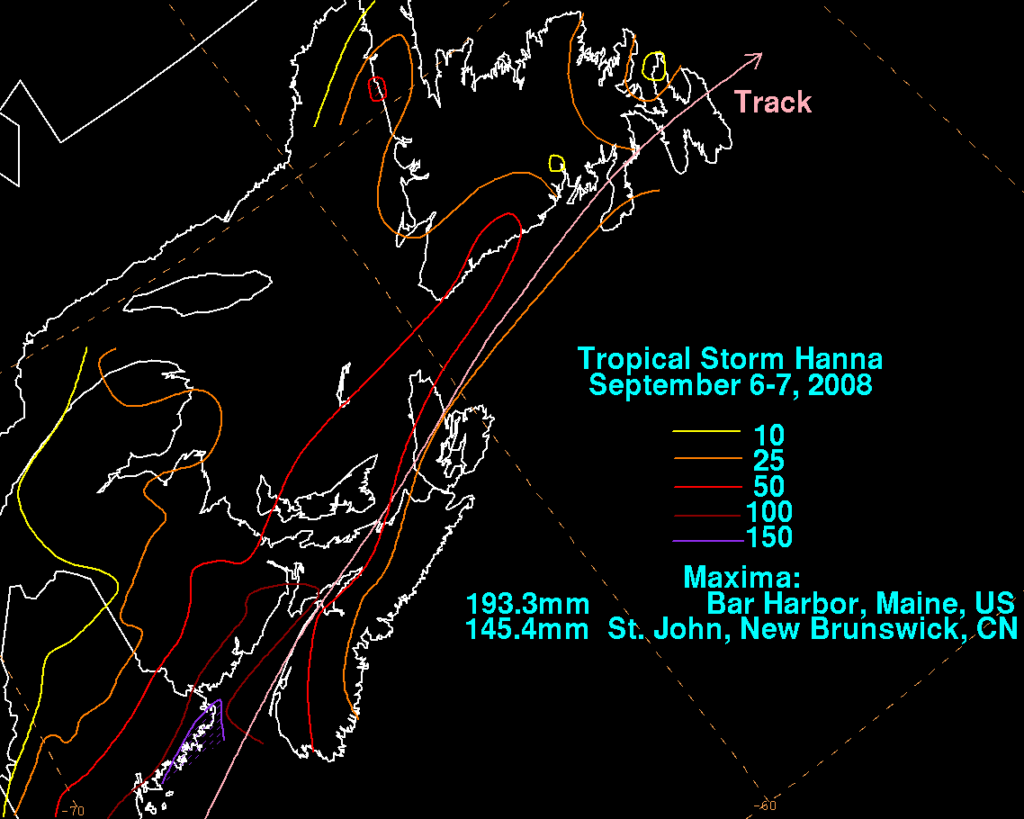
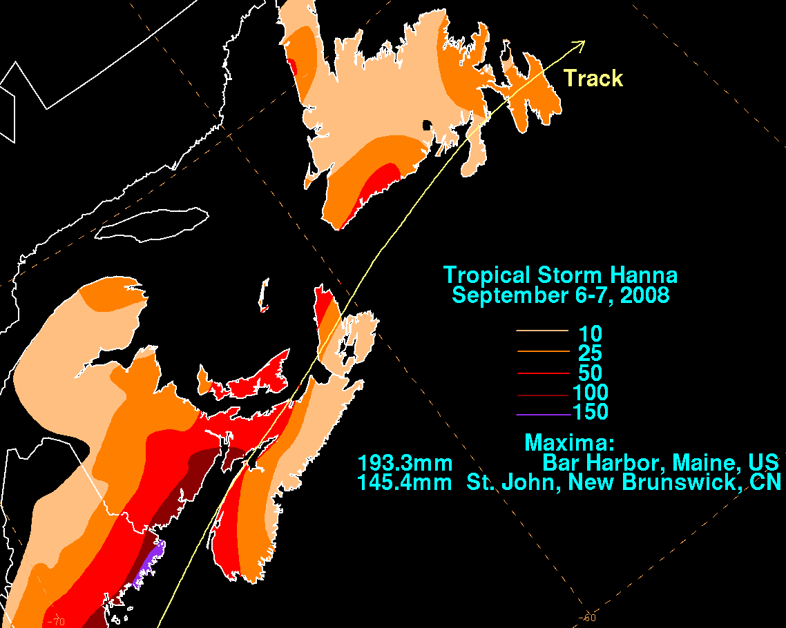
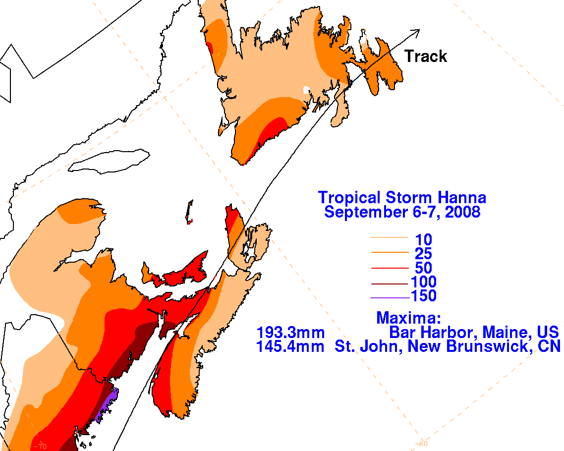
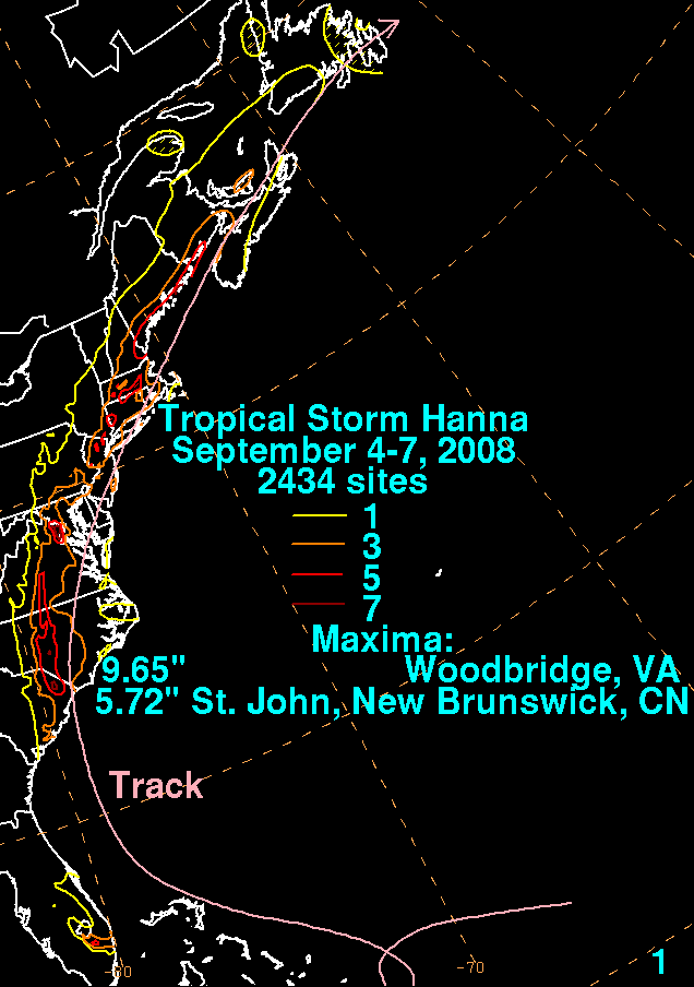
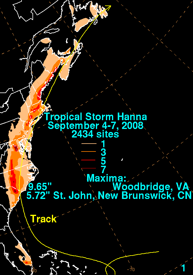
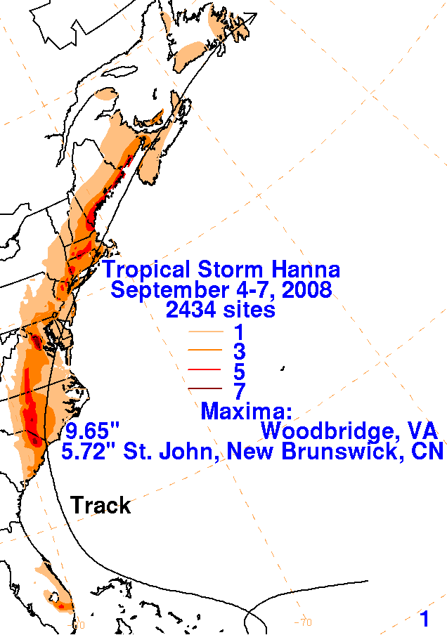
By September 3rd, Hanna finally turned to the northwest just shy of Hispaniola, and moved just east of the
Bahamas before making landfall at Myrtle Beach, South Carolina on the 6th. Its convective pattern took on
a hooked appearance, concentrating on its northwest side well prior to landfall due to southeast vertical
wind shear, and this rainfall pattern continued as Hanna moved through the Carolinas, Mid-Atlantic states,
and coastal New England. By early on the 7th, Hanna became an extratropical cyclone before moving through
Atlantic Canada. Below are the storm total rainfall graphics associated with Hanna. Data was compiled from
the National Weather Service River Forecast Centers, public information statements from National Weather
Service Forecast Offices across the East, CoCoRaHS, and Environment Canada.
 |
 |
 |