Passing through the southern Windward Islands as a well-developed
hurricane on October 5th, the cyclone
passed just north of Grenada moving west-northwest. On the night
of the 9th/10th, a deep trough developed
in the eastern United States, and Hazel turned northward, passing
through the Windward Channel into the
southeast Bahamas on October 13. Slowly curving to the
north-northwest, Hazel struck North Carolina
on the morning of the 15th. Moving rapidly through the western
Washington, D.C. suburbs into Ontario,
Hazel retained hurricane-force winds as it became a non-tropical
low. Heavy rains fell on its western side,
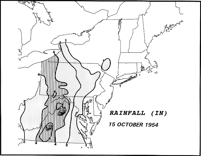
along an approaching frontal zone. Below is the rainfall graphic
for Hazel, created by Paul Kocin.