A tropical wave moved offshore the western African coast.
Moving into the extreme northwest Caribbean
sea on the 14th, the system organized into a tropical depression near
Cozumel. The system moved westward
south of a high pressure system. As it turned to the southwest on
the 16th, Henri intensified into a tropical
storm. Gaining hurricane strength on the 17th, Henri turned
northwest as the ridge to its northwest weakened.
Embedded with a large cyclonic envelope, the storm's motion became
erratic. After peaking in intensity, the
cyclone weakened as Mexico restricted its main inflow and a new cyclone
formed near the Texas coast. Henri
regained tropical depression status on the 19th. The system moved
east to northeastward, without regaining
thunderstorm activity near its center. By the 24th, Henri joined
up with a frontal zone, becoming a weak
extratropical low. Below
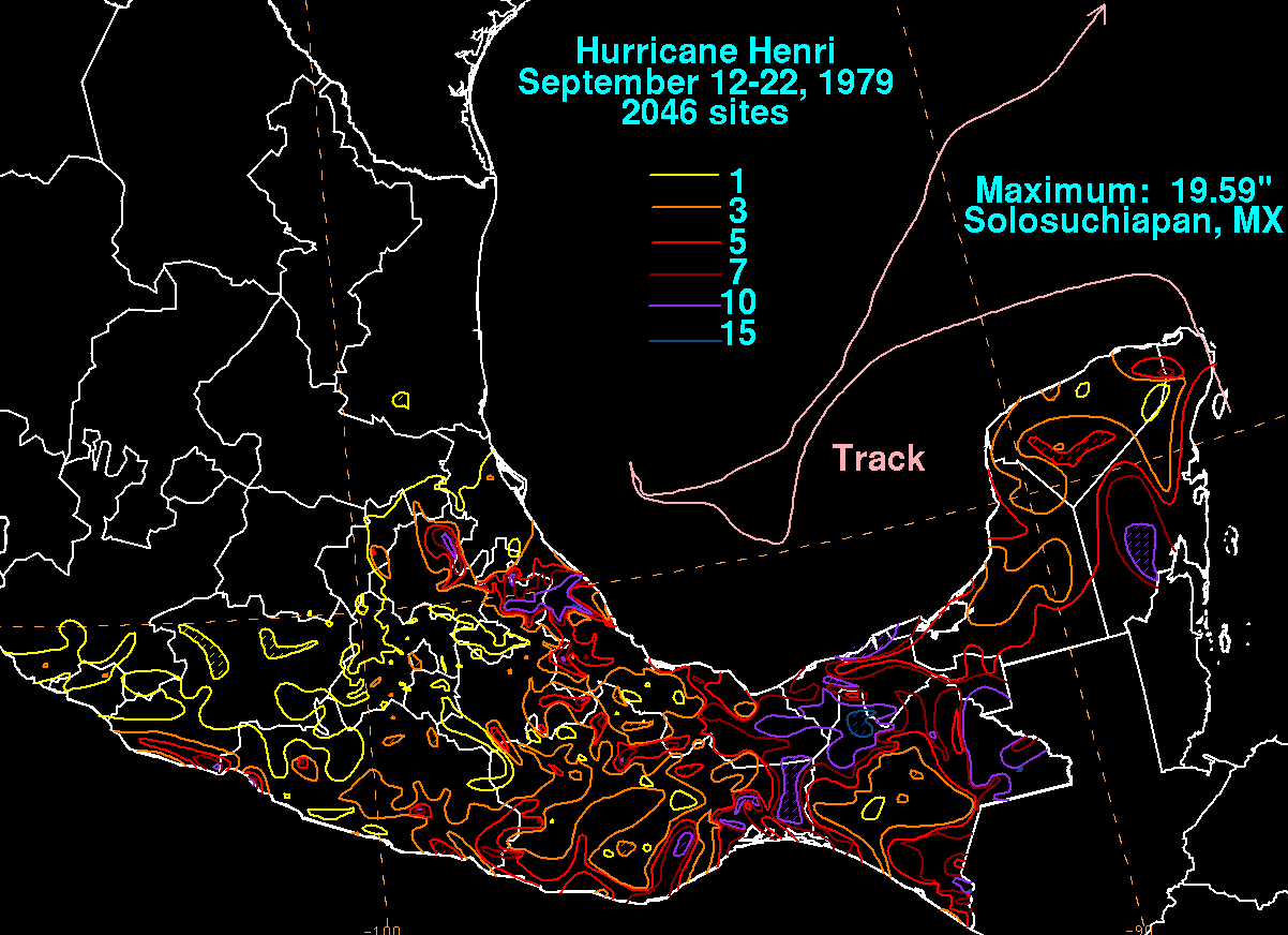
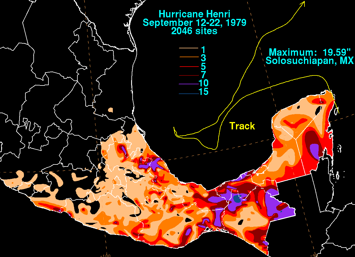
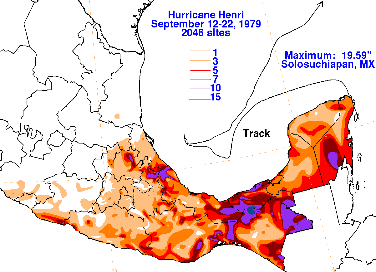
is a track of the storm, created by the National Hurricane
Center. Below are
the storm total rainfall maps for Henri, using data
provided
by the National Climatic Data Center.
 |
 |
 |