A tropical disturbance moved off the African coast on September 11th. For the next five days, no further
development of the system occurred. On the 17th, the system became better organized east of the Lesser
Antilles, but the disturbance was moving at near 20 mph to the west, which was preventing the formation
of a closed surface circulation. By the morning of the 20th, while south of Jamaica, a low level circulation
became defined, and the system became a tropical depression that morning and a tropical storm by evening.
Hermine moved by the northeast coast of Honduras and moved ashore Belize near Belize City on the morning
of the 22nd.
Crossing the Yucatan peninsula, Hermine weakened slightly.
This was temporary, as the center
of its circulation moved into the Gulf of Mexico and the system
restrengthened into a tropical storm. The
cyclone turned southwest and decreased its forward motion.
Hermine made landfall southeast of Vera Cruz
as a strong tropical storm on the morning of the 24th, with its
circulation dissipating a couple days later.
Satellite imagery shows that its mid-level circulation turned more to
the west across southern Mexico, causing
heavy rainfall along the western Mexican coast by the 27th. The
disturbance moved up the west coast of
Mexico, and recurved across northwest Mexico into central Texas by the
morning of the 29th.
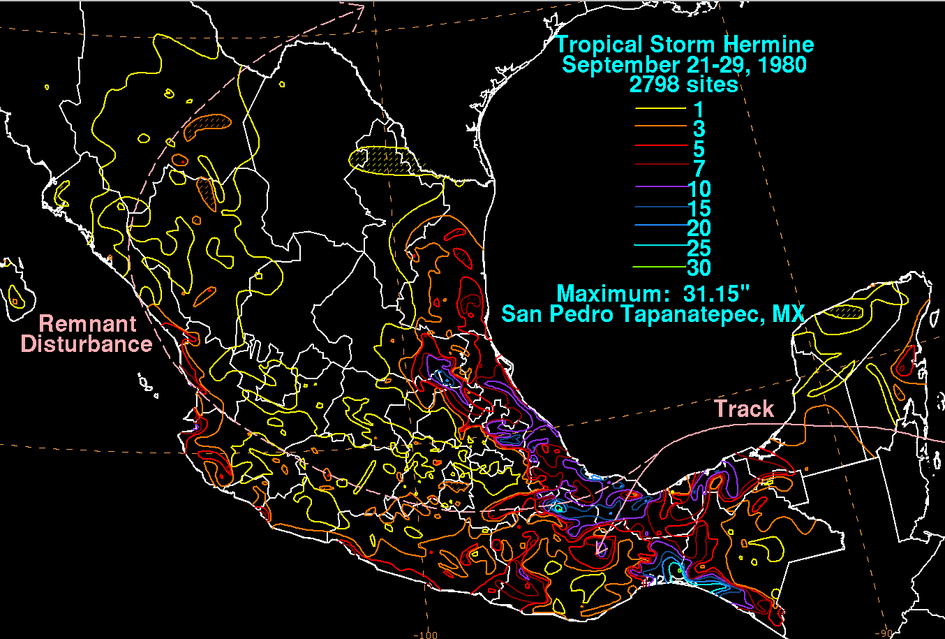
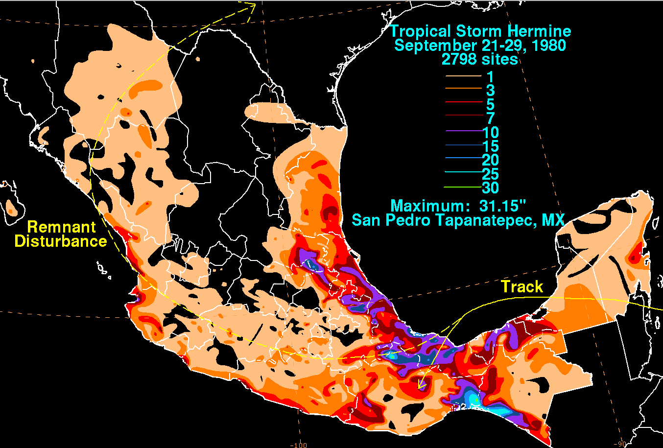
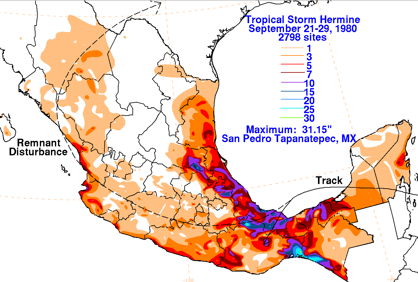
Below are the storm total rainfall
maps for Hermine, using data
provided by the Comision Nacional del Agua,
the parent agency of Mexico's national weather
service. The track was provided by the National Hurricane
Center.
 |
 |
 |