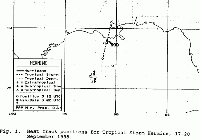
A tropical wave moved off the western coast of Africa on September 5
and moved westward
across the Atlantic. Showers and thunderstorms increased with
the wave as it approached the
Winward Islands on the 12th. Since it passed very close to the
South American coast, development
was hindered until it moved on a northwest course into the western
Caribbean away from the
continent. It was there when a tropical depression formed
on the 15th. Becoming involved with
an upper low in the Gulf of Mexico, development was slow, and the
system
became a tropical
storm on the morning of the 19th. It moved inland near Cocodrie,
Louisiana on the 20th, and
then tracked northeastward across southern Mississippi and into western
Alabama by the morning
of the 21st, dissipating in the Carolinas by the morning of the 22nd.
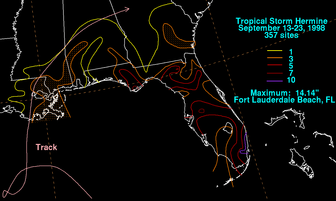
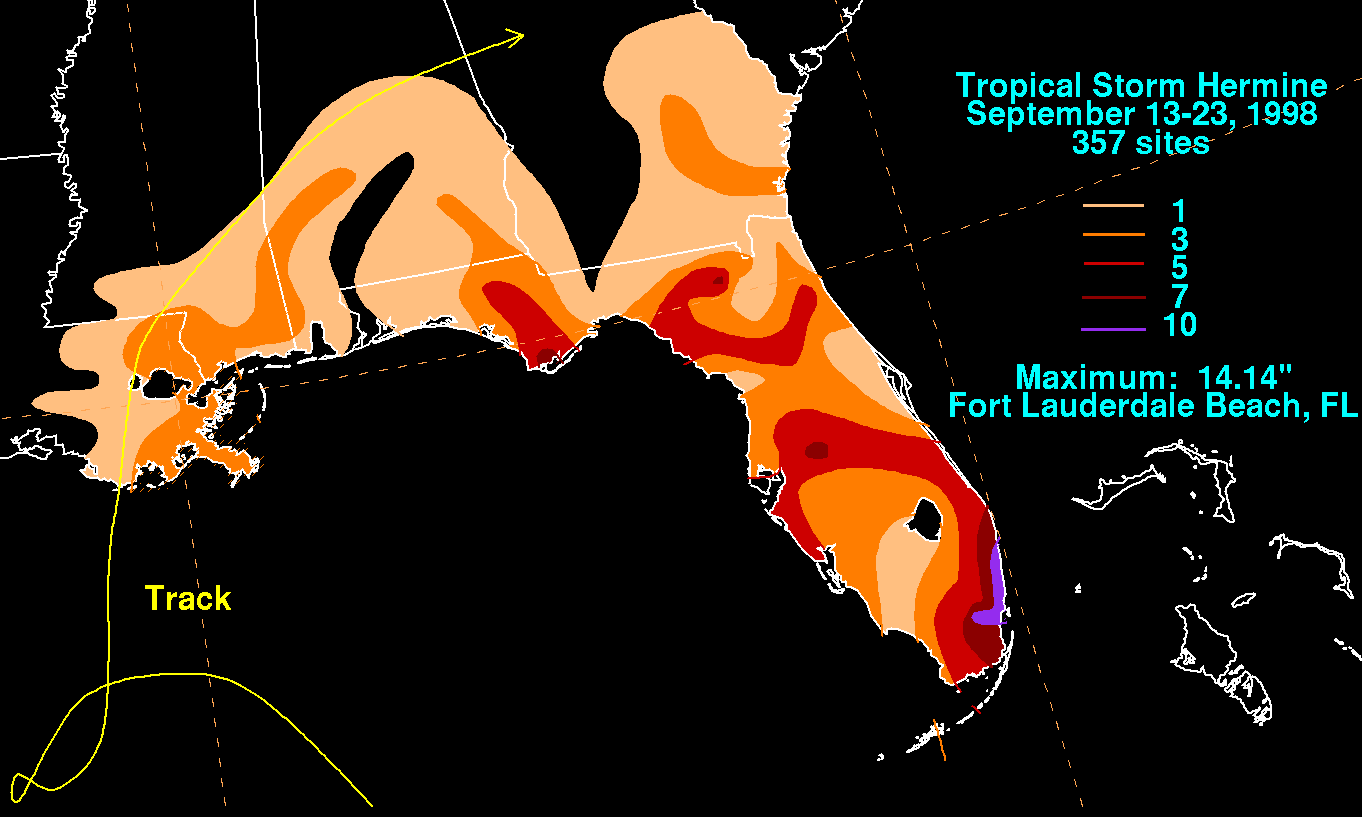
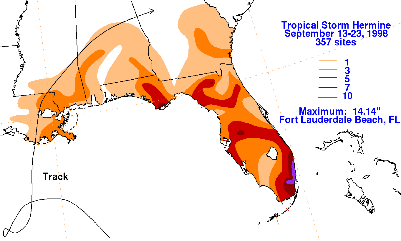
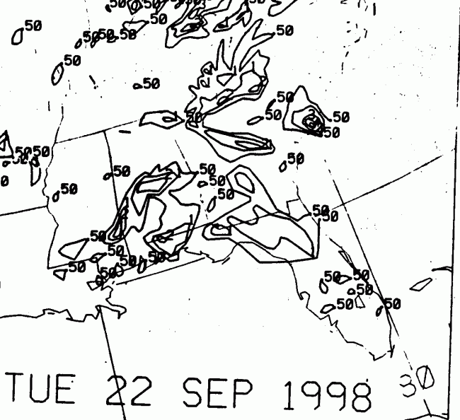
Below is the storm total rainfall for Tropical Storm Hermine.
Note the maximum along the
Gold Coast of Florida, due to the inflow bands from the cyclone over
a few days' time interacting
with an upper cyclone in its vicinity. A secondary maximum in the
South lies to the right of the storm's
track.
A tertiary maximum
lies along the dying cyclone's final inflow band while located well
inland. Data for the map
was compiled from Daily Precipitation Publications by the National
Climatic Data Center.
 |
 |
 |
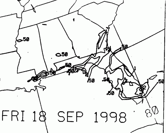
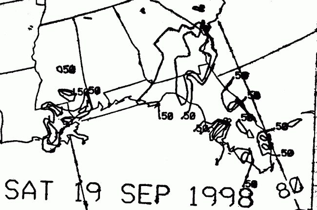
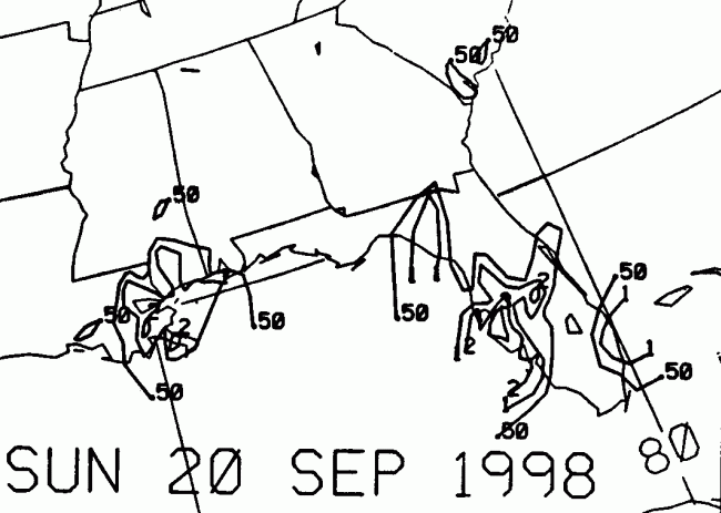
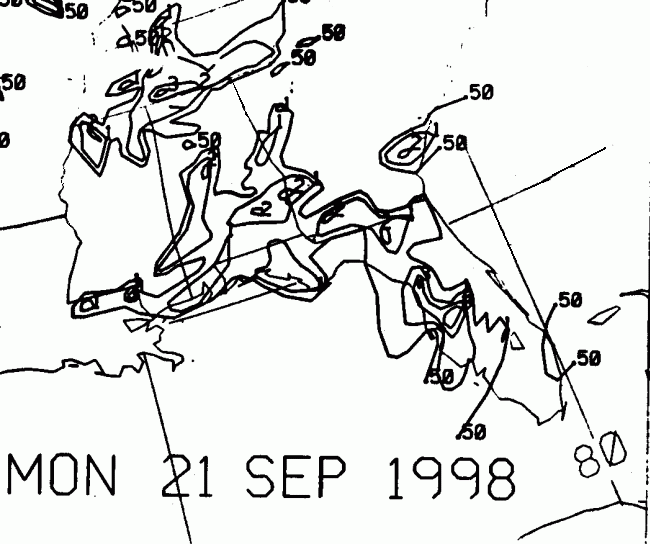
Below is the calendar for Daily Precipitation Maps. Note that
the 24-hour periods end
at 12z that morning.