The monsoon trough was located offshore the coast of southern Mexico in early September. On the 2nd,
an area of low pressure developed within this trough in the Gulf of Tehuantepec. The system drifted north-
west, developing into Tropical Depression 11-E on the 3rd. Although it developed an eye-like feature on radar
imagery the morning of the 4th, the system was considered a tropical depression until it made landfall southeast
of Salina Cruz, Mexico. The system dissipated as a tropical cyclone on the 4th. The remnant low moved north
across the Isthus of Tehuantepec into the Bay of Campeche. Moving north-northeast, the system redeveloped
organized convection on the 5th, and by the morning of the 6th, was upgraded to Atlantic Tropical Depression 10.
Strengthening continued, and the system was named Tropical Storm Hermine. Turning more to the northwest,
Hermine developed an eye-like feature before making landfall across northeast Mexico as a strong tropical storm.
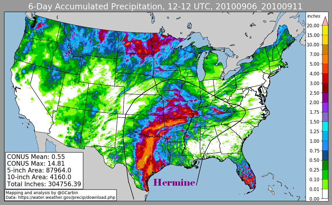
The cyclone turned northward through Texas, and its main inflow band intensified and stalled along the Interstate
35 corridor, flooding areas from Dallas to San Antonio and Austin. The weakening depression moved northeast
across Oklahoma while hooking up with a warm front and becoming extratropical. Its mid-level circulation moved
northeast into the cold sector north of the warm front, which led to heavy rains across northern Arkansas and southern
Missouri.
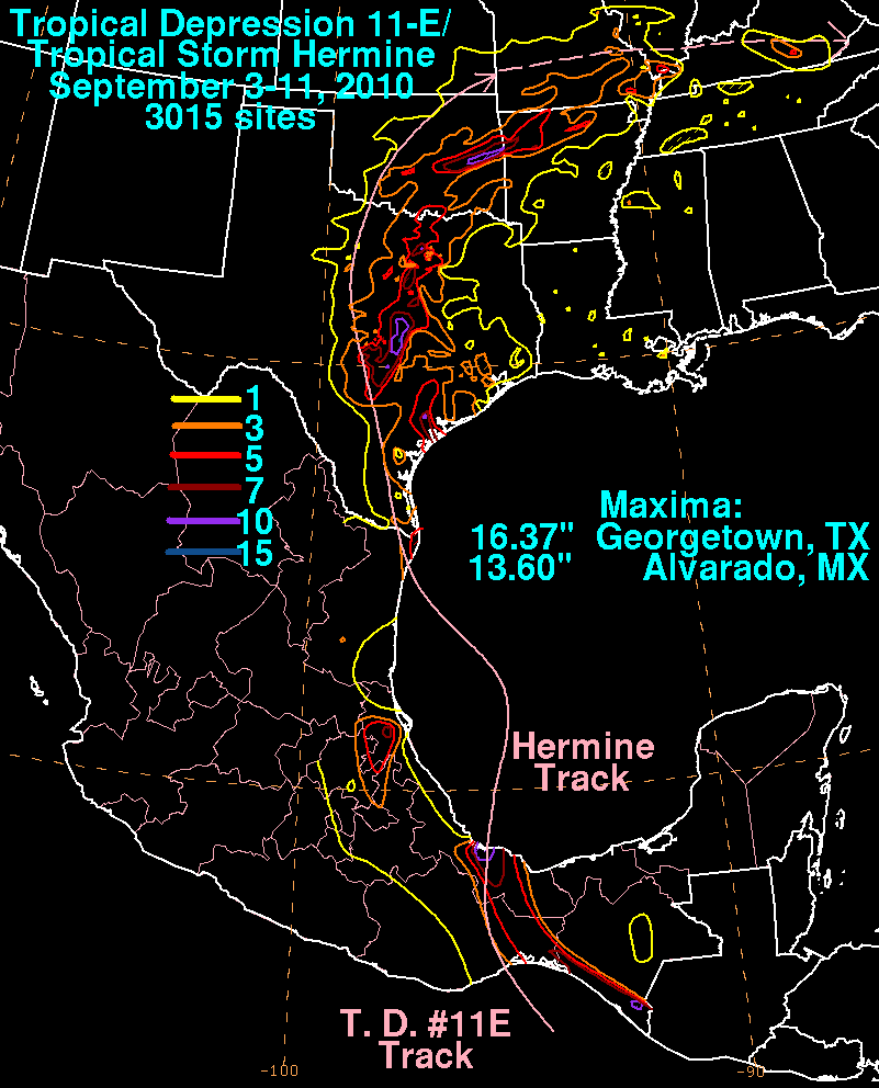
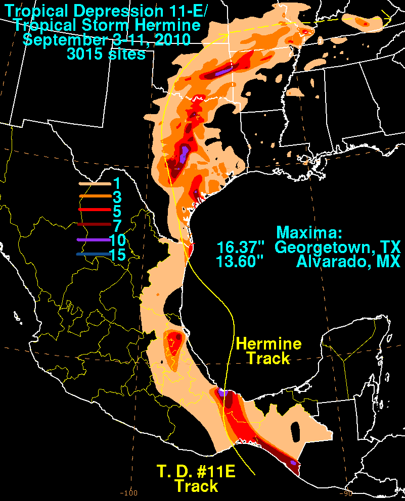
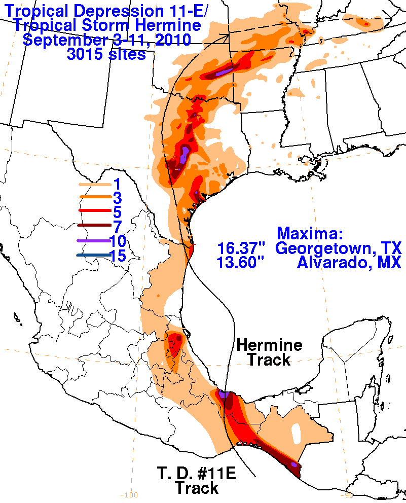
Data for the first three rainfall graphics below was compiled from rain guage observations from the National Weather
Service River Forecast Centers and the Comision Nacional del Agua (the parent agency of Mexico's national weather
service). The fourth graphic includes radar-dervied information.
 |
 |
 |
 |