A tropical wave emerged from the west coast of Africa on August 16th. A small batch of thunderstorms formed near the wave for a couple days afterward, but then waned on the 20th and 21st due to subsidence aloft. On the 22nd and 23rd, convection increased again near the wave, with heavy rainfall spreading across portions of the Leeward Islands late on the 23rd. Rains extended westward across the Greater Antilles on the 24th and 25th as the wave moved west at near 23 mph. Tropical storm-force winds were seen north of the Greater Antilles, but the fast motion of the wave prevented the existence of a closed wind circulation near an associated surface low. On the 26th, the northern portion of the wave moved towards the Florida Straits and slowed down. Vertical wind shear caused a loss of thunderstorm organization and winds weakened below tropical storm force. On the 28th, a well-defined center formed and a tropical depression was deemed to have formed 50 miles south-southeast of Key West that afternoon. The system moved west into the Gulf of Mexico through the 30th. Moderate northwesterly vertical wind shear kept development slow. The system became a tropical storm north of Cancun early on the 31st.
Strengthening increased thereafter while the system turned to the north-northeast across the eastern Gulf of Mexico. Within its central dense overcast, an eye feature formed on September 1st and Hermine became a hurricane that afternoon south of Apalachicola. Hermine made landfall near St. Marks very early on the morning of the 2nd and weakened thereafter, becoming a tropical storm again just north-northeast of Tallahassee. The storm moved northeast across the coastal plains of Georgia and the Carolinas from the 2nd into early on the 3rd. Transition into an extratropical cyclone began during this transit and completed early on the 3rd near Oregon Inlet, North Carolina. The strong extratropical cyclone edged away from the East Coast into the 5th. After the low occluded, it turned northwest and west, backing towards the Mid- Atlantic coast. The deep layer low drifted offshort New Jersey and Long Island on the 7th with the system losing tropical storm-force winds on the morning of the 7th. The system turned northeast on the 8th and dissipated near Chatham, Massachusetts during that afternoon.
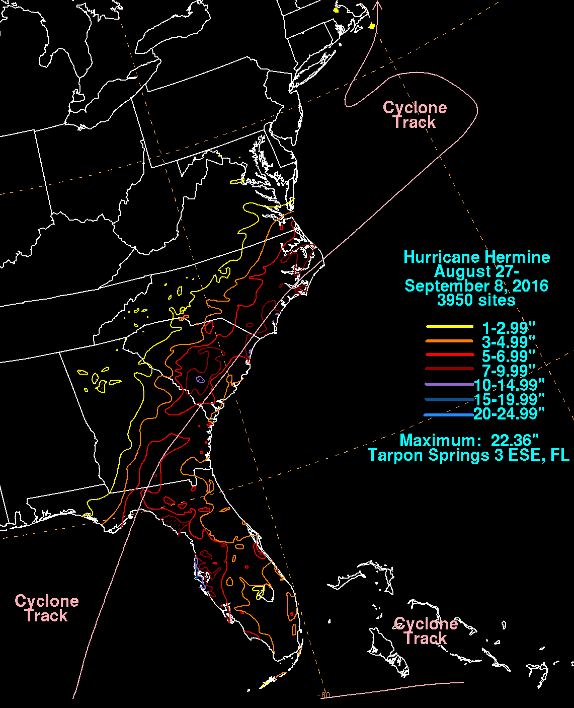
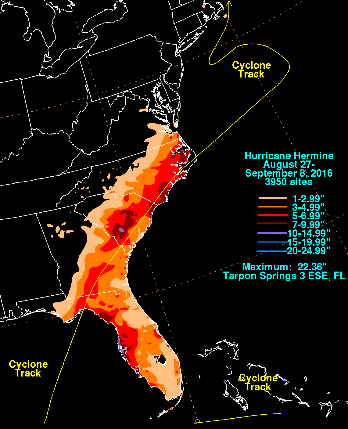
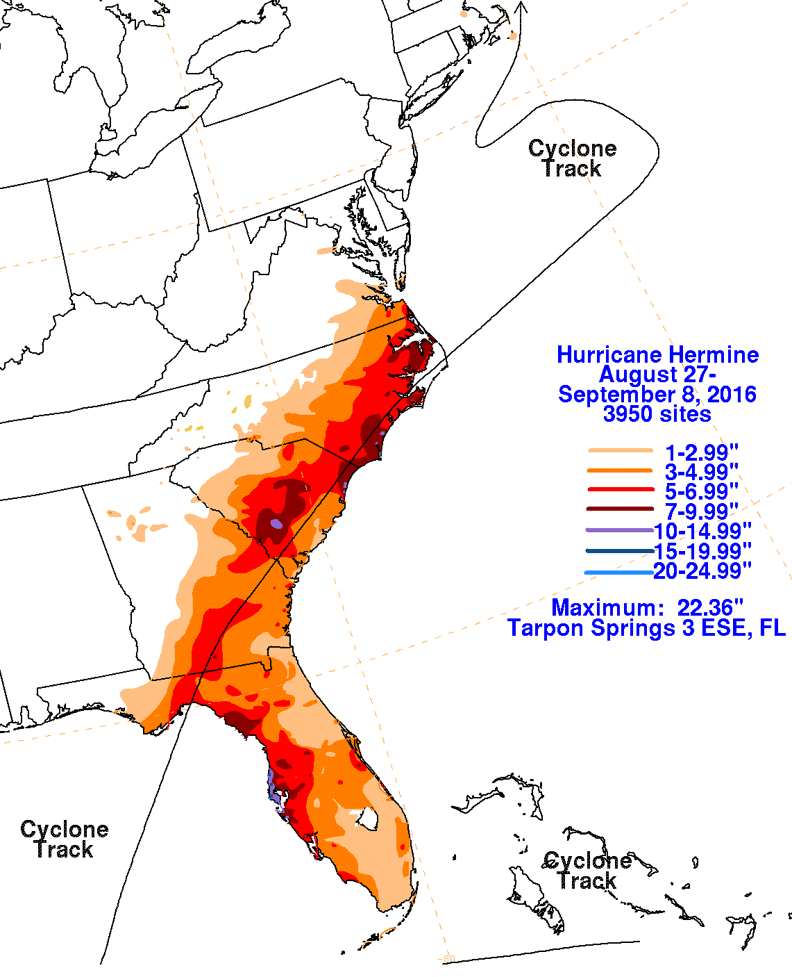
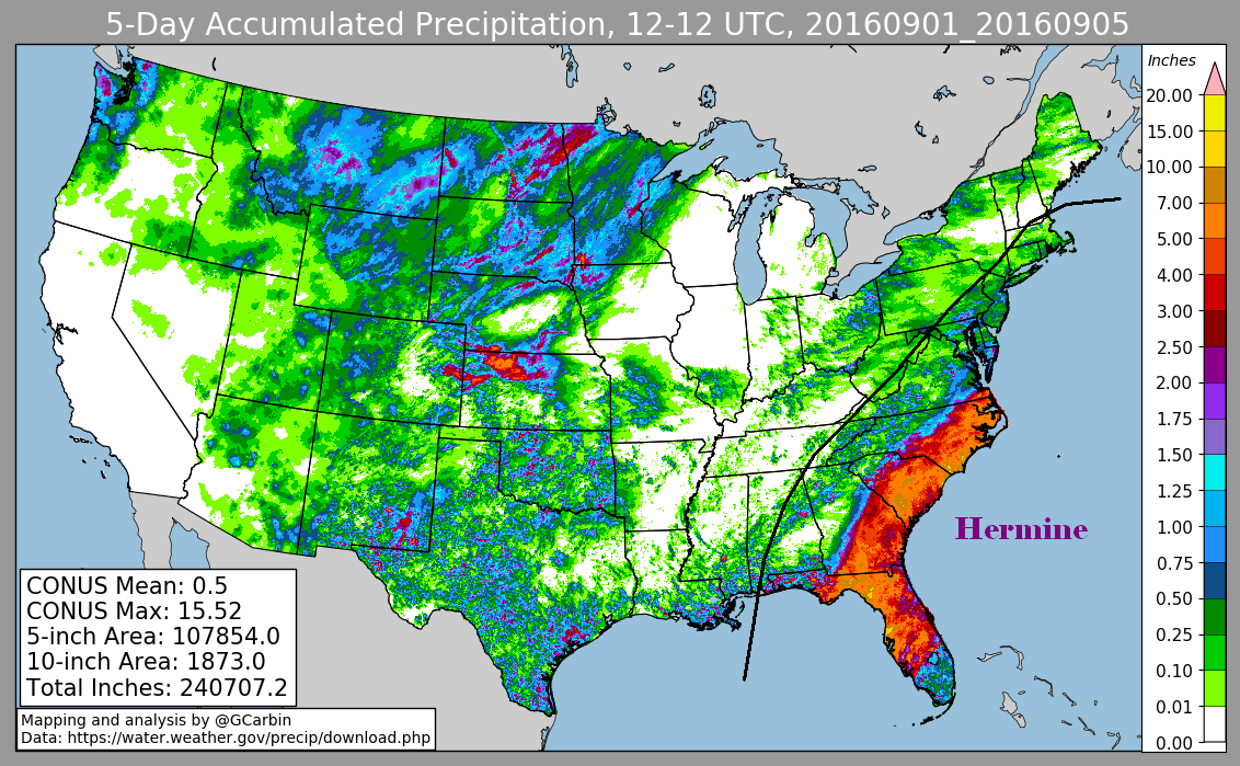
The first three graphics below show the storm total rainfall for Hurricane Hermine, which used rain guage information from National Weather Service River Forecast Centers, Forecast Offices, and CoCoRAHS. The fourth image is a National Weather Service composite radar/rain guage rainfall estimate graphic.
 |
 |
 |
 |