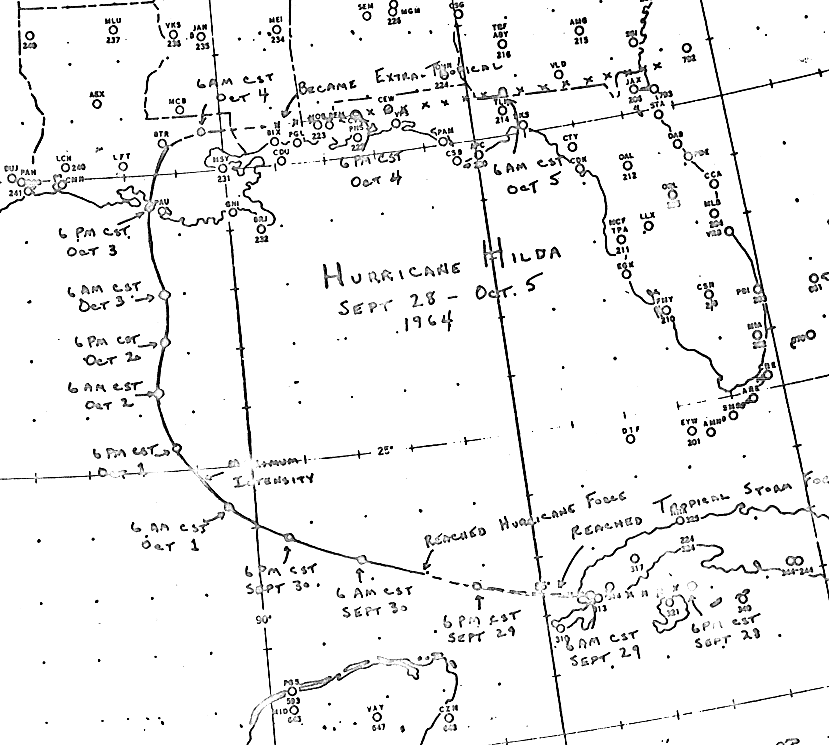
The initial depression formed offshore the coast of southern Cuba on September 28. The cyclone moved
west and west-northwest, strengthening into a tropical storm soon after entering the Gulf of Mexico, and
a hurricane during the night of the 29th. On October 1st, the hurricane slowly turned north and weakened
as it interacted with a nearby frontal zone and cooler waters across the northern Gulf of Mexico. Hilda
made landfall on St. Mary parish on the 3rd as a category 3 hurricane. Turning eastward after landfall,
the cyclone continued weakening and became an extratropical cyclone on the 4th which ultimately moved
eastward into the subtropical Atlantic. Below is the track of this cyclone provided by the National Hurricane
Center.
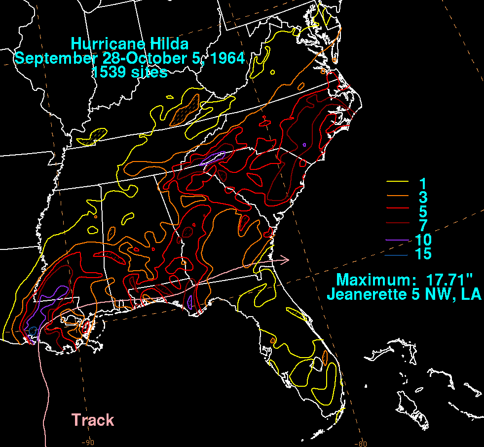
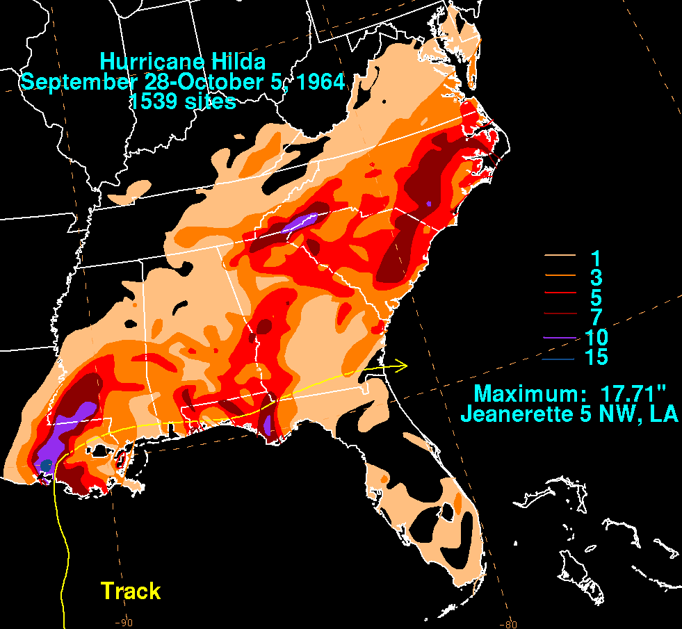
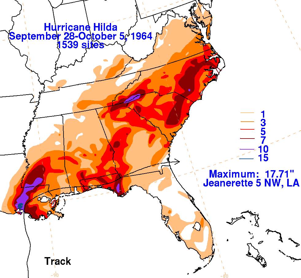
The graphics below show the storm total rainfall for Hilda.
The maximum across the Lower Mississippi Valley
fell just to the left of its track. The precipitation through the East
fell along a frontal boundary draping over the
northeast side of Hilda.
 |
 |
 |