A broad low pressure area formed along a surface trough in the western Gulf of Mexico. An area of thunderstorms
formed on the northern end of the trough, which forced the development of a new, well-defined low pressure area.
The system organized into a tropical depression on the morning of the 12th. Rapid development ensued, and within
18 hours of becoming a tropical depression Humberto became a tropical storm and then a hurricane as it headed
north-northeast into the Golden Triangle of Southeast Texas during the early morning hours of the 13th, becoming
the most rapidly developing tropical cyclone known to develop close to land in the Atlantic Basin. Weakening
slowly after landfall, Humberto regained tropical storm and then tropical depression status as it moved through
Louisiana into Mississippi. Its surface circulation was left behind across Louisiana as west-southwest vertical
wind shear carried its mid-level center northeastward.
According to surface analyses and satellite imagery, as Humberto's mid-level circulation continued progressing
northeast, it spawned a new low pressure area in Georgia which forced the original circulation southeast towards
northern Florida before dissipation. As the mid-level center continued progressing, a third cyclone in southeast
Virginia developed and moved northeast into the western Atlantic, absorbing the second low.
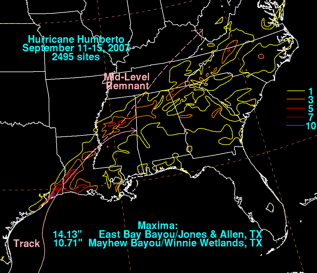
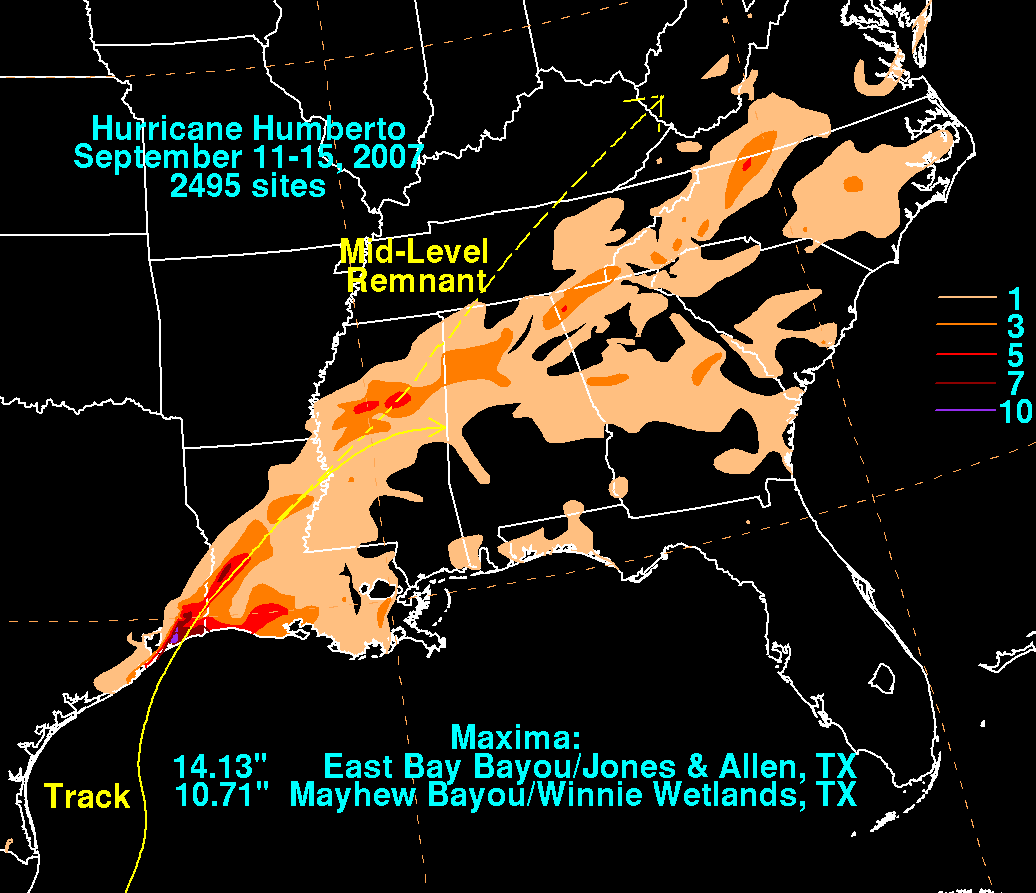
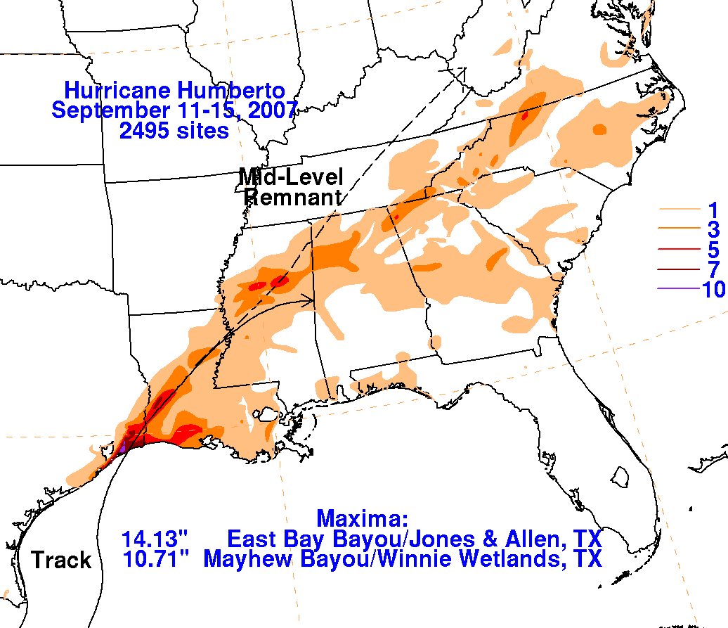
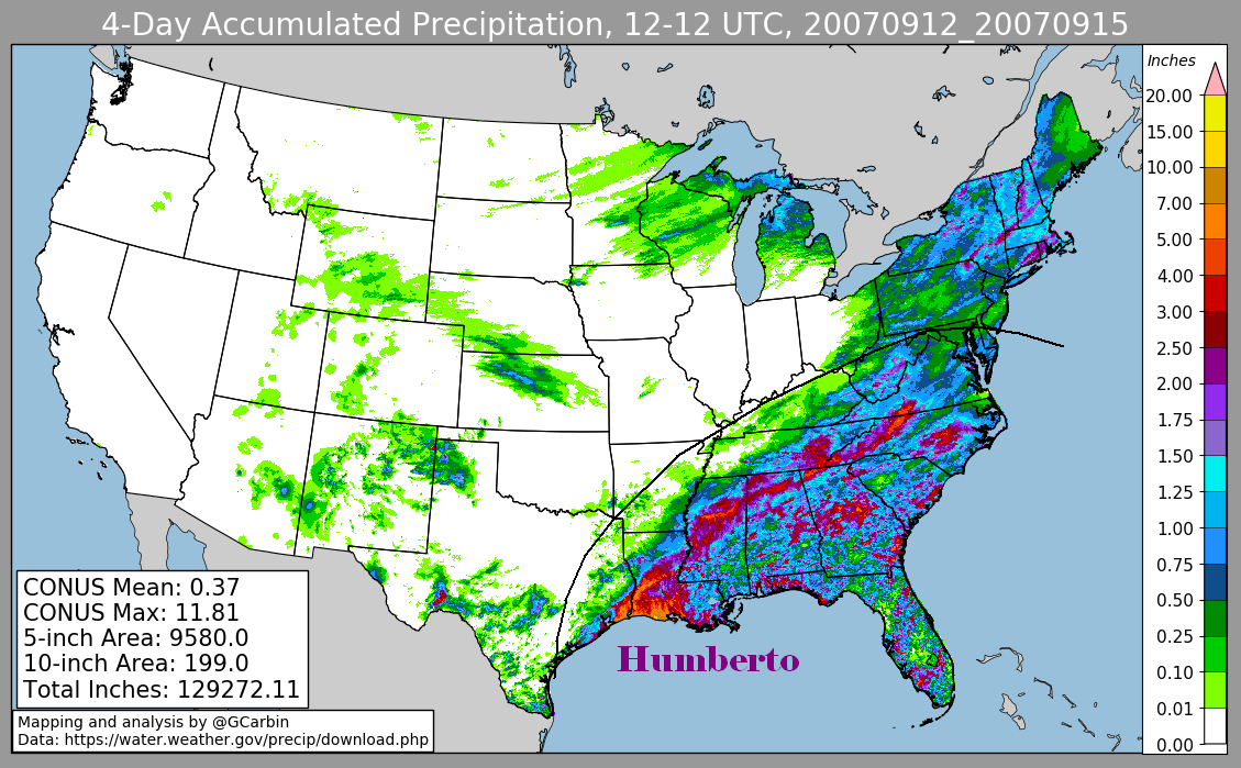
Below are the storm total graphics for Humberto. The first three were prepared with rain guage data from the NWS River Forecast
Centers. The fourth includes radar-derived information. As the storm approached
the Texas coast, warm advection ahead of the
cyclone overran a frontal boundary to its east-northeast, leading to an area of moderate to heavy rain which spread out well
ahead of the cyclone into the Carolinas.
 |
 |
 |
 |