An active tropical wave moved offshore the African coast on the morning of September 14th. The system moved due west, losing its thunderstorm activity, and moving innocuously through the tropical north Atlantic until it neared the Lesser Antilles, when convection returned to the wave on the 19th. After scraping the coast of northeast South America, it turned west-northwest and organized into Tropical Depression Nine on the 23rd as conditions aloft became more favorable for developement. That evening, the cyclone strengthened into Tropical Storm Ian while moving through the central Caribbean. After tracking westward into the western Caribbean, the system felt in the influence of an upper level trough to its northwest and turned sharply north- northwest, becoming a hurricane due to a favorable interaction with the incoming upper level trough. After moving across western Cuba as a major hurricane, Ian continued to strengthen upon approach to southwest Florida, making landfall at Cayo Costa and south of Punta Gorda while strengthening further. Increasing interaction with the nearby upper level trough led to extratropical transition beginning in earnest as it crossed central Florida as a weakening tropical storm, and although it emerged from the east coast of Florida as a tropical storm, it had hybrid characteristics it was never able to shed as it approached South Carolina.
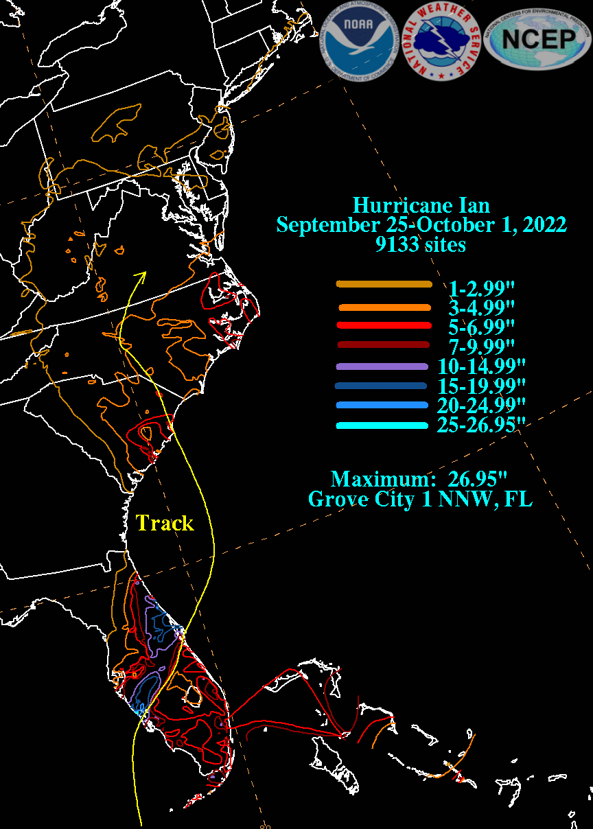
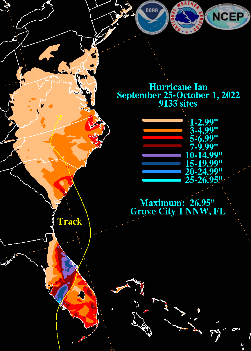
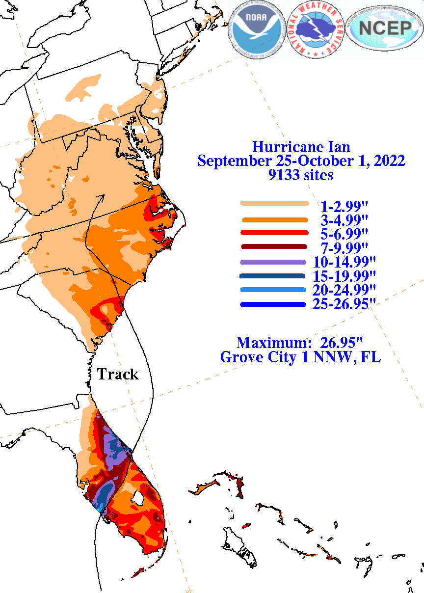
The graphics below show the storm total rainfall for Ian, which used rain gage information from National Weather Service River Forecast Centers, South Florida Water Management District, National Weather Service Forecast Offices, and CoCoRAHS. Efforts were made to subtract out the influence of the nor'easter that formed to Ian's east across the Mid-Atlantic States.
 |
 |
 |