On November 2nd, a small section of the Intertropical Convergence Zone developed convection north of Panama.
A small surface low formed the next day offshore Costa Rica, as the system drifted northwest. By the 4th, the circulation
developed a well-defined circulation and enough convective organization to be considered a tropical depression. The
system developed into a tropical storm, named Ida, later that day. Continuing its northwest movement, Ida strengthened
into a weak hurricane before moving ashore Nicaragua on the 5th. Weakened back into a tropical depression, Ida turned
to the north moving through eastern Nicaragua and Honduras. When its center re-emerged into the northwest Caribbean
sea, Ida strengthened back into a tropical storm on the 6th and eventually peaked as a category two hurricane in the
northwest Caribbean sea. Vertical wind shear from a mid to upper level low to its southwest led to weakening, and
Ida weaked to a tropical storm on the 9th, and became an extratropical cyclone as it moved ashore far southern Alabama
later that day.
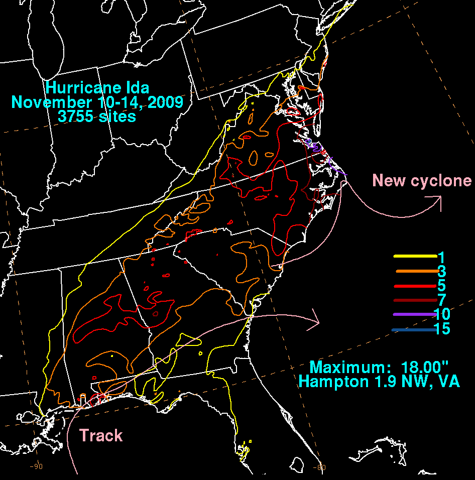
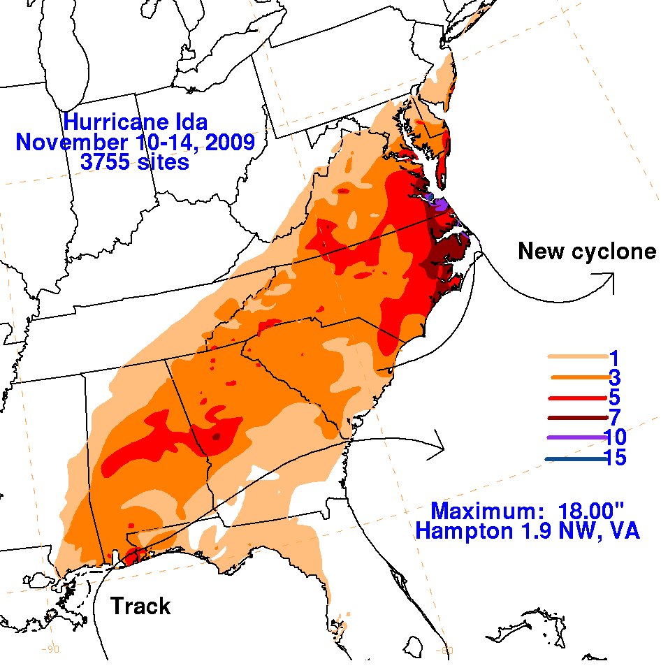
The extratropical low turned east-northeast, briefly acquiring two circulation centers on the 10th before degenerating into an
oblong low pressure area (or trough axis) in the wind pattern, though it continued to display a central closed isobar. As energy from
the Westerlies phased with Ida's mid-level circulation, a new low formed in South Carolina, steering Ida's orginal and broad low pressure
center east-southeastward into the western subtropical Atlantic. Ida's orginal low pressure area became absorbed by the new low
pressure area late on the 11th. The new cyclone moved up into the sounds of North Carolina before dropping southeastward away
from the United States by the 14th. As late as the 17th, this second low continued to linger in the Atlantic waters north of the Great
Antilles. Below are the storm total graphics for Ida. Data was compiled from the National Weather Service River Forecast Centers and
CoCoRAHS. No attempt was made to separate out the rainfall from the separate low pressure areas as radar imagery consisted of one
broad rain shield across the Southeast and Mid-Atlantic States. This is consistent with how the rainfall graphics for Agnes (1972) and
Humberto (2007) were constructed.
 |
 |
 |