A tropical wave left the coast of Africa on August 28th. The system slowly organized, becoming
a tropical depression, then a tropical storm, on September 1st. The cyclone moved westward for
much of its lifetime as the subtropical ridge extended westward to its north. By the 3rd, Ike had
become a hurricane, then a major hurricane as it rapidly intensified underneath an upper level high.
Ike wavered between category 2 and 4 strength as the effect of northerly vertical wind shear and
eyewall replacement cycles caused fluctuations in strength. On the 7th, Ike moved through the
southeast Bahamas into eastern Cuba. Briefly emerging into the northwest Caribbean, Ike remained
a hurricane through its next landfall across western Cuba on the 9th. Land interaction appears to
have made Ike a larger cyclone, and after emerging into the Gulf of Mexico, its central pressure
fell significantly on the 10th as it moved over the Loop Current. The large system strengthened
back into a category 2 hurricane, which moved west-northwest through the Gulf of Mexico around
the periphery of the subtropical ridge.
On the 12th, Ike became slightly more compact as it moved into a confluent zone between the subtropical
ridge to its east-northeast and troughing across the Plains. This allowed maximum sustained winds to
increase despite a relatively constant central pressure. Ike developed a banding-type eye, and moved
into Galveston, Texas, and weakened as it moved into through eastern Texas and Arkansas. The system
became extratropical as it approached the Mid-Mississippi Valley, and rapidly accelerated northeast through
southeast Canada on the 14th and 15th.
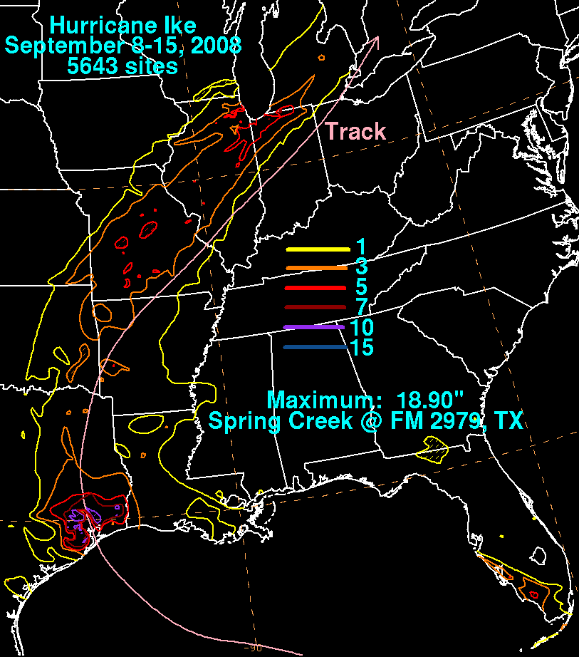
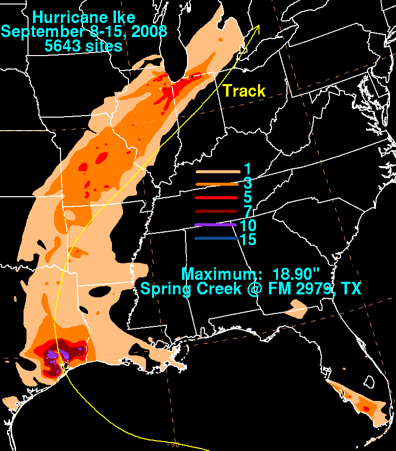
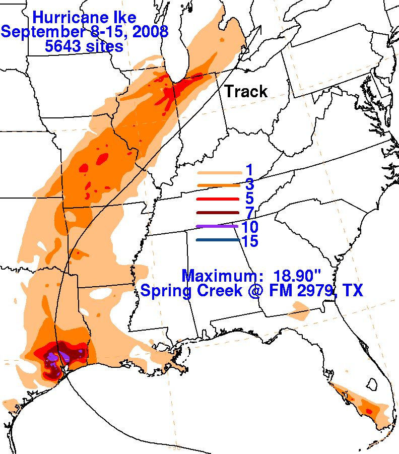
The first three rainfall graphics use rain guage data compiled from the National Weather Service River Forecast
Centers, National Climatic Data Center, CoCoRaHS, and the Harris County (Texas) Office of Emergency Management.
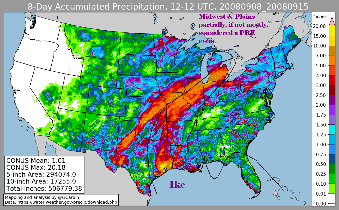
The fourth image includes radar-dervied information. It should be noted in that much of the rain in the Plain and
Midwest focused along a front well in advance of Ike and is considered a PRE/predecessor rainfall event.
 |
 |
 |
 |