A weak tropical depression moved off the coast of Africa on the morning of September 18th. It moved
westward through the tropical Atlantic. Further development finally commenced by the afternoon of the
24th, when the system had become a tropical storm several hundred miles east of Martinique. Slowing
down its westward progression, strengthening continued, and Inez developed into a hurricane by the
morning of the 26th.
Inez moved west-northwest, directly over Guadeloupe as a category 3 hurricane and was a storm of
small diameter with hurricane force winds only extending 50 miles from the center. Intensification resumed
across the eastern Caribbean, where the system reached category 5 status about 160 miles southwest of San
Juan. Striking the Barahona Peninsula of the Dominican Republic around noon on the 9th, Inez rapidly
weakened. Intensifying rapidly after leaving Hispanola, Inez hit Cuba near Guantanamo City on the morning
of the 30th as a category 4 hurricane. Moving along the southern coast of the island for a time, it moved across
Central Cuba around the 1st and continued a slow recurvature into the northwest Bahamas.
The high pressure ridge built in across the Gulf of Mexico, and Inez turned to the west-southwest, moving
over all the Keys from Key Largo to Key West, and brushed to northern coast of the Yucatan Peninsula. It
briefly turned northwest in the Gulf of Mexico as the ridge weakened, but rising pressures across south
Texas turned the system back to the west-southwest to just north of Tampico on the morning of the 10th.
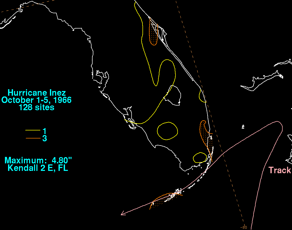
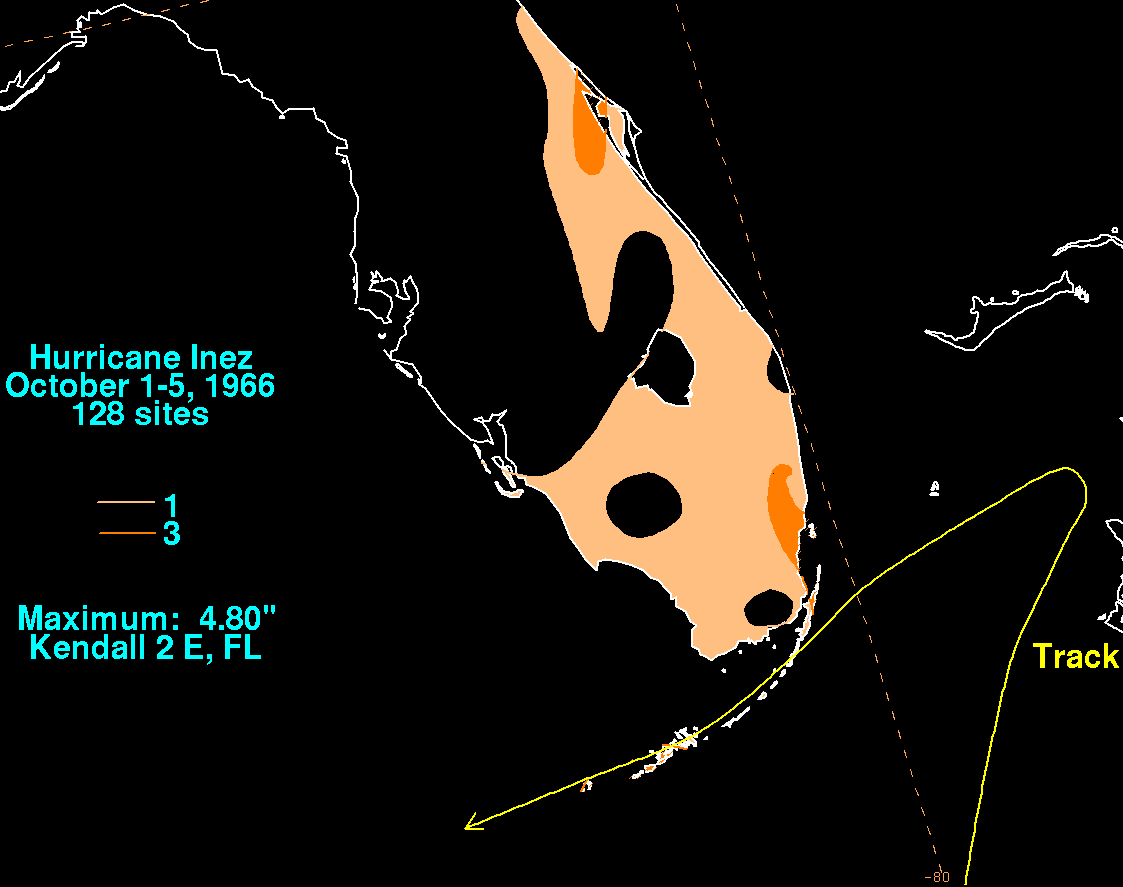
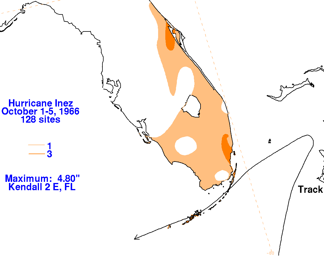
The graphics belowshow the storm total rainfall for Inez. Data was provided by the National Climatic Data
Center in Asheville, North Carolina.
 |
 |
 |