A tropical wave moved offshore the African coast on the 15th, with an accompanying low pressure area. Thunderstorms
were displaced to its southwest as the system moved westward through the Cape Verde Islands. On the 19th, convection began
to organize around the surface low, which then began to strengthen. By late on the 20th, reconnaissance aircraft confirmed
the formation of Tropical Storm Irene east of Dominica. The cyclone moved west-northwest through the Caribbean Sea, turning
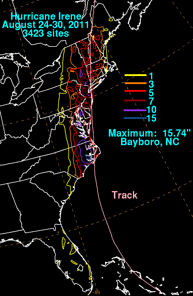
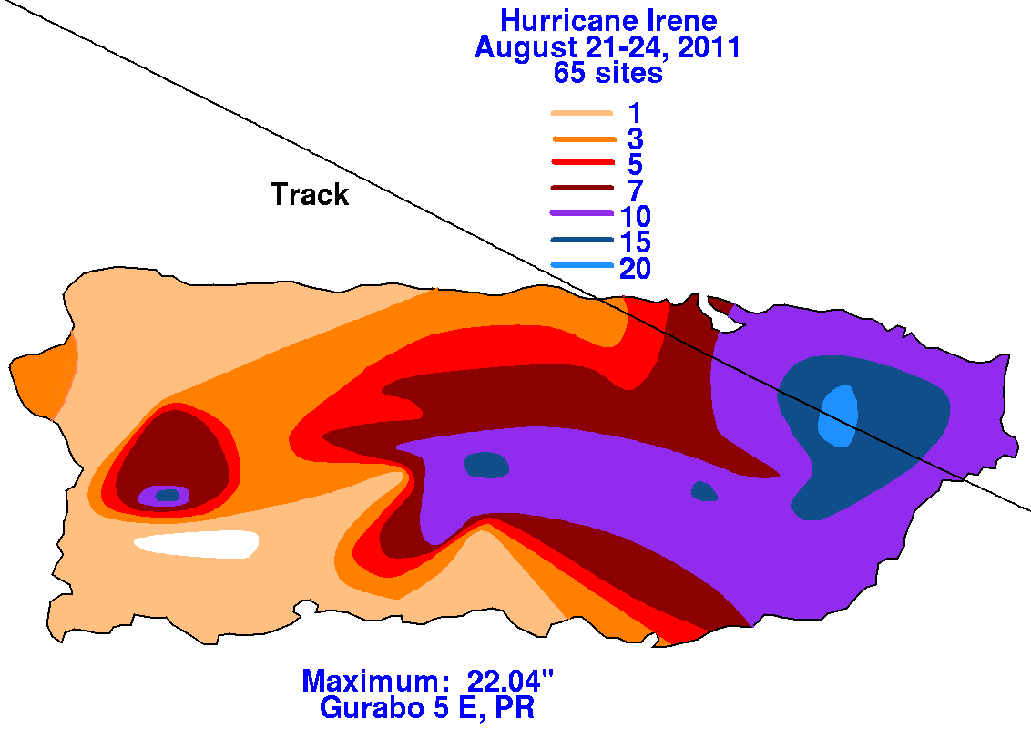
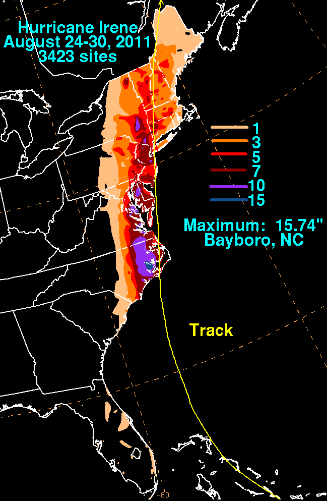
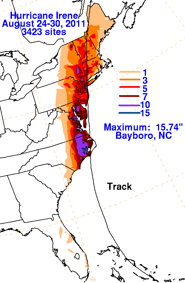
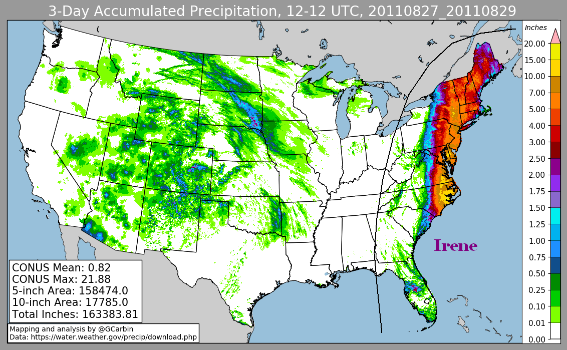
northwest near St. Croix, and becoming a hurricane near Puerto Rico. Below are rainfall graphics relating to Irene's rainfall across
Puerto Rico.
 |
 |
 |
While moving near the Greater Antilles, further development was slow to occur until the 23rd. An eye developed at the hurricane's
center, and its upper level outflow became more pronounced as it moved through the southeast Bahamas. Irene briefly became a major
hurricane on the 24th. Continuing to turn northward into a break within the subtropical ridge steering the storm, Irene paralleled the
Florida coast and moved towards the Carolinas. Slowly weakening, Irene made landfall near Cape Lookout, North Carolina on the
morning of the 27th. Slowly weakening as it moved up the East coast, Irene regained tropical storm status near New York City. The
cyclone moved north-northeast through New England, transitioning into an extratropical cyclone over Maine late on the 29th.
Data for the first three rainfall graphics below was compiled from rain guage reports originating with the National Weather Service River Forecast
Centers, CoCoRAHS, as well as tropical cyclone reports and public information statements from National Weather Service Forecast Offices. The fourth image
includes radar-derived information.
|
 |
 |
 |