A tropical wave moved off the west coast of Africa on August 27th. Its associated thunderstorm activity concentrated near
the northern portion of the tropical wave on the 28th and 29th. By the evening of the 29th, a tropical depression had formed.
That night, the depression had strengthened into a tropical storm named Irma while located west of Cabo Verde. The cyclone
strengthened rapidly, with Irma becoming a hurricane early on the 31st and a major hurricane that evening. The dangerous
hurricane fluctuated in intensity through the 3rd due to eyewall replacement cycles while turning west-southwest.
The system had become larger by the 4th, heading towards the northern Leeward Islands while restrengthening. Maria
reached peak intensity on the 5th just east-southeast of Barbuda. Striking Barbuda and St. Martin, Irma moved just north
of Puerto Rico and the Dominican Republic while approaching the Bahamas. Irma made landfall in Little Inagua, then scraped
the northern coast of Cuba, making landfall at Cayo Romano on the night of the 8th before moving across the Cuban Keys. Irma
then turned sharply northwest and intensified while heading towards Key West, striking Cudjoe Key on its way to Southwest Florida.
Irma weakened while interacting with an upper level trough and the Florida landmass, making landfall east of Naples on the 10th
before weakening while moving through the western Florida peninsula. Irma regained tropical storm status on the morning of the
11th while interacting with a much cooler airmass. Tallahassee set a new record low maximum for the month of September when
Irma's center went by to their northeast. Irma tracked northwestward, moving into southeast Missouri, then southern Illinois
before dissipating on the afternoon of the 13th.
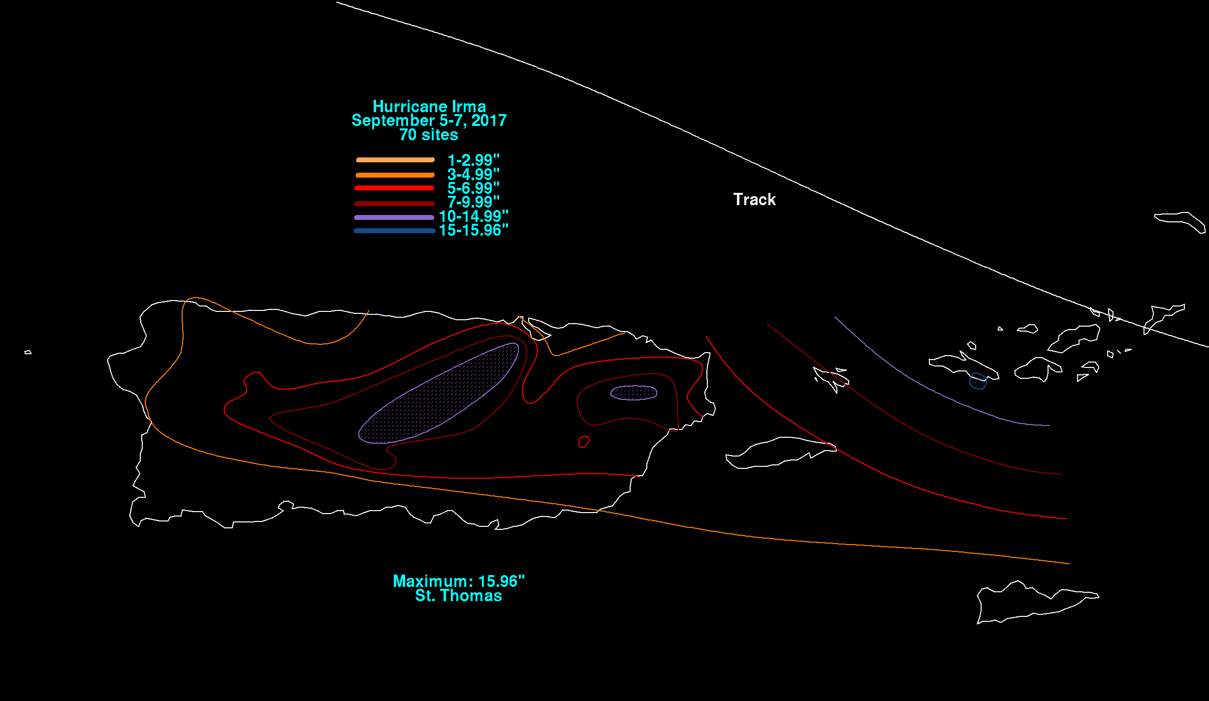
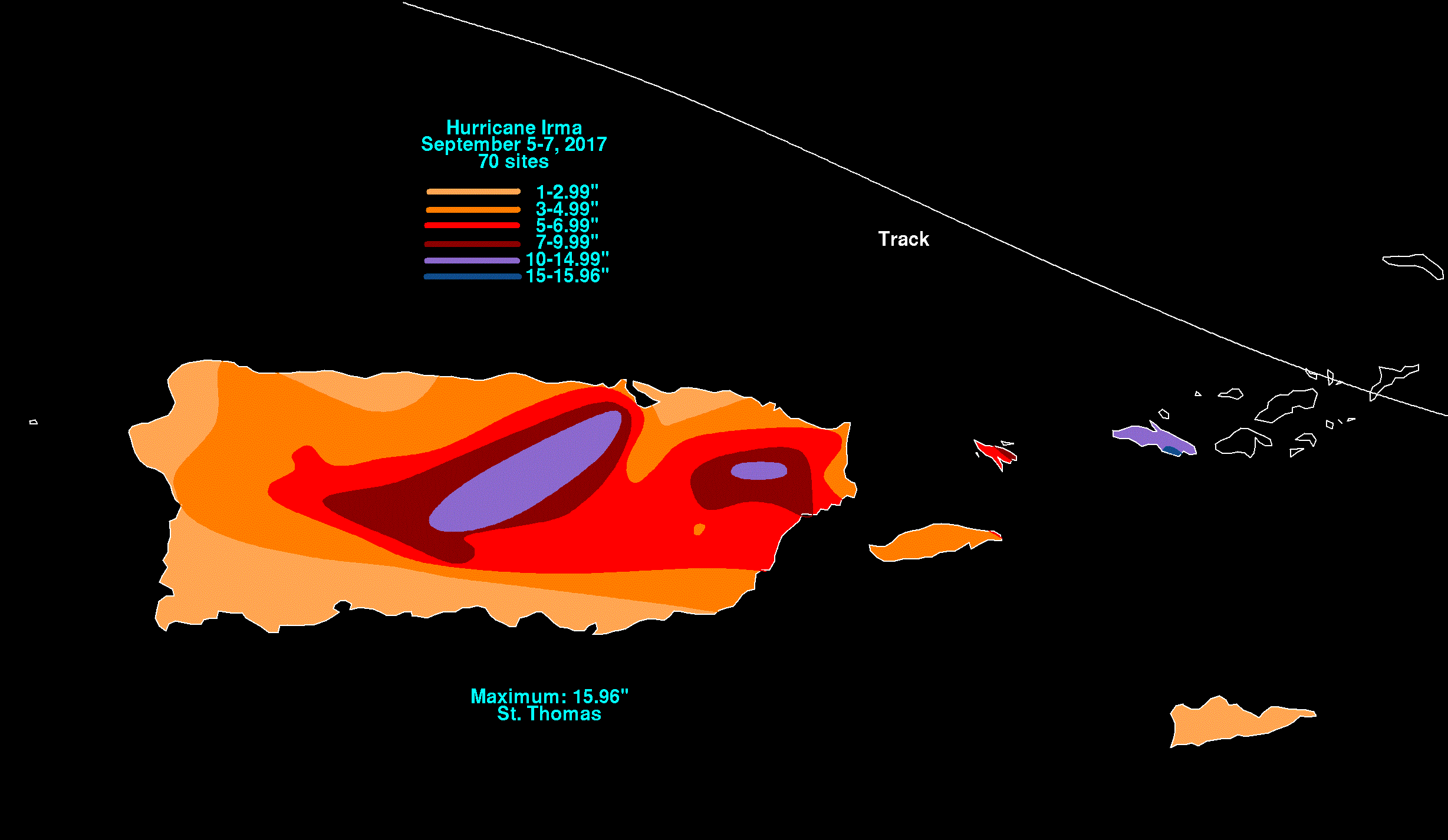
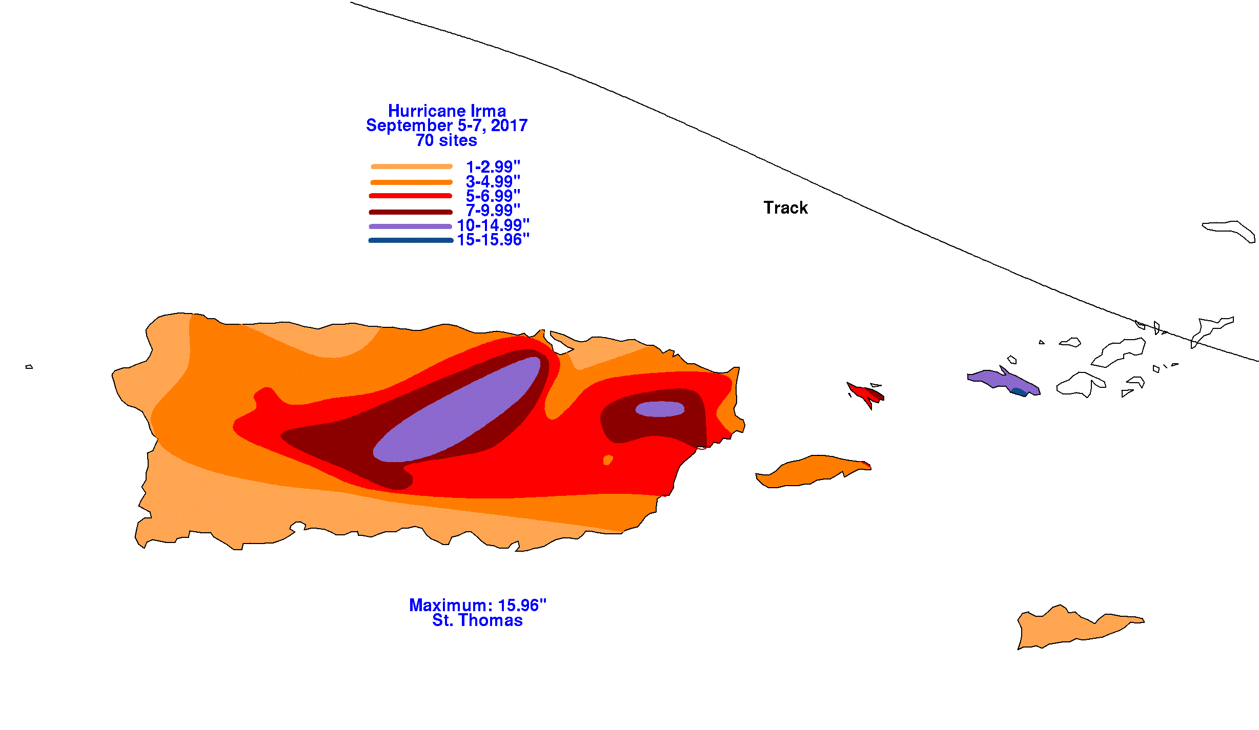
The Puerto Rico graphics below show the storm total rainfall for Irma, which used rain guage information from the National Weather
Service River Forecast Centers, Forecast Offices, and CoCoRAHS.
 |
 |
 |
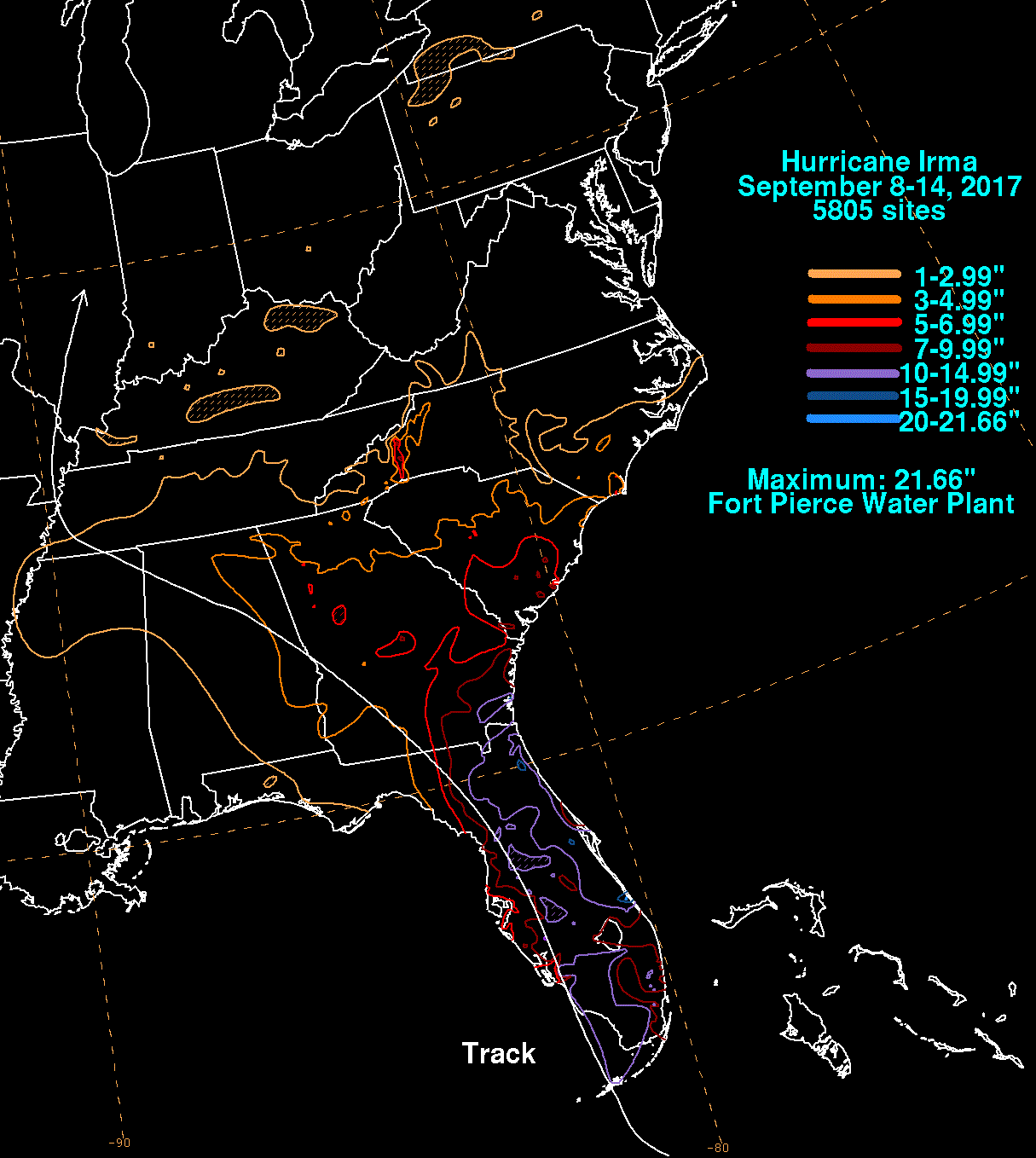
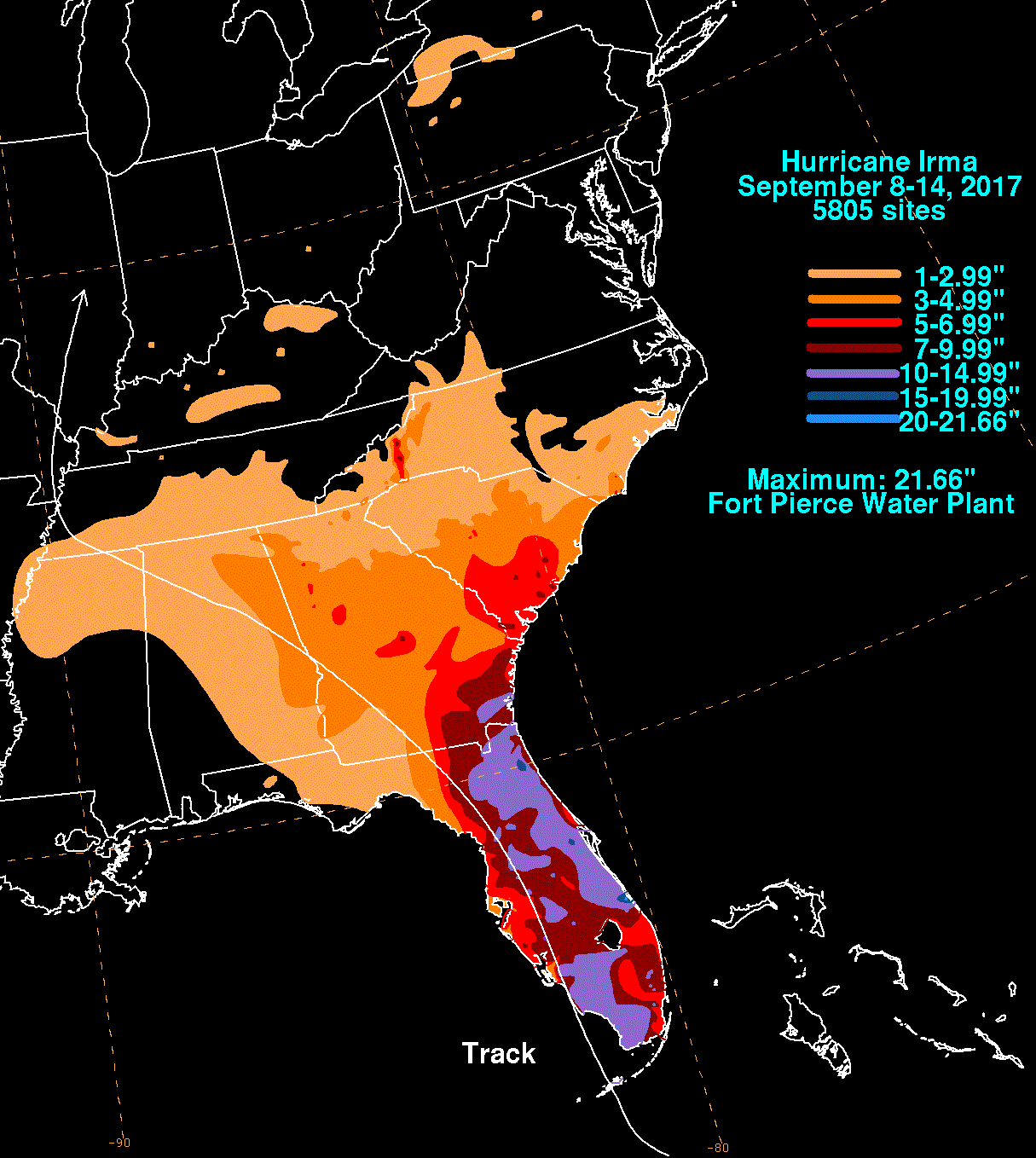
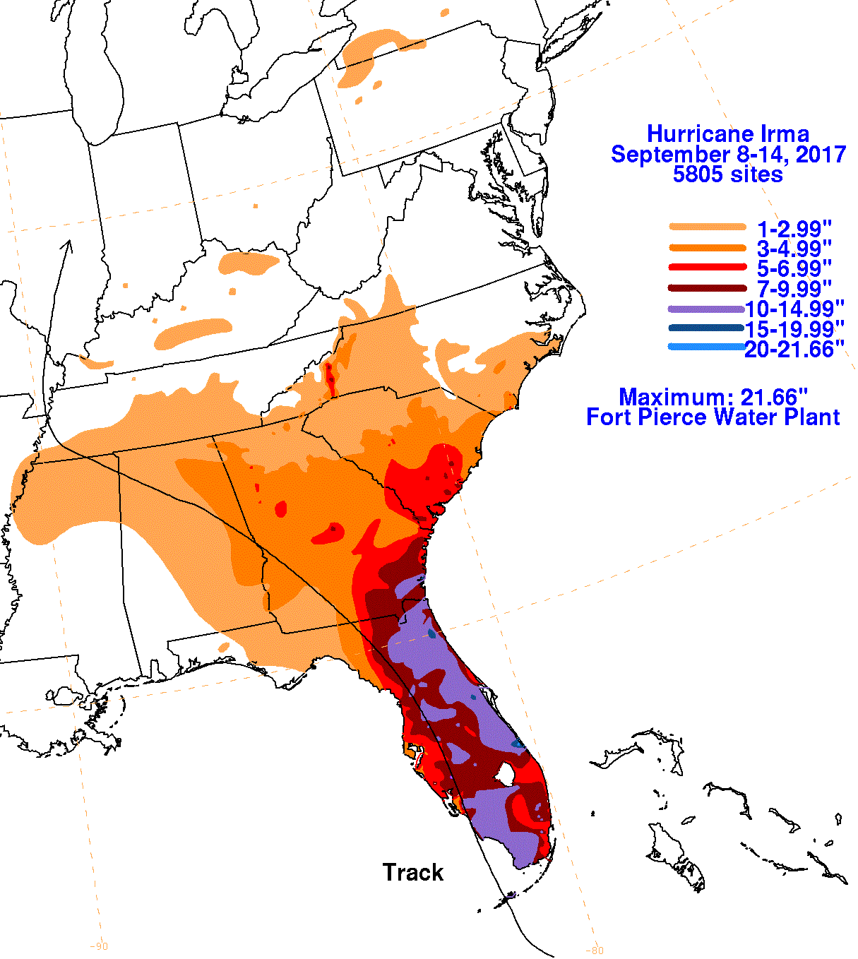
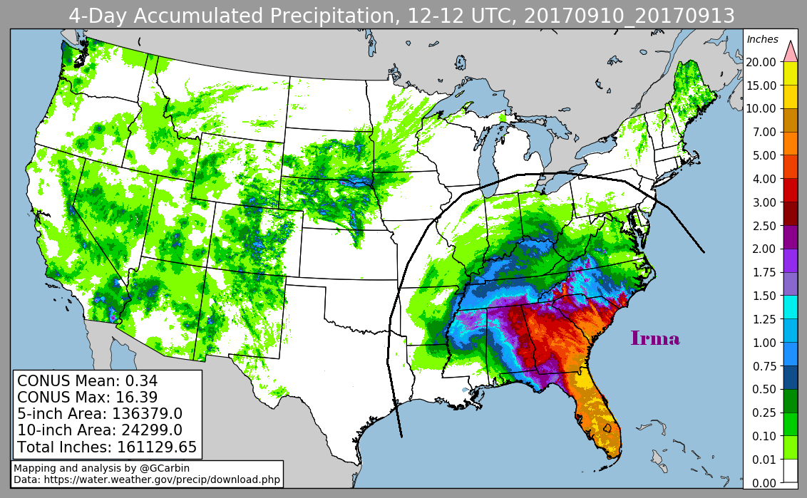
The first three graphics below for the Lower 48 show the storm total rainfall for Irma, which used rain guage information from the
National Weather Service River Forecast Centers, Forecast Offices, and CoCoRAHS. The fourth graphic uses the official National Weather
Service multi-sensor rainfall estimates, which include radar-derived information.
 |
 |
 |
 |