A tropical wave moved off the west coast of Africa on September
29th. The wave migrated into the eastern
Caribbean on October 5th. Shower activity was enhanced by an
upper trough to its west, spurring heavy
rains and mudslides over Puerto Rico between October 5th and 8th.
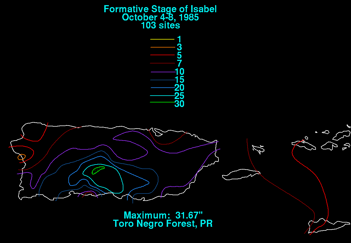
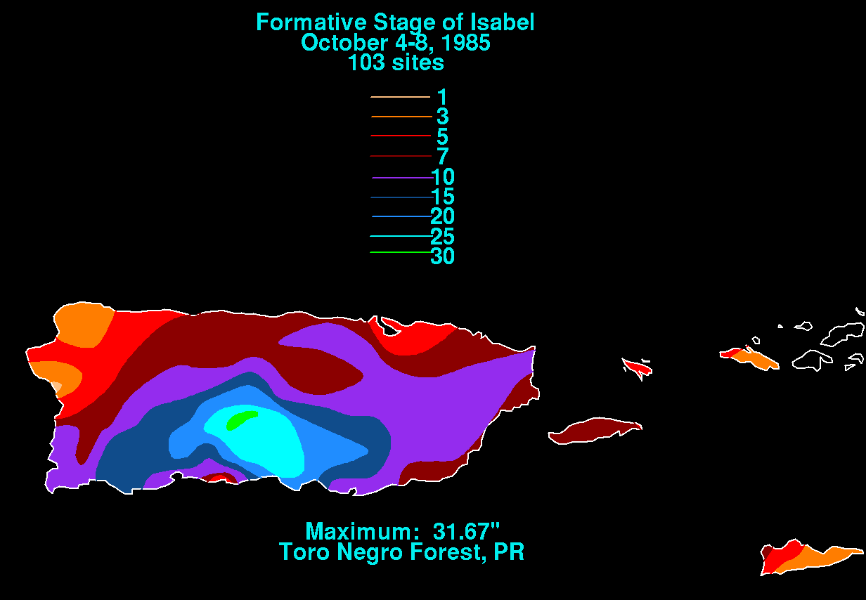
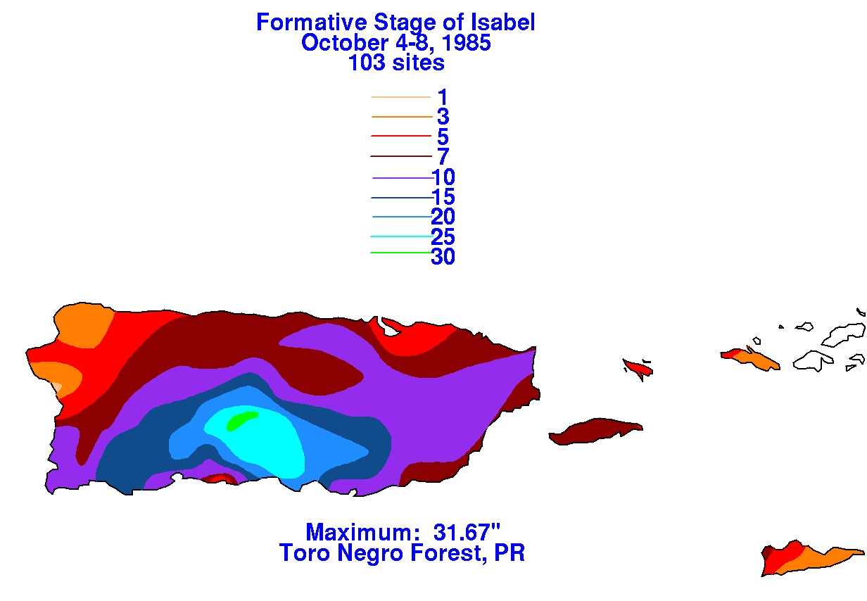
Below are the graphics showing the rainfall
totals for Puerto Rico and the U.S. Virgin Islands. Data was
provided by the National Climatic Data Center
in Asheville, North Carolina.
 |
 |
 |
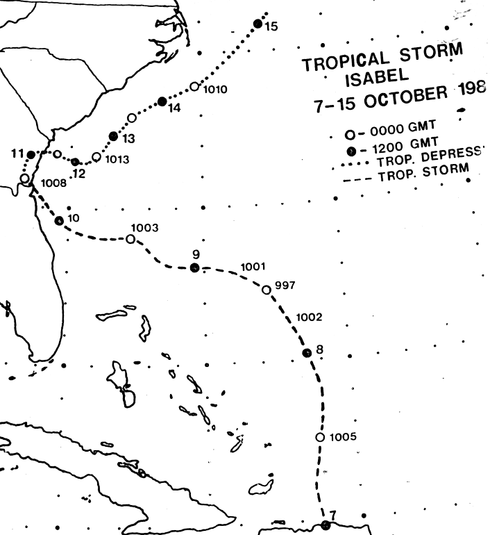
The area of disturbed weather over the Greater Antilles moved
westward,
developing a weak low pressure area
near Hispaniola which became a tropical depression on the 7th. The
depression moved northward around the
western edge of the
subtropical ridge. A nearly ship reported gale force winds, and
Isabel was named. On
the 8th, Isabel
reached its peak intensity before interacting with a frontal zone and
strong southwesterlies aloft.
The high behind
the front bridged across to the subtropical ridge, moving Isabel more
westward. By the
afternoon of the 9th,
Isabel had lost much of its convection as it neared the
Southeast. The cyclone weakened
to a tropical
depression as it made a brief landfall in Georgia, before a cold front
to the west steered Isabel
northeasterly offshore
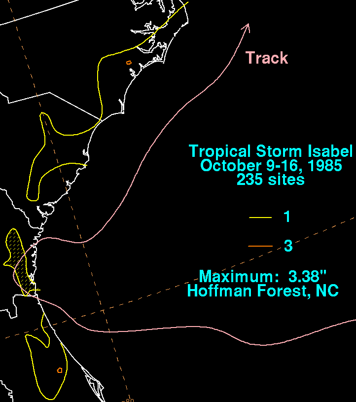
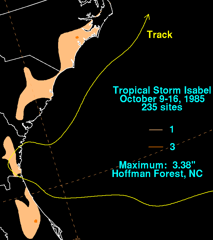
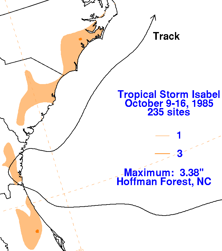
the Carolinas. Its track lies below, provided by the National
Hurricane
Center.
Below are the storm total rainfall maps for Isabel. Since the
cyclone
came ashore as no more than an
exposed low-level cumulus swirl, precipiation amounts were relatively
light.
 |
 |
 |