Satellite imagery showed a poorly organized area of cloudiness and
showers centered 150 miles
south of the coast of Guatemala on September 9th. The tropical
disturbance moved slowly west-
northwest for the next couple days without further development.
On the 12th, a surface low likely
formed and convective improvement led to the formation of a tropical
depression by afternoon 300
miles south-southwest of Manzanillo, Mexico. By that evening, the
system evolved into a tropical
storm, and by the next night, a hurricane just south-southeast of Baja
California. As a category 1
hurricane, Ismael accelerated northward steered by a mid to upper level
trough to its west, and the
system made landfall near Topolobampo on the night of the 14th.
Weakening rapidly as it moved
across the Sierra Madre Occidental mountain chain, the surface
circulation nearly dissipated across
northwest Mexico. As a weak baroclinic low, it moved rapidly
east-northeast from southeast New
Mexico and the Big Country of Texas across the Mid Atlantic.
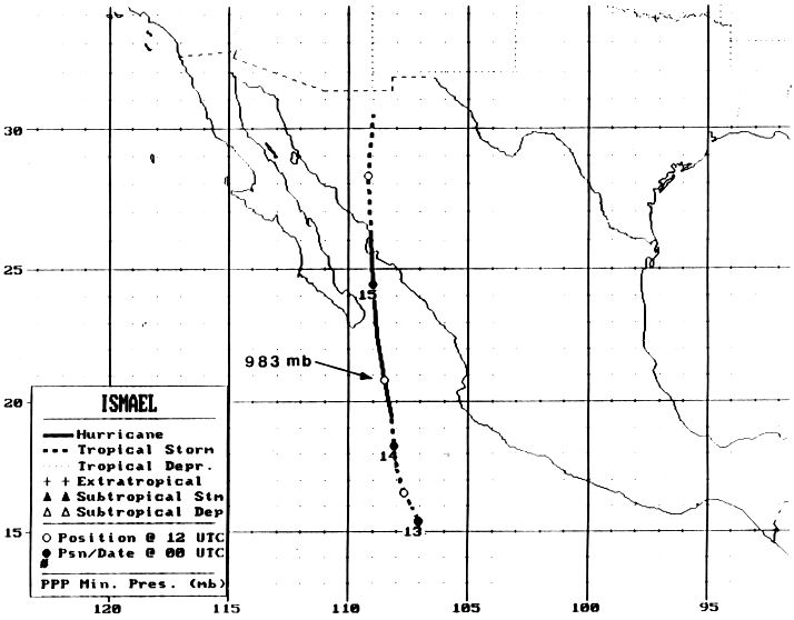
Below is the track of Ismael provided
by the National Hurricane Center.
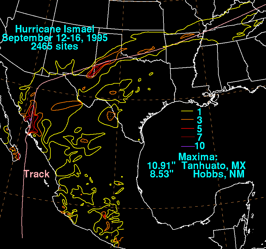
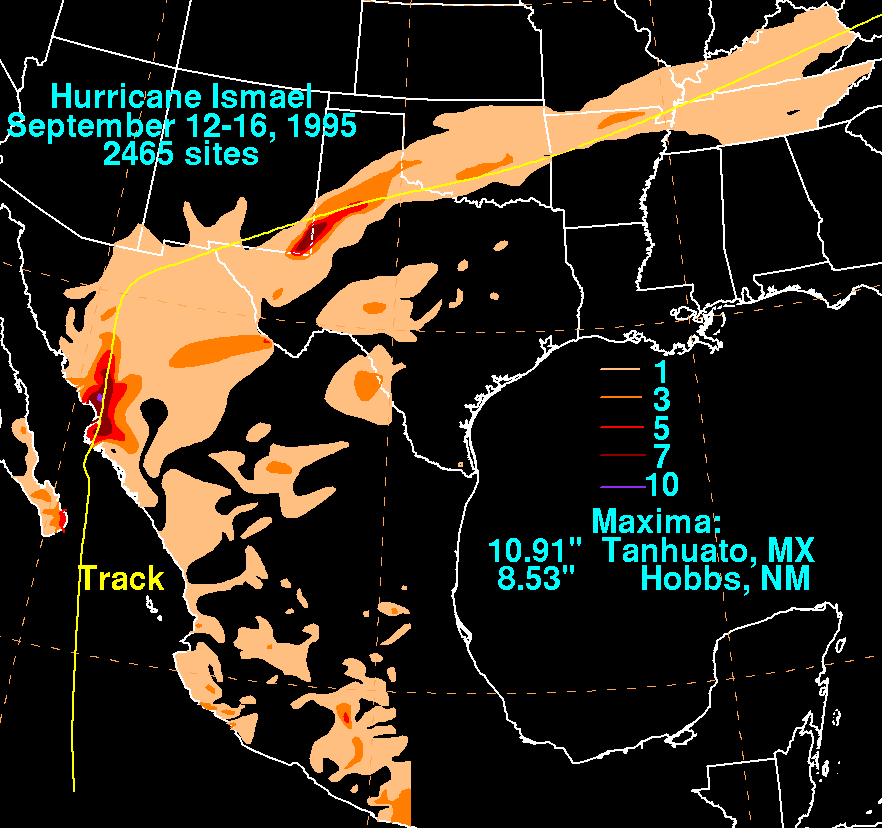
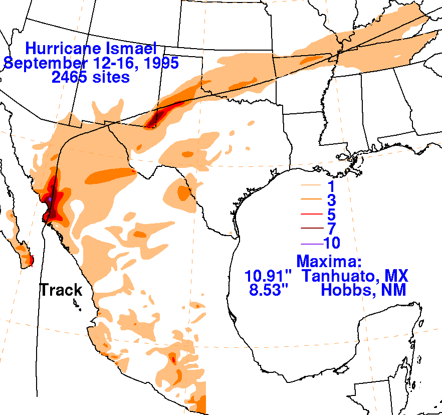
The storm total rainfall maps below were constructed using data from
the
National Climatic Data Center in
Asheville, North Carolina and the Comision Nacional del Agua, parent
agency of Mexico's national weather
service. A significant burst of rains fell upon the New
Mexico/Texas border, with
Ismael's remains dropping
more rain on the Land of Enchantment than any other tropical cyclone or
its
remains since at least 1976.
 |
 |
 |