Javier originated from a tropical wave that crossed the west coast of Africa 29 August. The wave
was devoid of deep convection for several days during its westward trek across the tropical
Atlantic. It then interacted with an upper-low near the Lesser Antilles, and both systems moved
westward across the Caribbean Sea. The upper-low weakened and the wave continued westward,
and it crossed Central America on 9 September with an increase in convective activity. Once the
wave entered the eastern Pacific, the cloud pattern became better organized with deep convection
but limited upper-level outflow. Satellite imagery suggested a tropical depression formed around
noon on 10 September about 300 n mi south-southeast of Salina Cruz, Mexico. A central dense
overcast developed over the circulation center, and intensity estimates based on this cloud pattern
indicate that the cyclone became a tropical storm early in the morning of 11 September.
Under light wind shear, Javier continued to
strengthen and reached hurricane status around noon
12 September.
It then moved slowly between the west-northwest and northwest
around the
periphery of a subtropical ridge centered over Mexico.
Thereafter, Javier intensified at a rapid
rate as indicated by the
quick development of a distinct eye. The hurricane reached its
estimated
peak intensity of 130 knots and a minimum pressure of 930
mb at 0000 UTC 14 September,
when the cyclone was located about 270
n mi south-southwest of Manzanillo, Mexico. Microwave
data showed
the formation of concentric eyewalls and Javier weakened, but it
maintained
category 3 intensity on the Saffir/Simpson Hurricane
Scale for the next three days. Javier moved
northwestward toward
cool waters, and this along with strong southwesterly shear
resulted in
weakening. Javier then turned northward and
north-northeastward, and as a weakening tropical
depression crossed
Baja California between Cabo San Lazaro and Punta Abreojos early on the
morning of 19 September. The depression continued toward the
north-northeast over the Sea
of Cortes and weakened to a remnant
low around noon on 19 September. The low moved
inland near Guaymas,
Mexico, and dissipated over the high terrain of the state of
Sonora.
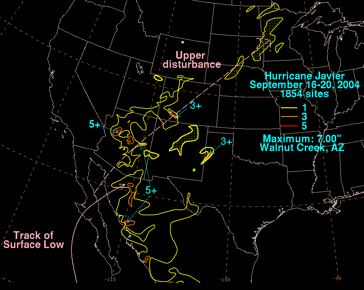
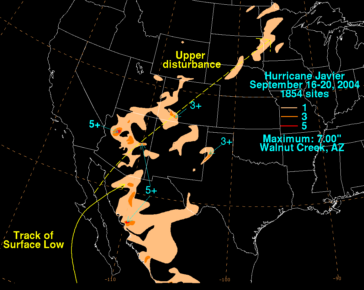
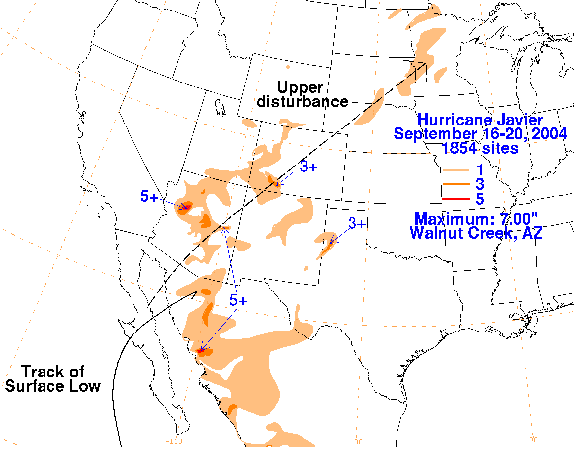
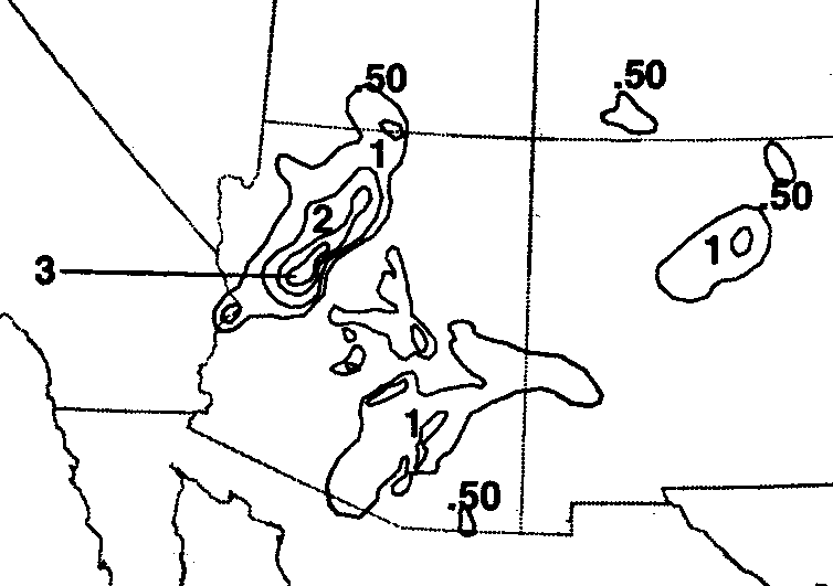
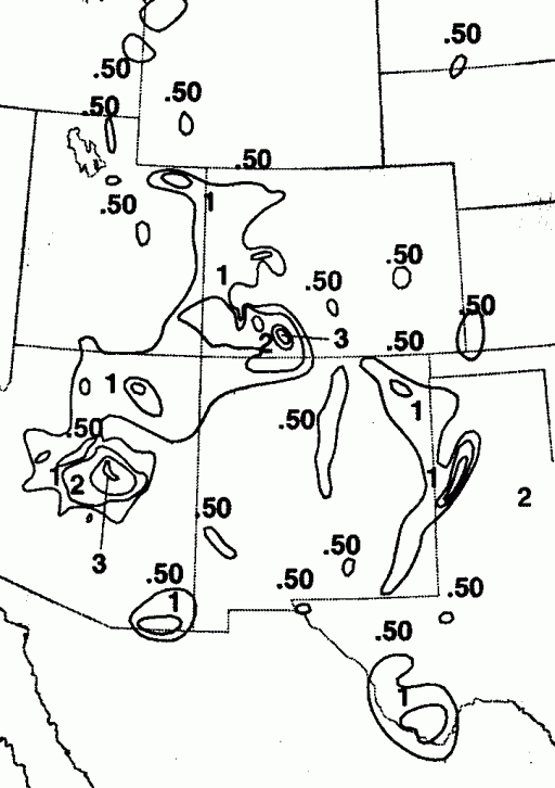
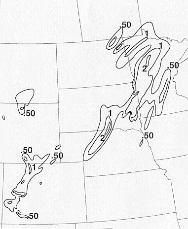
Mid-level moisture from Javier spread northeastward over
northern Mexico and the
southwestern United States, producing moderate to heavy rainfall.
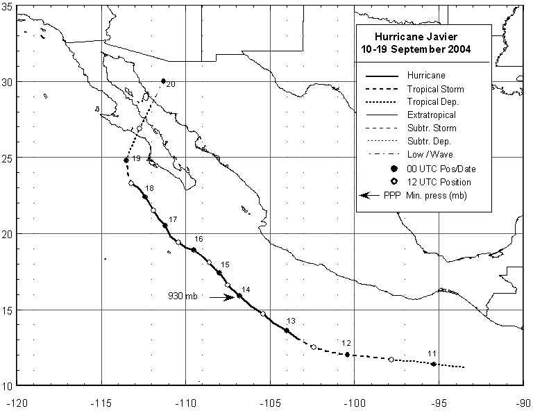
Below is
a track of the
cyclone provided by the National Hurricane Center.
The storm total rainfall maps below were constructed using data from
data
provided from NWS River
Forecast Centers, from additional data archived at the National
Climatic Data Center in Asheville,
North Carolina, and also from data gathered during the North American
Monsoon Experiment.
 |
 |
 |
Below are the calendar for Daily Precipitation Maps. Note that
the 24-hour periods end
at 12z that morning.