A tropical wave that left western Africa on August 9th propagated
westward
across the tropical Atlantic
through the 15th. When the wave moved over the eastern and
central
Caribbean Sea, rawinsonde data from
San Juan and Santo Domingo revealed that the system was fairly strong
at mid-to lower-tropospheric levels,
as evidenced by 30- to 40-knot wind reports east of the wave axis at
850 and 700 mb. It moved west-
northwestward to northwestward, interacting with the mountainous land
mass of eastern Cuba. On the
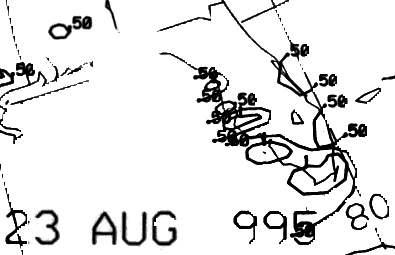
22nd, surface reports indicated that a tropical depression formed from
this system a short distance
southwest of Andros Island around noon on the 22nd.
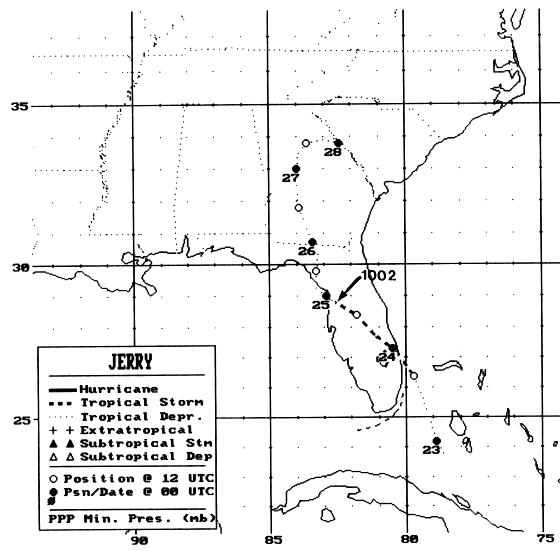
As the depression moved north-northwestward toward southeast
Florida,
slow strengthening took place, and
the system strengthened to a tropical storm on the morning of the 23rd.
Tropical Storm Jerry made landfall
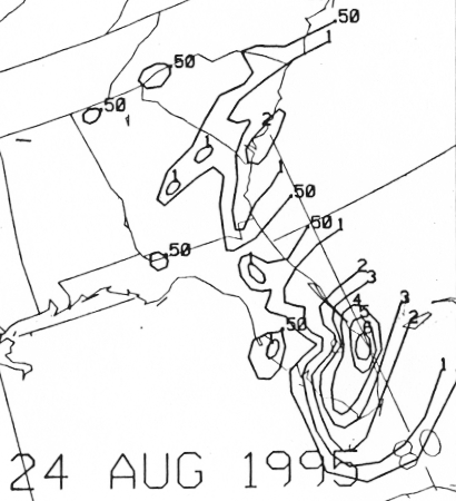
later that same day near Jupiter, Florida as a 35-knot storm. Jerry
moved northwest to west-northwest across
the Florida peninsula, weakening back to a tropical depression by the
afternoon of the 24th when nearing
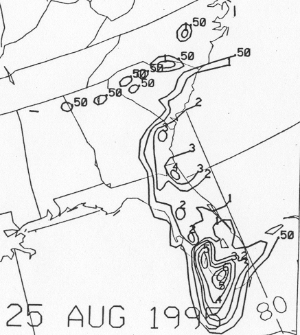
the upper west coast of Florida. The forward motion slowed, and after
the center drifted a short distance
out over the waters of the Gulf of Mexico, Jerry turned toward the
north and moved back inland over northern
Florida and across the Georgia/Florida border on 25 August.
The weak depression moved slowly northward to north-northwestward
over
Georgia on the 26th and 27th.
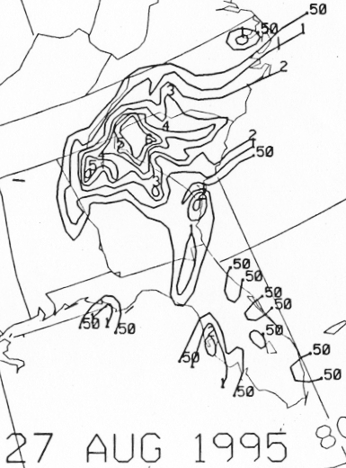
Later on the 27th, Jerry turned eastward toward South Carolina and
produced very heavy rains. The
circulation of Jerry became elongated in a northeast-southwest oriented
trough, and six hours later it was
difficult to distinguish a circulation center. However, the trough
persisted near the Carolinas during the
next couple of days and two discrete low pressure centers could be
followed.
The first, the stronger of the two,
moved eastward from the coast of North Carolina into the Atlantic,
along Jerry's previous trajectory, without
significant development. In the Daily Weather Map series, this
cyclone was credited as being the remnant of
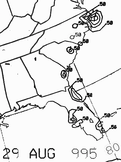
Jerry. The second, weaker cyclone, became evident just
offshore of the Georgia/South Carolina border early
on the 29th.
This weak surface low moved
southward and southwestward, across the Florida peninsula on 30-
31st, and died a slow death over the southeast Gulf of Mexico during
the first few days of September. While
the first stronger cyclone was likely Jerry's remnant, it is not
completely clear. Below is the track of Jerry,
furnished by the National Hurricane Center.
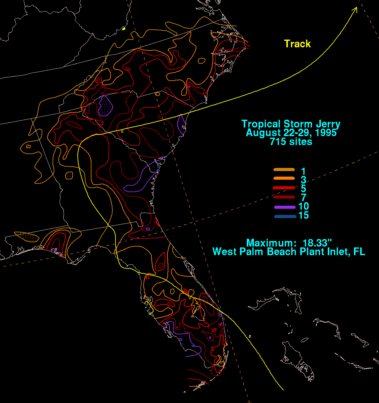
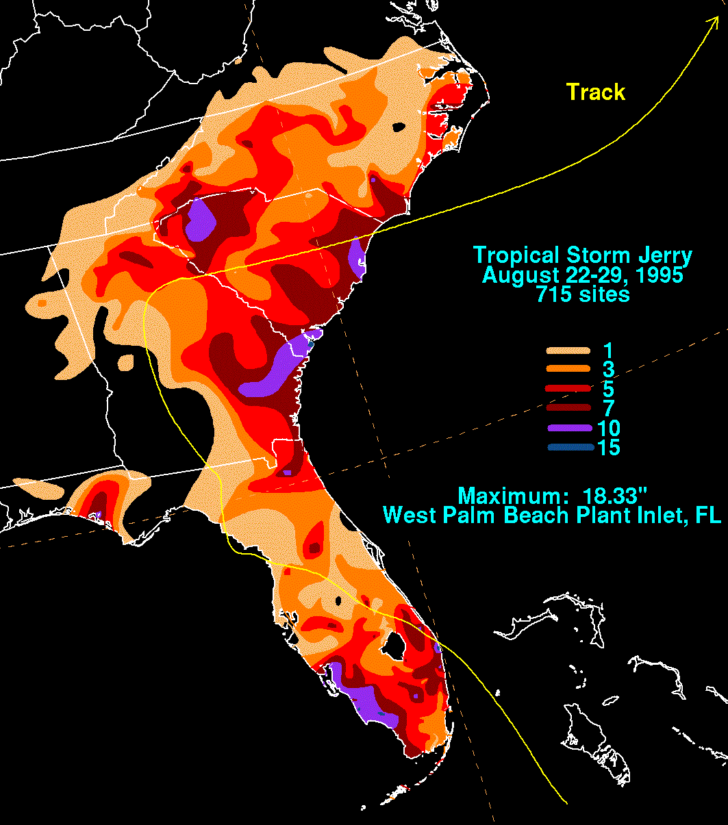
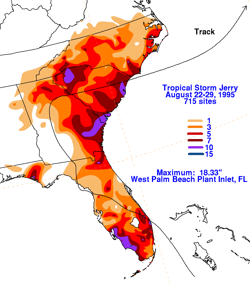
The storm total rainfall map below was constructed using data
from the National Climatic Data Center
and South Florida Water Management District. Due to the confusion
over which of the later low pressure
areas could
be directly attributed to Jerry, the
storm totals shown on the map only go through the 29th,
when the rains
ended in the eastern Carolinas.
 |
 |
 |
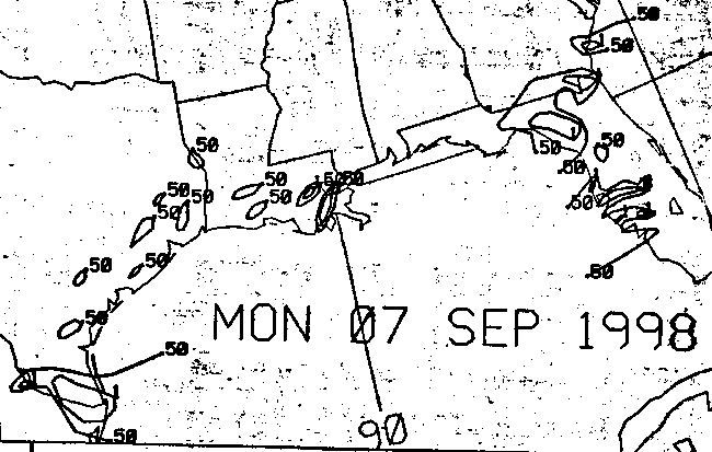
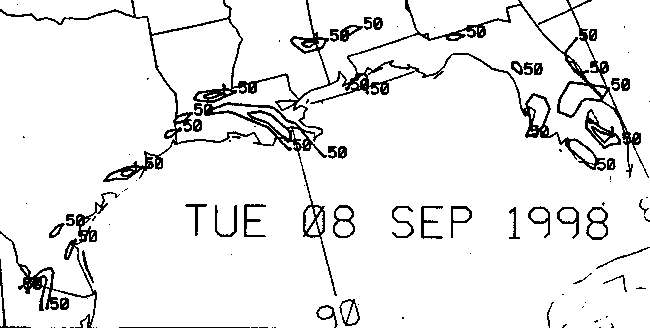
Below is the calendar for Daily Precipitation Maps. Note that
the 24-hour periods end
at 12z that morning.