A broad trough of low pressure slowly formed over the central
Gulf of Mexico during the 24th of October, due
to the interaction between an upper level low which dropped southeast
from Texas and an invading tropical
wave. Satellite imagery indicated a rapid increase in cloudiness
and showers during the day which culminated
in the formation of a depression on the 25th. East winds
approaching gale force lashed the northern Gulf of
Mexico as a strong surface high over the eastern half of the United
States slipped in from the north, increasing
the pressure gradient across the region.
On the morning of the 26th, the depression strengthened into a
tropical storm named Juan, which was confirmed
by reconnaissance aircraft that afternoon. Juan had many of the
characteristics of a subtropical storm with the
band of strongest sustained winds well away from the center. Also
similar to a subtropical cyclone, Juan's
movement was quite erratic, and its pressure center was embedded in a
wide area of light and variable winds.
On the morning of the 27th, its circulation tightened up as it moved
generally northward at 12 mph. By afternoon,
Juan had strengthened into a hurricane.
As it neared the Louisiana coast, Juan executed a pretzel-shaped
track, apparently rebuffed by the high pressure/
cold air still entrenched along the Gulf coast and also due to the
nearby influence of an upper level low. The
center made landfall on the morning of the 29th near Morgan City,
Louisiana, only to re-emerge into the Gulf of
Mexico offshore Vermillion Bay on the 30th as a tropical
storm. The cyclone skirted the Louisiana coast, turning
northeast as it passed Burrwood. The center struck the coast near
Pensacola midday on the 31st. Juan then turned
northward, steered by a deepening upper trough, becoming extratropical
and accelerating northward through the
Midwest into southern Canada. After Juan moved into Canada, a new
occluded cyclone closed off in the
Tennessee Valley, and led to a continuation of the heavy rain event
across the Mid-Atlantic. This second
onslaught of rain was not included in the storm total rainfall graphic,
since it had little to do with the cyclone
that was once Juan.
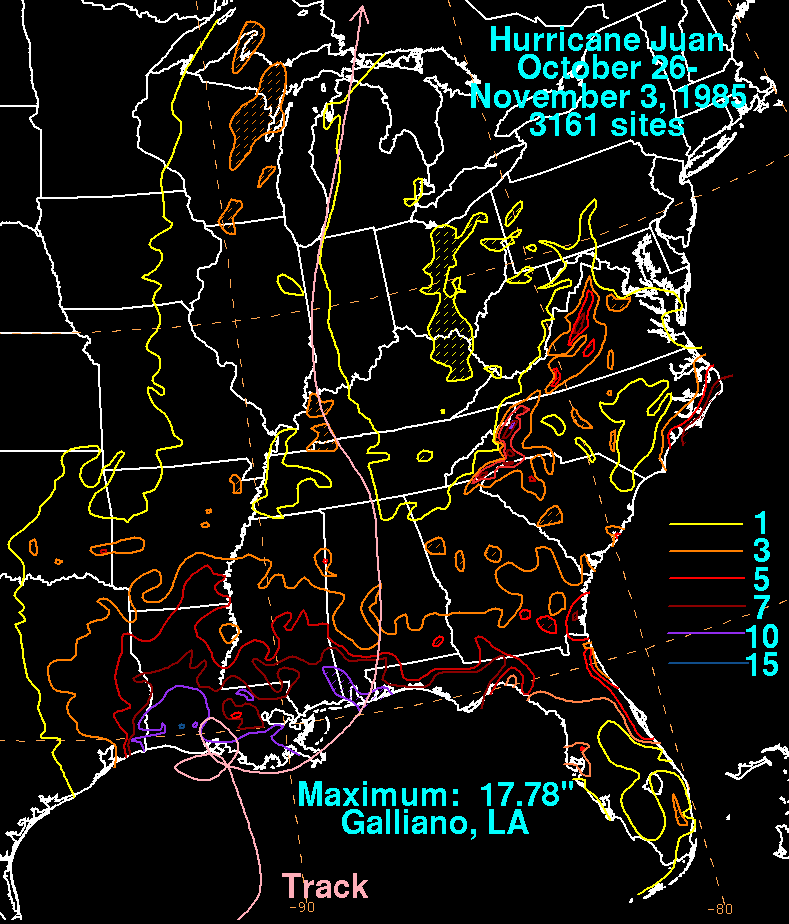
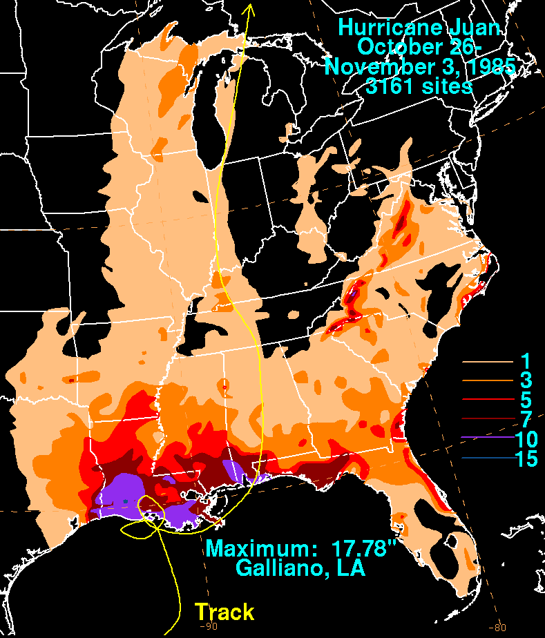
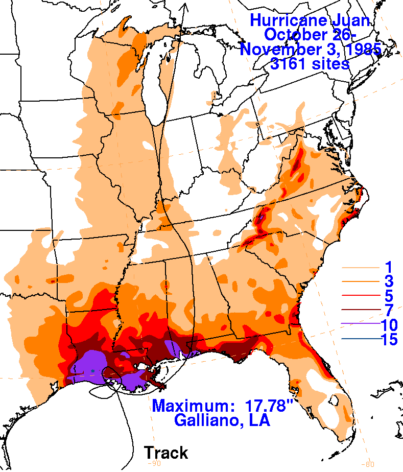
Below are the storm total rainfall maps for Juan. Note
the
maxima along the western and central Gulf coast in
the proximity to its track; much of this rainfall fell while Juan was
quasi-stationary across southern Louisiana
and the northwest Gulf of Mexico.
 |
 |
 |