A large tropical wave with a broad area of low pressure moved off the west coast of Africa on
September 14. Moving westward, the shower activity increased significantly on the 20th due to
interaction with an upper level cyclone which was carved out by the outflow of Hurricane Isabel.
A mid-level circulation formed within the convection, which moved northwest into a decaying
frontal zone. A low-level circulation formed along the old frontal zone on the 23rd. It slowly
transitioned into a tropical depression the following morning, with tropical storm status late on
the 24th. Hurricane intensity was reached early on the 26th.
The cyclone began to move north-northwest around a high latitude blocking ridge. Juan became
a category 2 hurricane on the 27th. Accelerating northward, Juan crossed Nova Scotia as a
hurricane, becoming absorbed by a large extratropical cyclone in the Gulf of St. Lawrence.
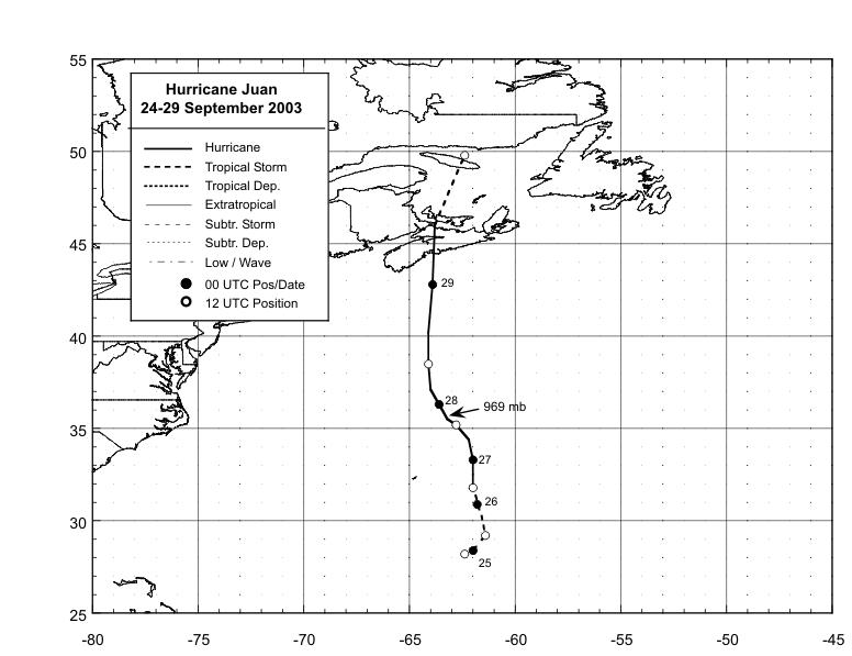
Below is the track of Juan, supplied by the National Hurricane Center.
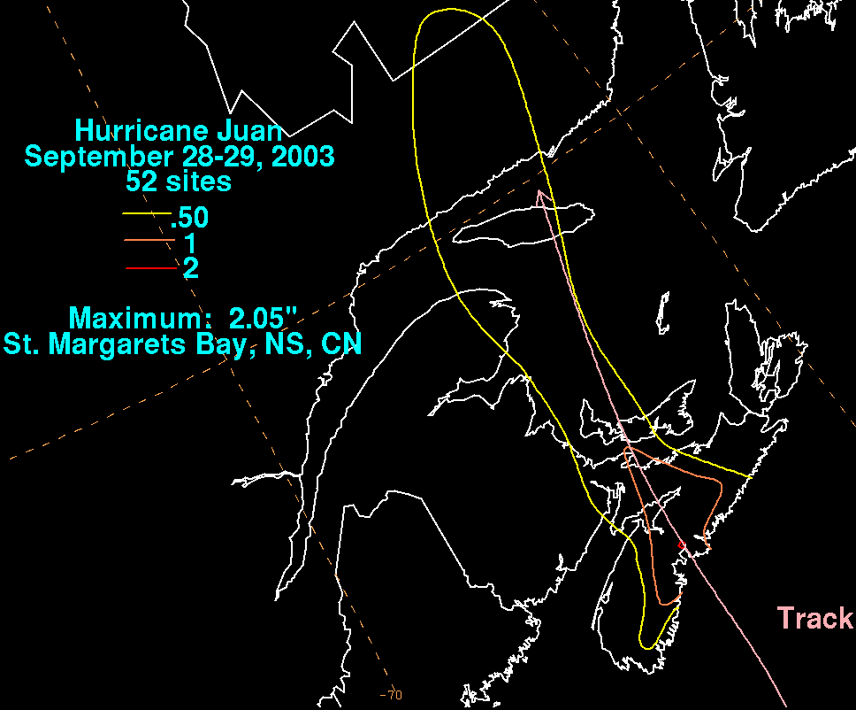
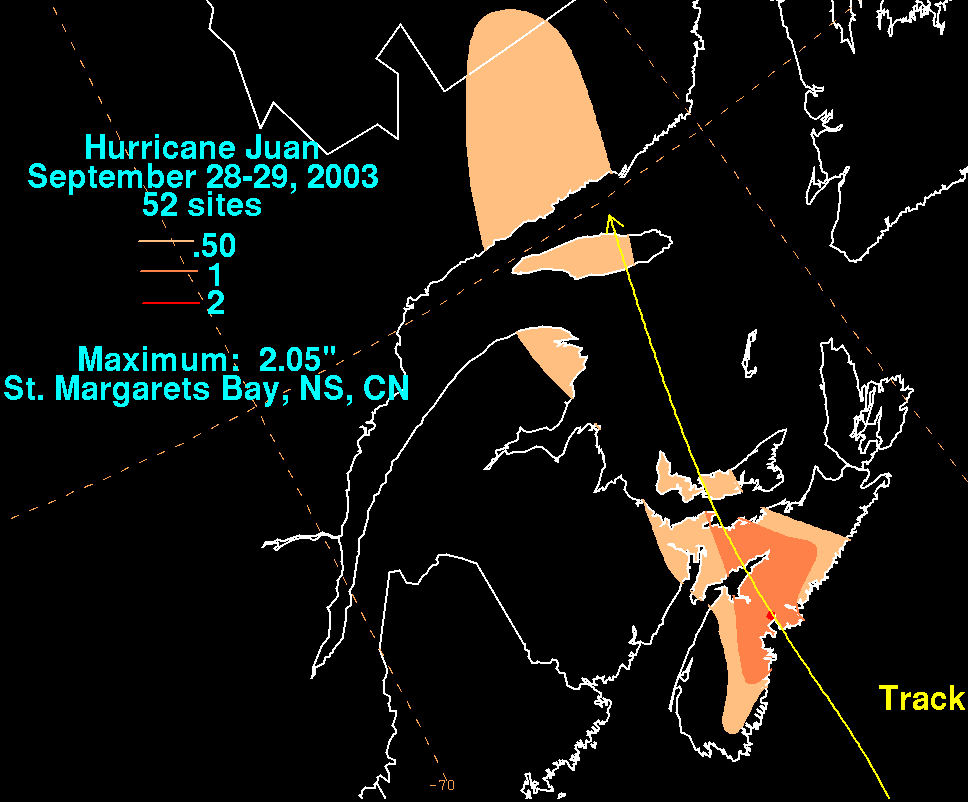
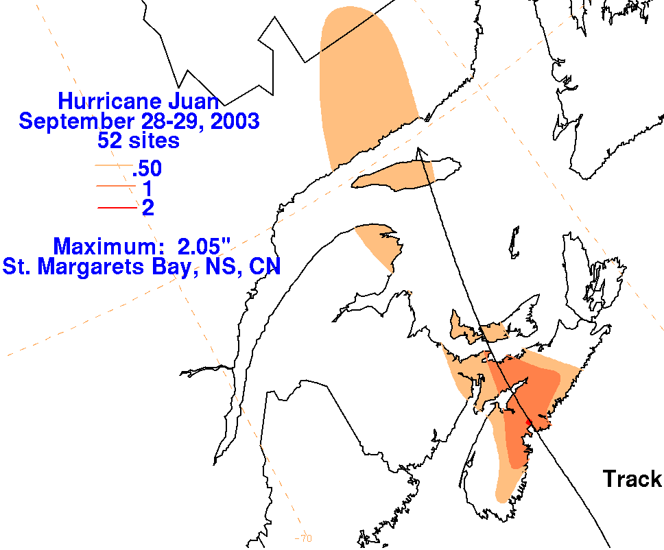
The graphics below show the storm total rainfall for Juan, which used rainfall data
provided by Chris Fogarty of the Canadian Hurricane Center, part of Environment Canada.
 |
 |
 |