A tropical wave moved offshore western Africa on September 16. The system moved westward over the next several days, moving into
the Caribbean on September 25. As it approached an upper level trough on September 27, thunderstorm activity increased near the
wave axis. On September 28, a surface trough of low pressure formed to the southeast of Jamaica. Favorable upper level conditions
built over the system, leading to slow development. The system became a gale center by October 2. Once it developed a well-
defined center on October 3, the system became a tropical storm. Karen moved near the tip of the Yucatan peninsula into the
Gulf of Mexico. By October 4, Karen's center became exposed. Westerly vertical wind shear increased on October 5, with Karen
weakening into a tropical depression late in the day and into a remnant low early on October 6. The remnant low linked up with
a frontal zone on the morning of October 7, becoming extratropical. The cyclone crossed Florida later in the day, entering the
western subtropical Atlantic. The cyclone became elongated northeast- southwest offshore the Carolinas on the morning of
October 9, with the system consolidating offshore North Carolina later that day. Over the next few days, the cyclone looped
near the coast of North Carolina, before turning southward on October 12. The cyclone weakened as it turned southwest and then
more westward, dissipating while approaching the eastern Florida coast late on October 15.
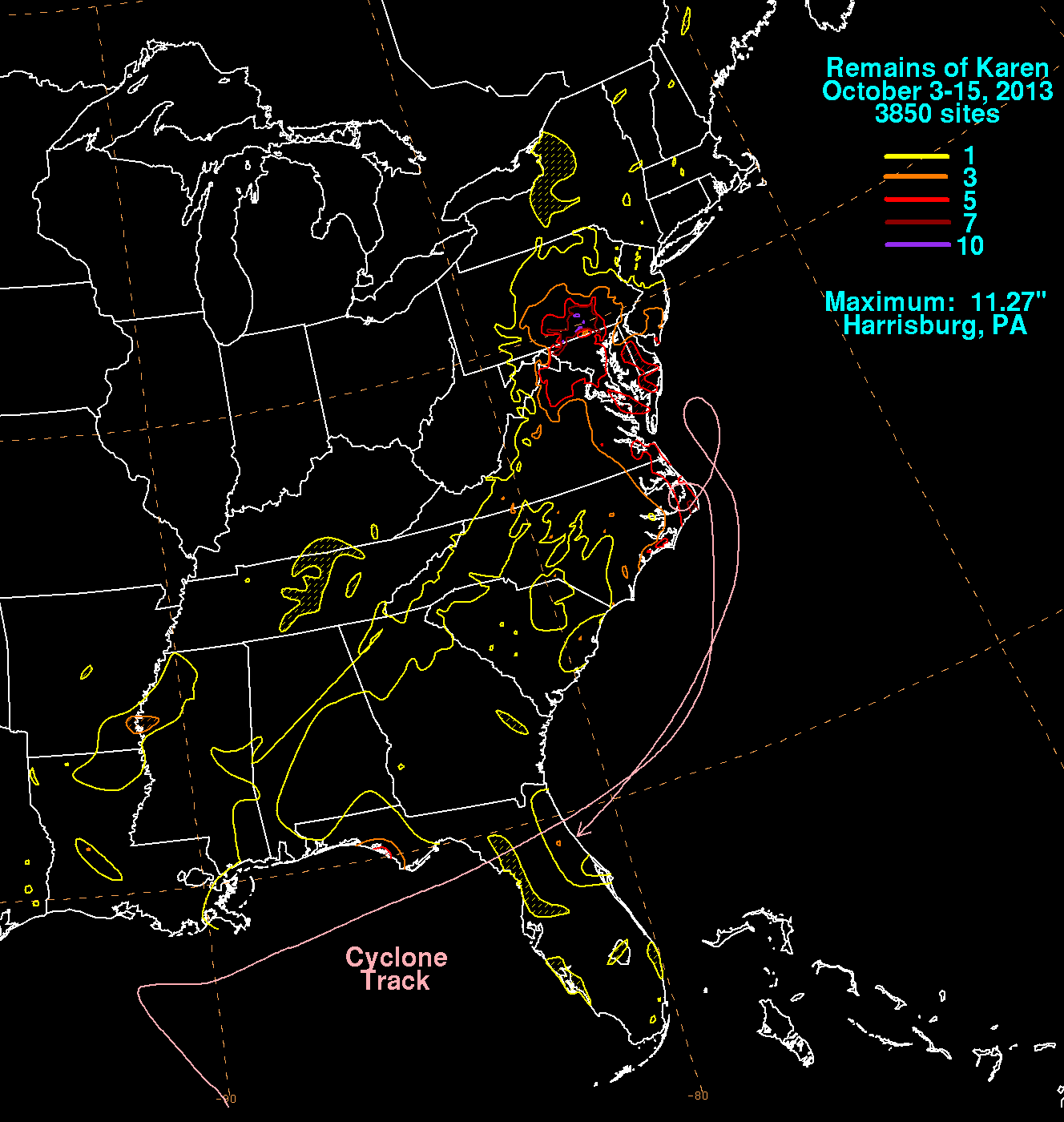
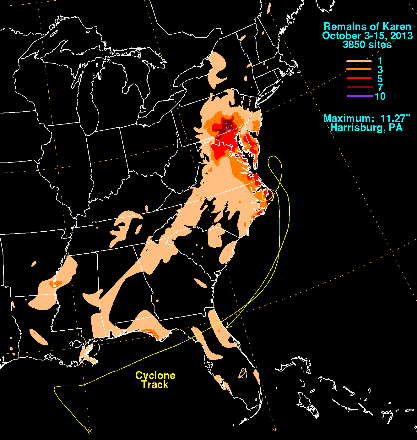
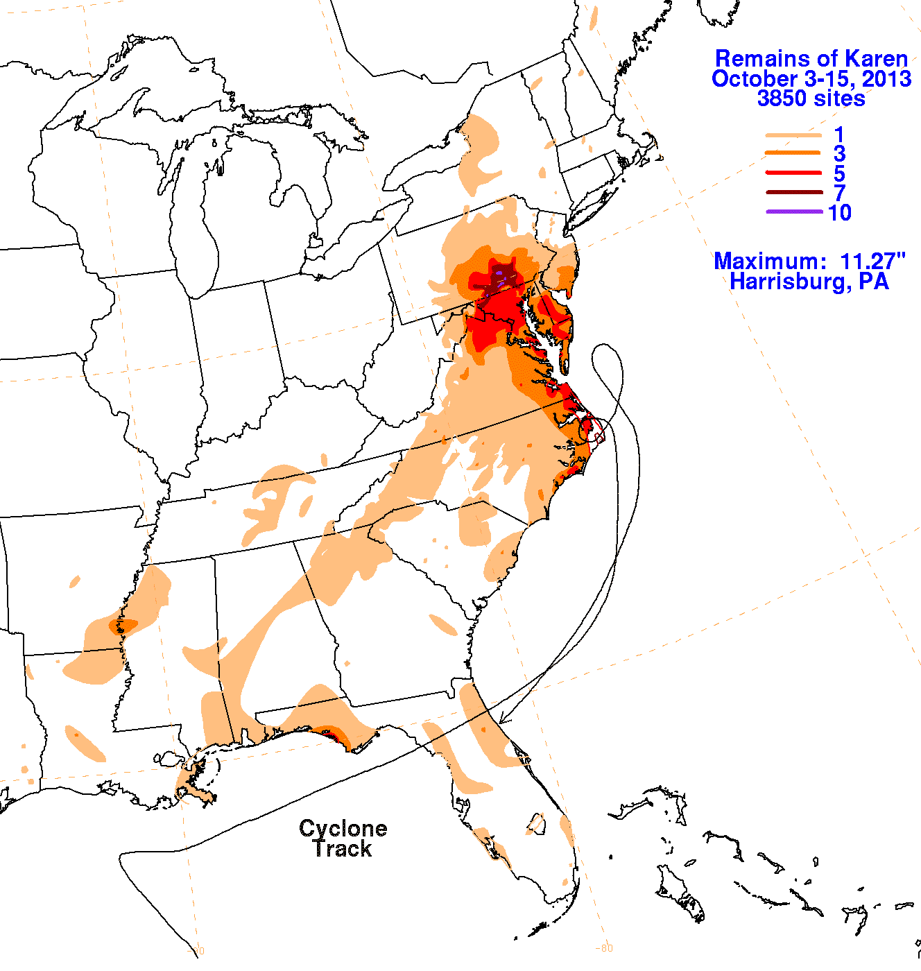
The first three graphics below show the storm total rainfall for Arthur, which used rain guage information from the National Weather
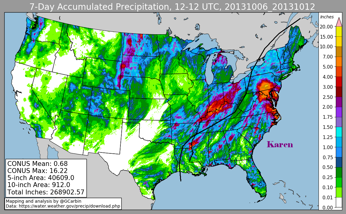
Service River Forecast Centers, Forecast Offices, and CoCoRAHS. The fourth image uses multi-sensor rainfall estimates, which include
radar-derived information.
 |
 |
 |
 |