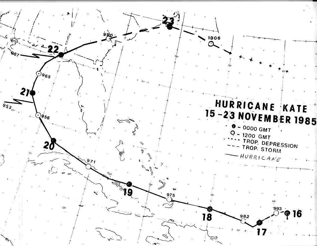
A strong subtropical ridge set up across the Southeast and southwest Atlantic, which kept the polar front
north of the 32nd parallel in the week prior to Kate. A tropical wave moved underneath the subtropical
ridge and began to develop northeast of the Virgin Islands as it interacted with an upper trough between
the 13th and 14th of November. The system was already a tropical storm by the time reconnaissance aircraft
reached the cyclone on the 15th. An upper low closed off in the trough ahead of Kate on the 17rh and
accelerated to the southwest, which improved the upper environment over the tropical storm. Kate became
a hurricane by the afternoon of the 16th as it moved westward through the southeast Bahamas.
Kate maintained itself as it moved across northern Cuba, only weakening 7 hPa during its passage over the
isle. Kate resumed strengthening, and became a major hurricane on the evening of the 19th as it passed the
eastern Gulf of Mexico data buoy. At this point, the hurricane was moving northwest in response to a frontal
zone approaching from the west. The cyclone continued to recurve, passing over cooler waters of the northern
Gulf of Mexico and began to slowly weaken as it bagn to experience southwesterly shear. Kate made landfall
as a weak category 2 hurricane on the Florida Panhandle on the evening of the 21st. The cyclone moved
through the Southeast and back out into the southwest Atlantic on the evening of the 22nd, as it became an
extratropical low. Below is the track of Kate, supplied by the National Hurricane Center.
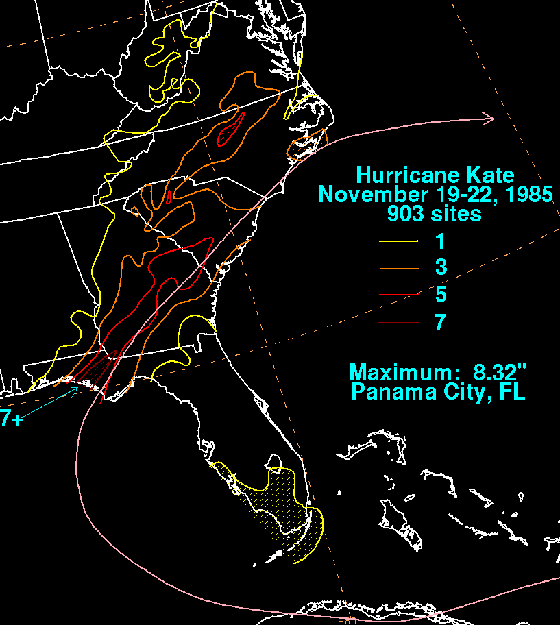
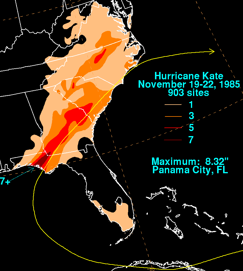
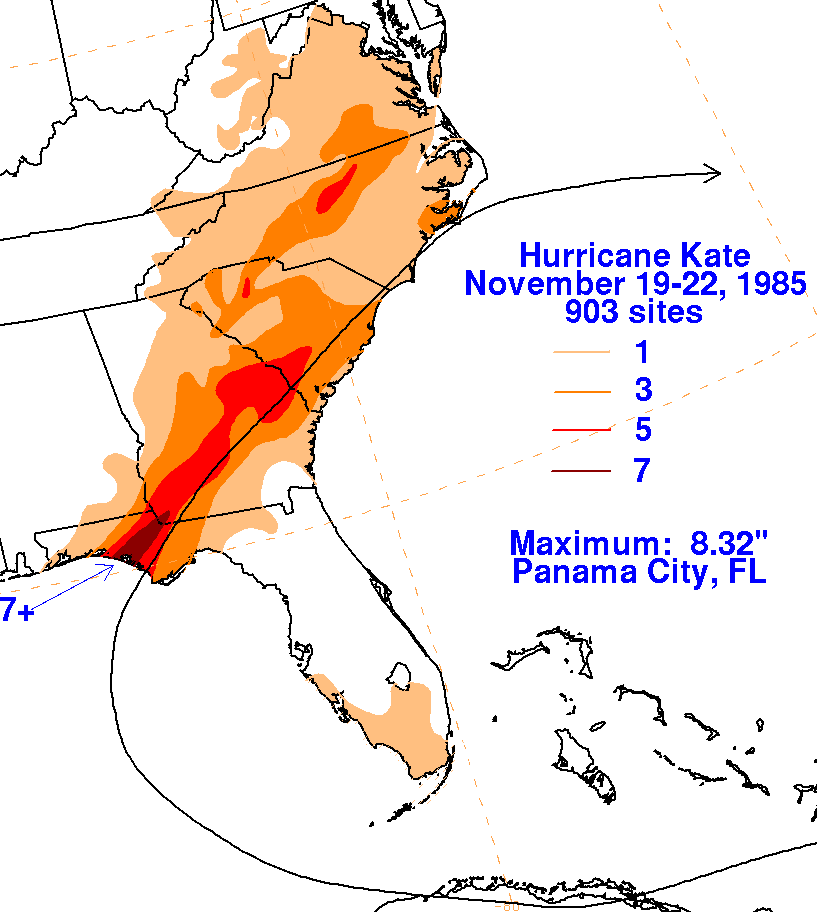
Below are storm total rainfall maps for Kate. Rainfall
information was obtained from the National
Climatic Data Center. Note the maxima is left of Kate's
track, mainly along a frontal zone in advance
of the cyclone.
 |
 |
 |