This cyclone was first noted 300 miles southwest of Acapulco late on September 5th. Moving rapidly
west-northwest, the system became a tropical depression on the night of the 6th while 360 miles southwest
of Manzanillo. Slowing down on the 7th, the cyclone strengthened into a tropical storm on the afternoon of
the 7th. Intensification continued and on the 9th Kathleen became a hurricane as it accelerated northward
to the west of Mexico. As it moved quickly over cool waters near the west coast of Baja California, the system
regained tropical storm status during the night of the 9th. The cyclone clipped the Point Eugenia peninsula as it
moved north at over 35 mph. Its next landfall was in Ensenada just prior to 4 am local time. By late that
morning, Kathleen had entered California. Late that night, the center of Kathleen passed 140 miles southeast
of Reno, Nevada. As the center became more diffuse, its remains moved northward through the Northern
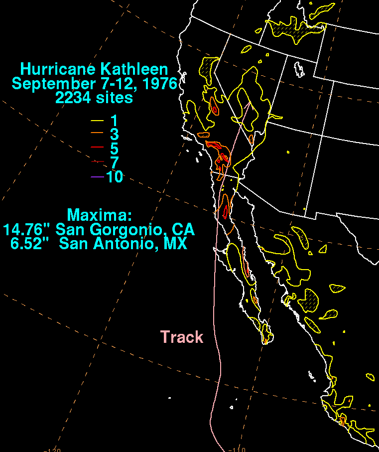
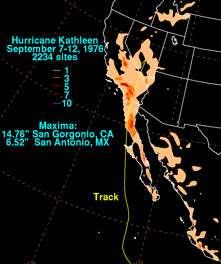
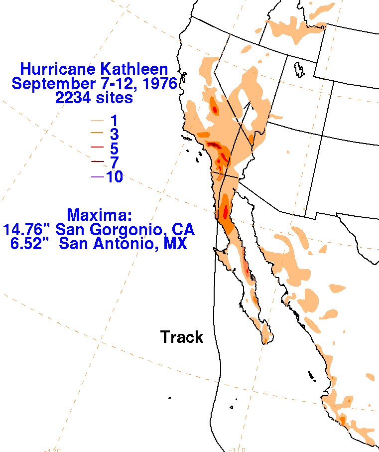
Continental Divide, spreading rain and wind northward through Idaho and Montana. The storm total graphics
lie below for Kathleen. United States rainfall data was gathered from the National Climatic Data Center in
Asheville, NC. Mexican data was obtained from the Comision Nacional del Agua, parent agency of Mexico's
national weather service.
 |
 |
 |