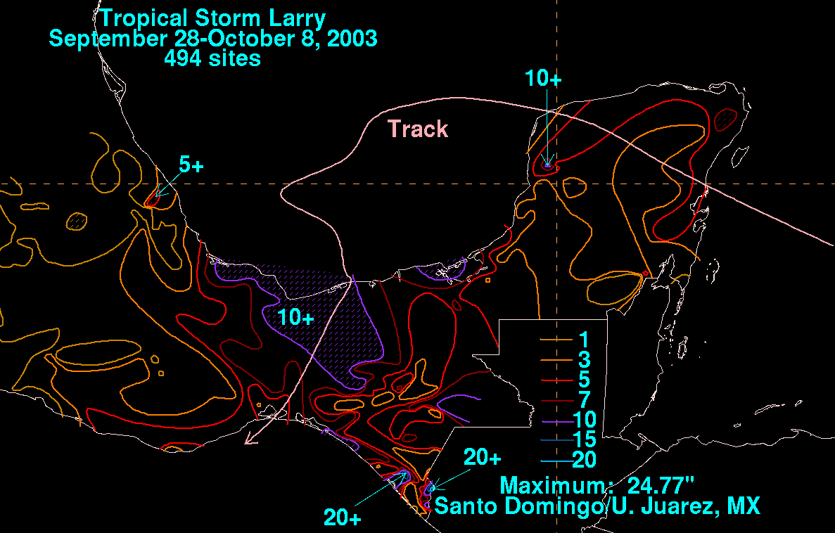
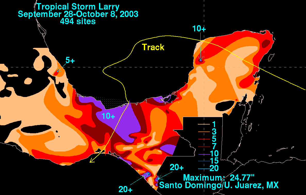
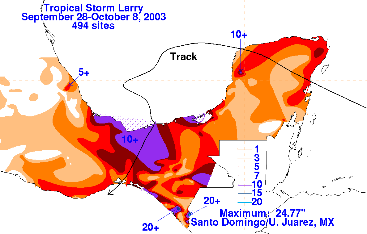
Tropical Storm Larry - September
28-October 8, 2003
A tropical wave moved off the coast of Africa on September 17th.  The system moved westward without
development due to an unfavorable upper level environment.  By the 28th, the wave moved under an upper
level anticyclone, which spurred development.  By the next day, a surface low had formed in the western
Caribbean Sea as nearly a tropical depression, which moved westward through the Yucatan peninsula.  By
the 30th, the cyclone merged with a stationary boundary which resulted in a large area of gales across the
central and southern Gulf of Mexico.  By October 1st, significant deep convection redeveloped northeast
and southwest of the broad center of the low, with the gale center slowly acquiring tropical character.  By
late in the day, reconnaissance aircraft indicated the system was a tropical storm about 260 miles east-
southeast of Tampico, Mexico.

Larry was located just south of the col in the subtropical ridge that extended from Florida westward into
Texas and northern Mexico.  The strong high to its northwest caused Larry to drift west initially, before it
turned more southerly due to a strengthening of the ridge to its northwest.  On the morning of the 5th, Larry
made landfall near Paraiso, in the state of Tabasco.  The cyclone weakened as it crossed the Isthmus of
Tehuantepec, and became a non-convective low when it moved into the eastern Pacific ocean 240 miles
east-southeast of Acapulco.

The graphics below show the storm total rainfall for Larry, which used rainfall data provided by Miguel
Cortez of the Comision Nacional del Agua, parent agency of Mexico's National Weather Service.