A strong tropical wave emerged off the African coast on August 30th. Convective development improved as it moved across the far
eastern tropical north Atlantic. By the afternoon of the 31st, it had evolved into a tropical depression to the east-southeast
of the Cabo Verde Islands. By that night, it had developed into Tropical Storm Larry. Continuing to develop as it moved west-
northwest, Larry strengthened into a hurricane very early on the 2nd while over 400 miles west-southwest of the Cabo Verde Islands.
and a major hurricane on the evening of the 3rd, remaining so until the morning of the 7th. Larry, then a large hurricane, turned
northwest and then north-northwest, missing Bermuda 130 miles to the east. The cyclone then accelerated northward as a mid-latitude
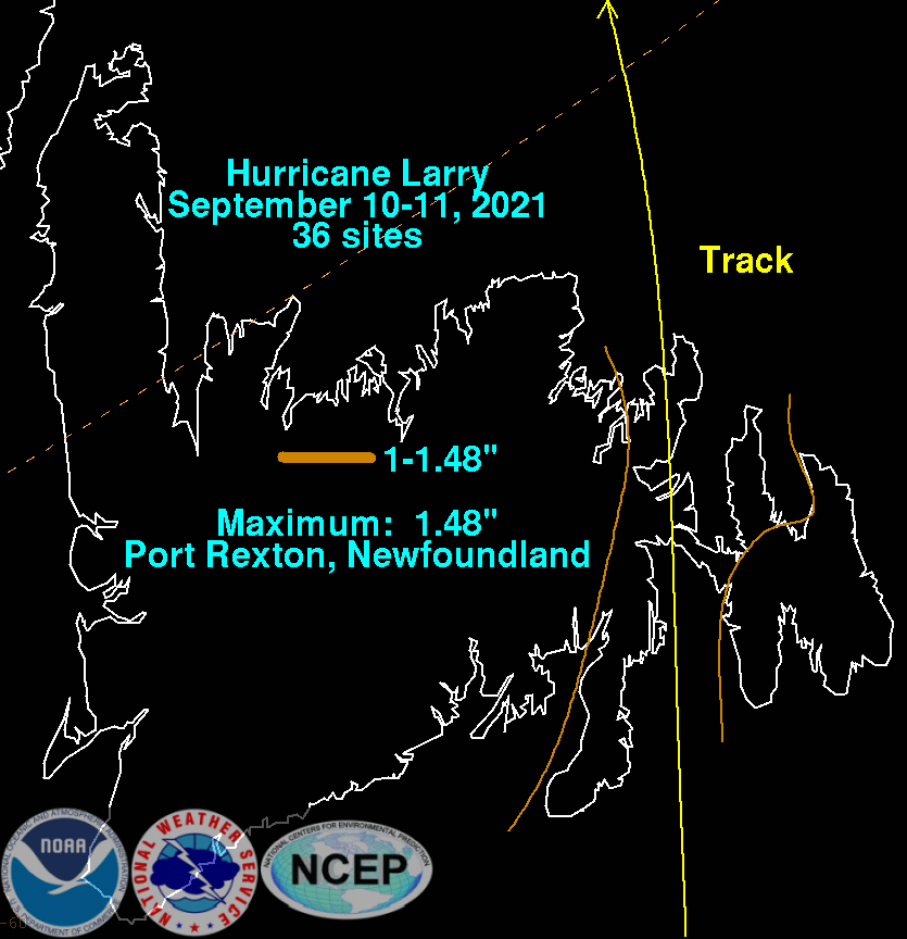
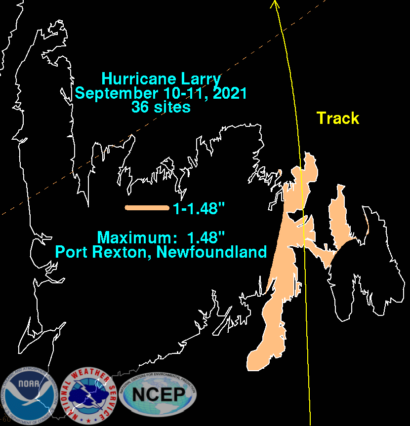
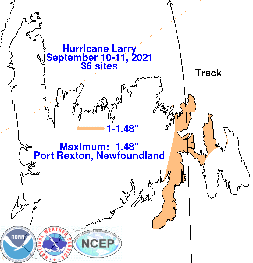
trough approached from the west. Larry slowly weakened while approaching southeast Newfoundland late on the 10th. Landfall
occurred at Great Bona Cove. By the morning of the 11th, Larry had evolved into a large extratropical cyclone northeast of Newfoundland.
The graphics below show the storm total rainfall for Larry, which used rain gage information from the National Weather Service River
Forecast Centers, Forecast Offices, and CoCoRAHS.
 |
 |
 |