A tropical wave moved offshore western Africa on August 16th. Moving quickly westward, there was not much
development. On the 18th, it moved into the circulation of a broad surface low a few hundred miles west-southwest
of the Cape Verde Islands. Thunderstorm activity became better organized around the low on the 19th, and by evening
it was designated a tropical depression well to the east-southeast of Antigua. A strong subtropical ridge continued its
west to west-northwest motion. Southeast mid-level wind shear kept the system from organizing into the 20th. By early
on the 21st, a slight increase in organization led to its designation as Tropical Storm Laura not far from the northern
Leeward Islands. It remained weak until late on the 22nd while south of the U.S. Virgin Islands and Puerto Rico. Turning
west-northwest, Laura made landfall along the south coast of the Dominican Republic before moving across Hispaniola
into the Windward Passage on the 23rd. It then moved across eastern Cuba to the west of Guantanamo early on the 24th, while
finally beginning to strengthen further. Laura moved south of much of Cuba before making landfall in Pinar del Rio province
late on the 24th.
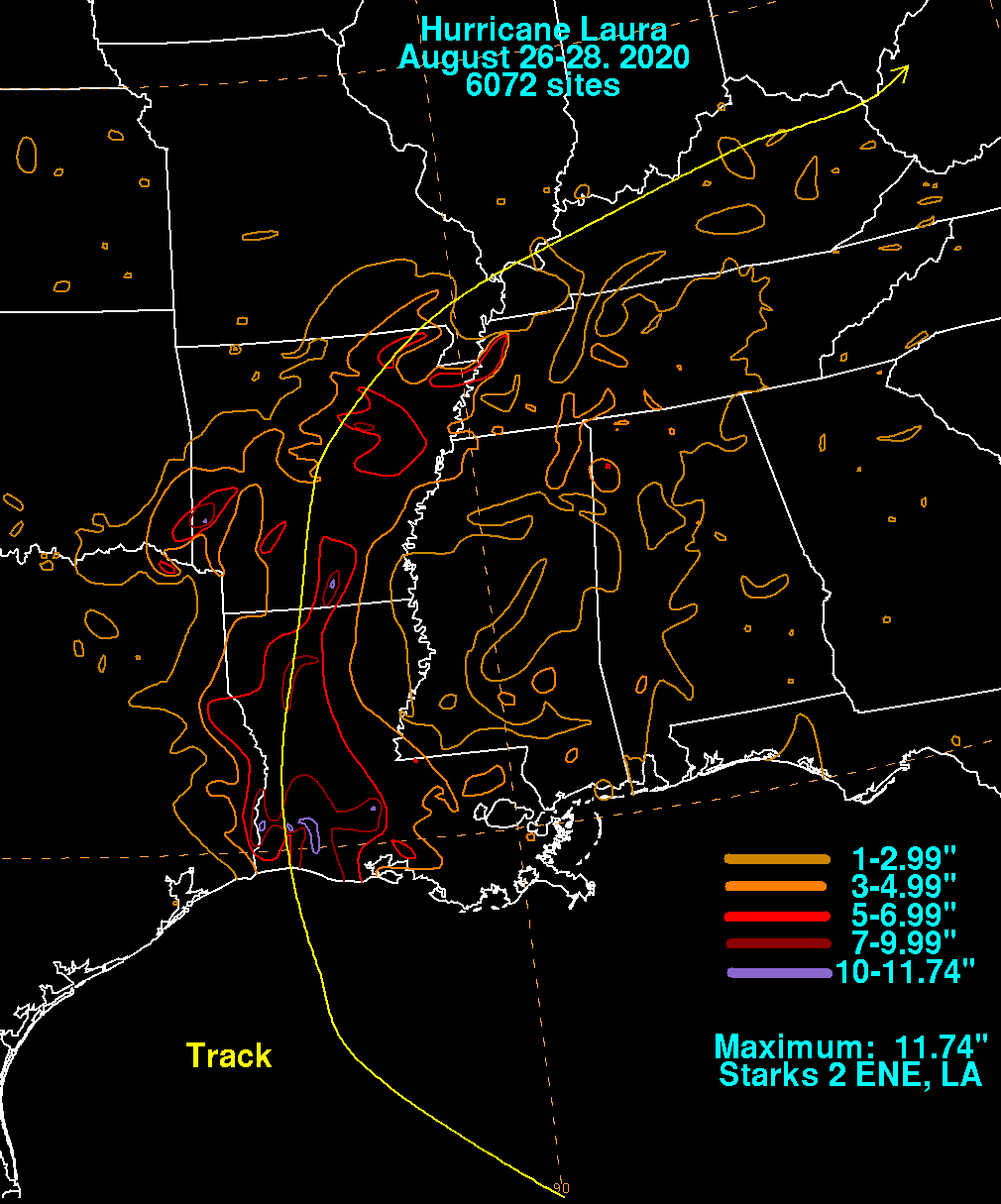
A more steady strengthening trend occurred once Laura entered the Southeast Gulf of Mexico on the 25th, and it became a
hurricane that morning well to the south-southeast of the Mouth of the Mississippi River. Moving more definitely west-
northwest at a slower pace of speed into the Loop Current within a very favorable upper level environment, rapid strengthening
ensued. Laura became a major hurricane on the 26th, nearing the threshold of category five intensity while approaching
southwest Louisiana. Laura made landfall around midnight and was the strongest hurricane to strike Louisiana since Camille
in August 1969. Laura rapidly weakened inland while moving north across western Louisiana, regaining tropical storm status
on the afternoon of the 27th, and back into a tropical depression around midnight while trekking across Arkansas. The
weakening depression moved up the Ohio River Valley, becoming a remmant low on the 29th in western Kentucky. The low
dissipated as it entered West Virginia, absorbed by another low over the Great Lakes on the morning of the 29th.
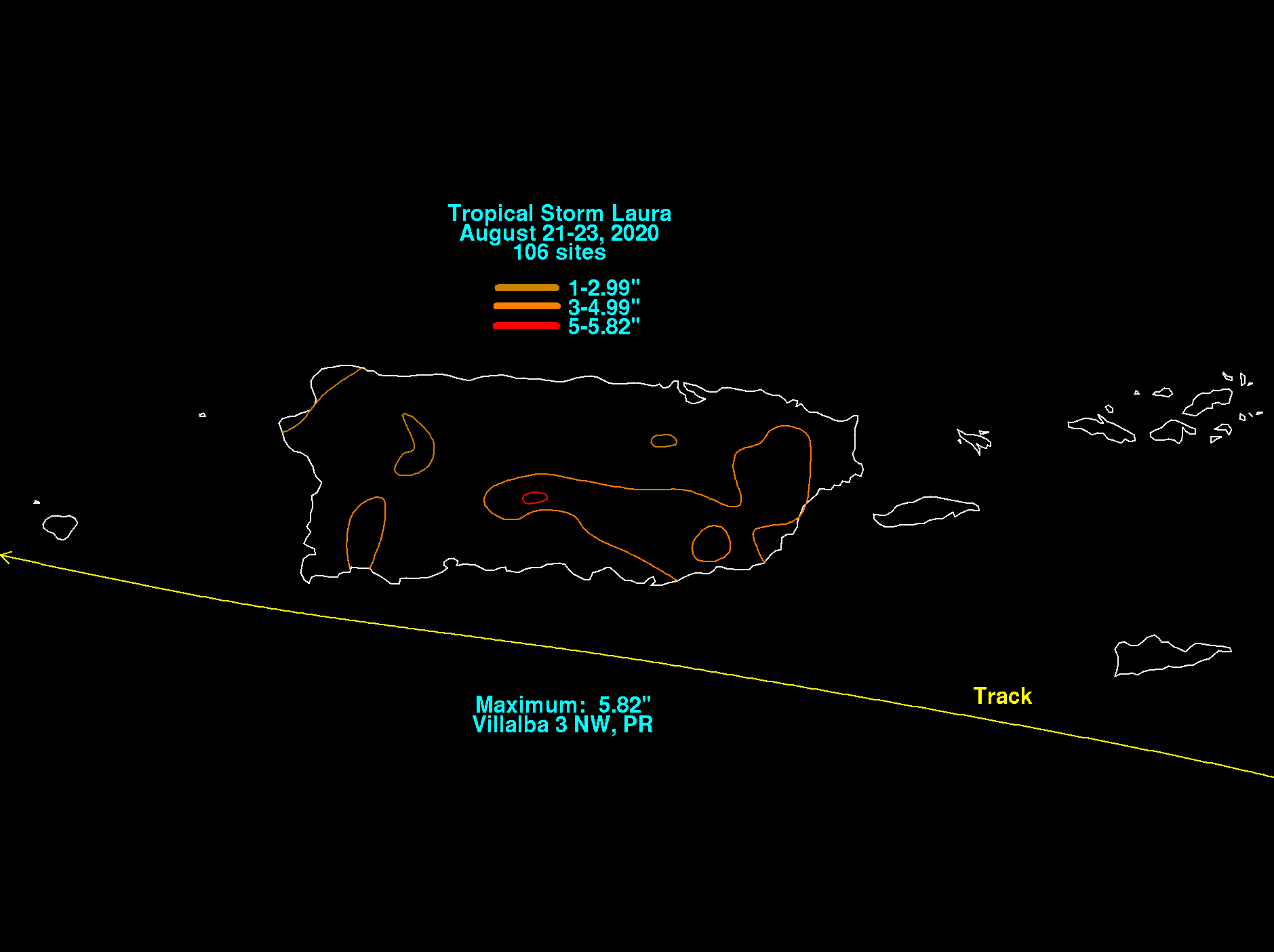
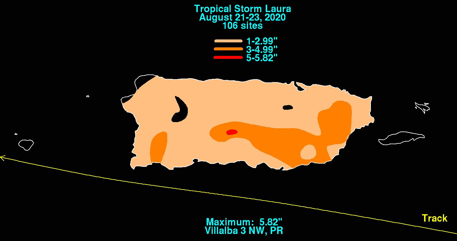
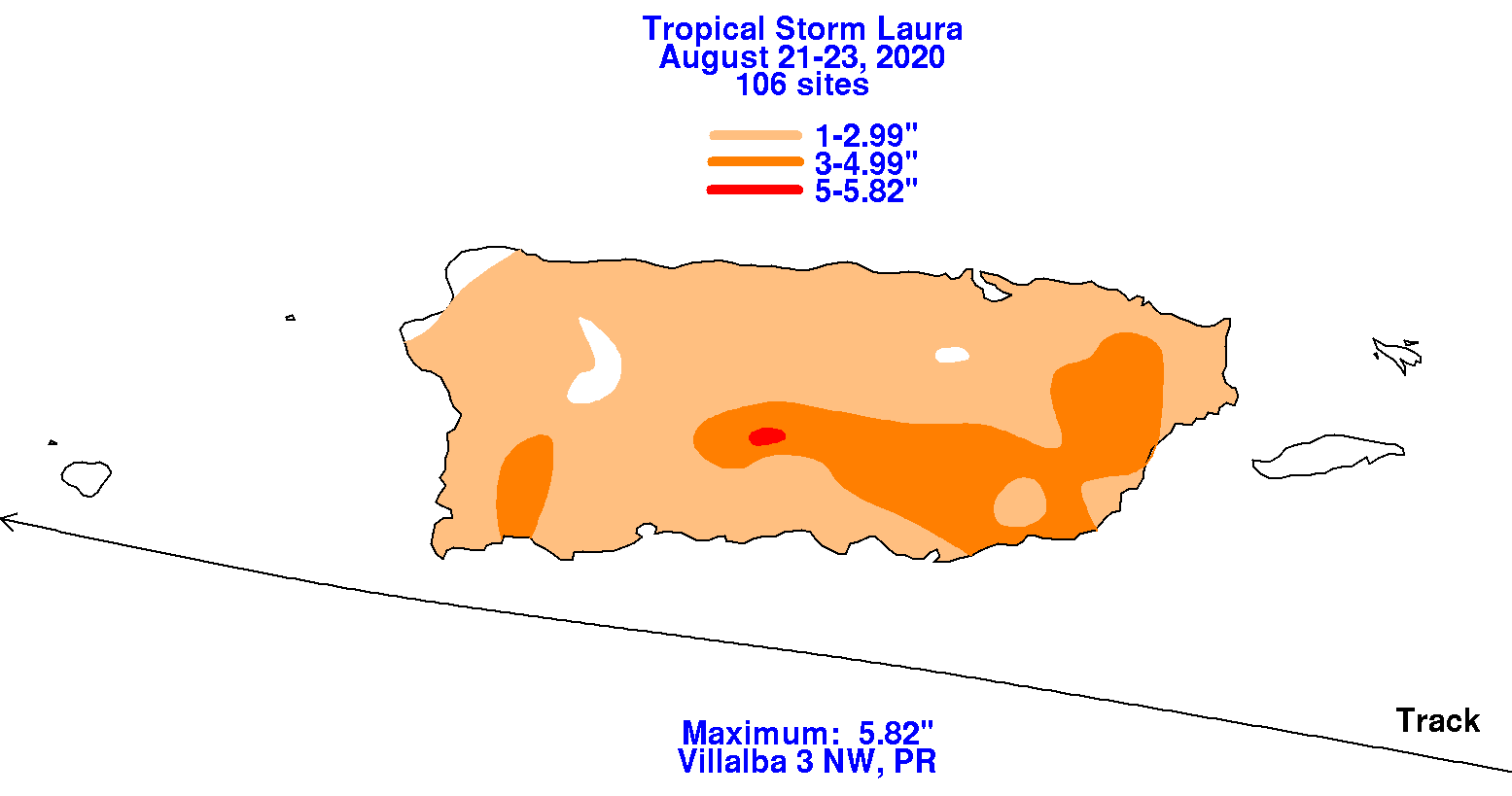
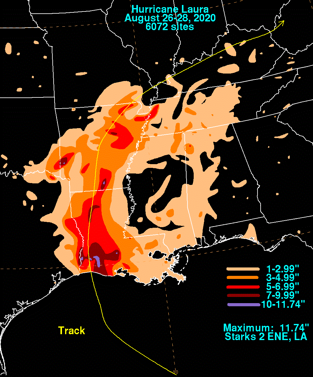
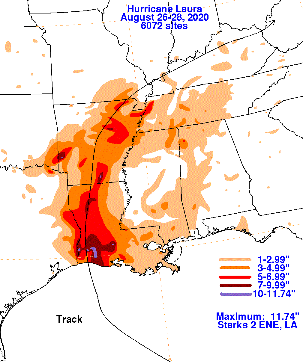
The graphics below show the storm total rainfall for Laura, which used rain gage information from the National Weather
Service River Forecast Centers, Forecast Offices, and CoCoRAHS.
 |
 |
 |
 |
 |
 |