East of an upper level trough, a weak tropical wave led to the development of an area of disturbed weather late in August across the
western Caribbean sea. The disturbed weather area, with an accompanying low pressure area, moved west-northwest through the
Yucatan Channel. Vertical wind shear over the disturbance led to slow development, and the system became sufficiently organized
to be upgraded to a tropical depression on September 1st around 250 miles south of the Louisiana coast. The system drifted northward,
becoming a tropical storm early in the afternoon of the 2nd. Lee co-located with the upper level cyclone which initially caused the vertical
wind shear, giving the system a subtropical appearance. Its central pressure continued to fall while its maximum sustained winds decreased
to friction over land and a broadening of its circulation. Lee drifted ashore south-central Louisiana on the 4th.
An upper level trough in the Mississippi Valley turned the system east-northeast on the 4th, and the cyclone's circulation slowly moved
through the Southeast. Becoming an extratropical cyclone on 5th, Lee turned more northeastward, and a triple point low developed near the
intersection of its occluded front, cold front, and warm front. This surface low became dominant, and turned north, then west, then southward
across the Midwest and Ohio Valley over the next several days, blocked by ridging to its north. By the afternoon of the 11th, the triple
point low dissipated as it tracked into Tennessee.
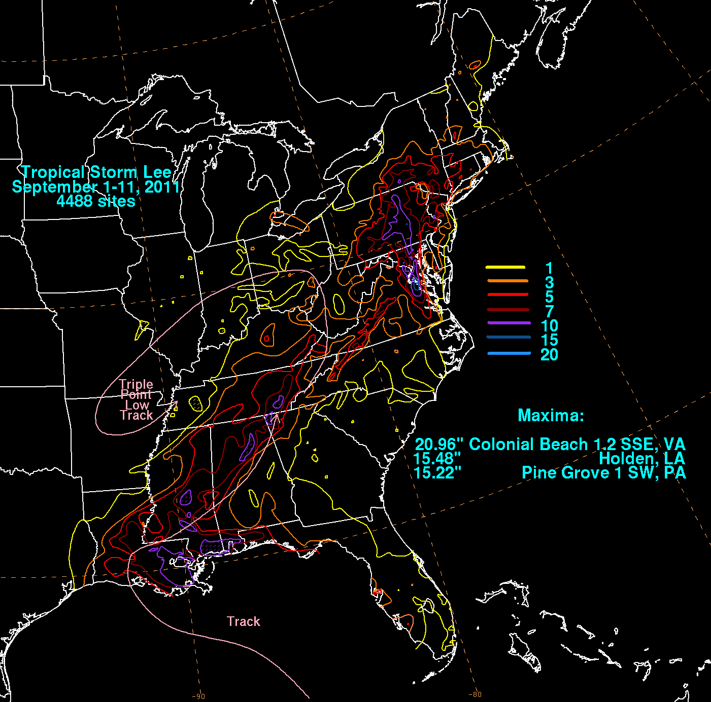
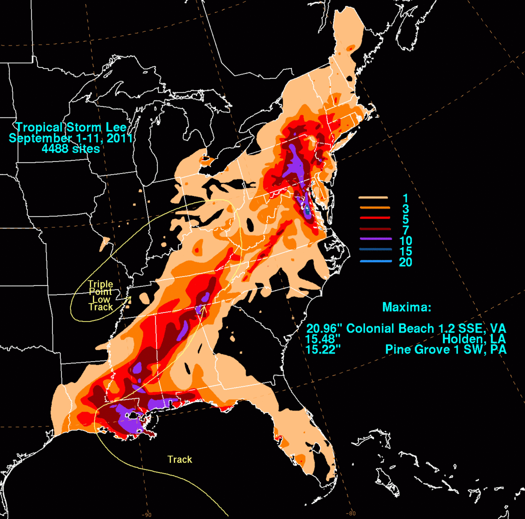
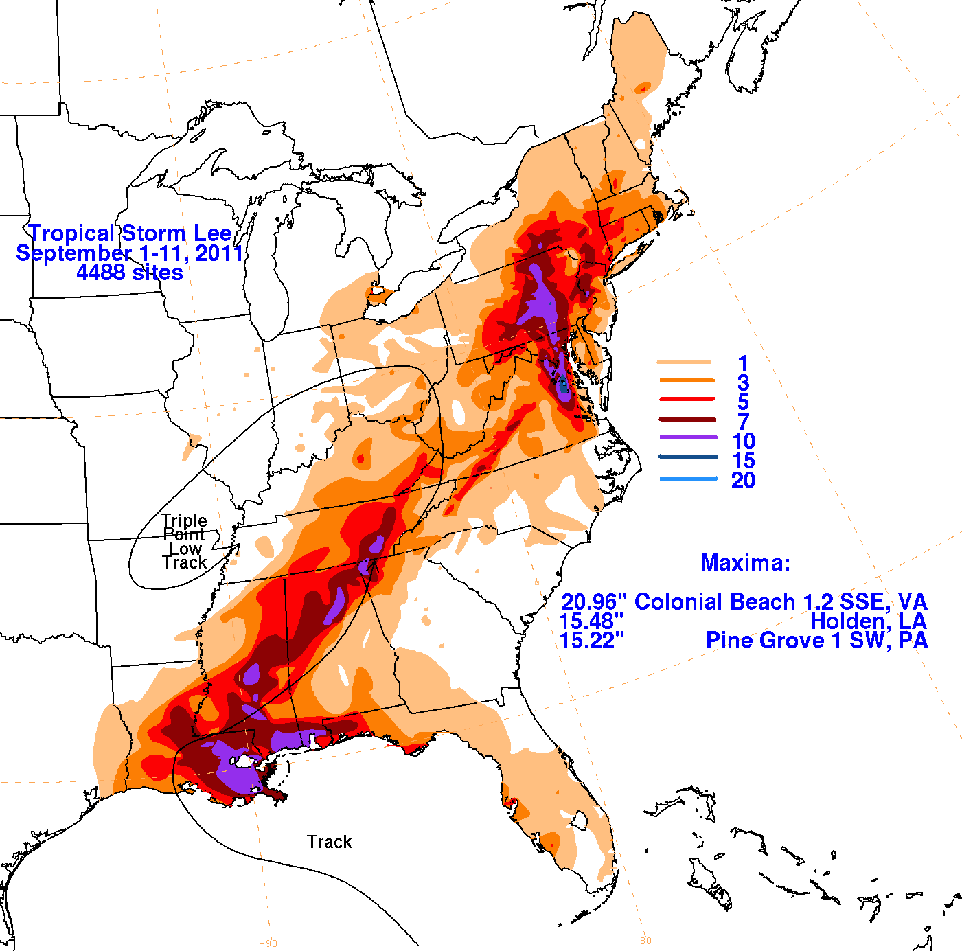
Data for the first three rainfall graphics below was compiled from rain guage reports obtained by the National Weather Service River Forecast Centers,
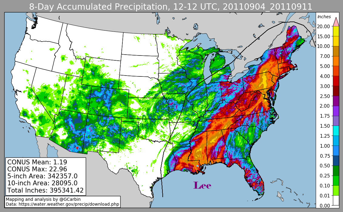
CoCoRAHS, as well as tropical cyclone reports and public information statements from National Weather Service Forecast Offices. The fourth graphic
includes radar-derived information.
 |
 |
 |
 |