A tropical wave moved offshore western Africa into the tropical Atlantic Ocean on September 2nd, producing disorganized shower and thunderstorm activity which then began to gradually organize as they moved farther out to sea. An area of low pressure formed from the wave on the 4th, to the west-southwest of Cabo Verde. On the 5th, the low became more organized, with multiple cloud bands developing and the formation of a well-defined center. Consequently, advisories were initiated on Tropical Depression Thirteen early that afternoon. Amid favorable conditions for intensification, which included warm sea surface temperatures, moderate wind shear, and moderate mid-level relative humidity, the depression quickly strengthened into Tropical Storm Lee later that day. Lee tracked west-northwestward, steered by a mid-level ridge located to its north, and continued to intensify as it became better organized, with increased convective banding, development of a central dense overcast, and formation of a ragged eye, evident in visible satellite imagery by the following afternoon. By the evening of the 6th, the system strengthened into a hurricane while located far to the east of the Northern Leeward Islands. Explosive intensification began the next day, with Lee becoming a major hurricane during the evening of the 7th. It became quite intense that night, but it wouldn't last. An increase of southwesterly wind shear and eyewall replacement cycles caused Lee to weaken and grow in size. From the 9th into the 12th, Lee's intensity would fluctuate around the lower bound of major hurricane status. Lee slowly tracked west-northwestward to northwestward during this time, before turning northward on the 13th, moving around the western side of a subtropical ridge situated over the central Atlantic. Lee encountered increasing southwesterly shear coupled with dry air entrainment, weakening below major hurricane status once and for all. Slow weakening continued while Lee made a close, 185 mi pass to the west of Bermuda. Extratropical transition was underway, which was completed early on the 16th. Later that day, the center of the cyclone made landfall on Long Island, Nova Scotia. Overnight into the 17th, Lee's center traversed both New Brunswick and Prince Edward Island, on its way towards Newfoundland. As an extratropical low, Lee began impacting Ireland and the United Kingdom on the 20th.
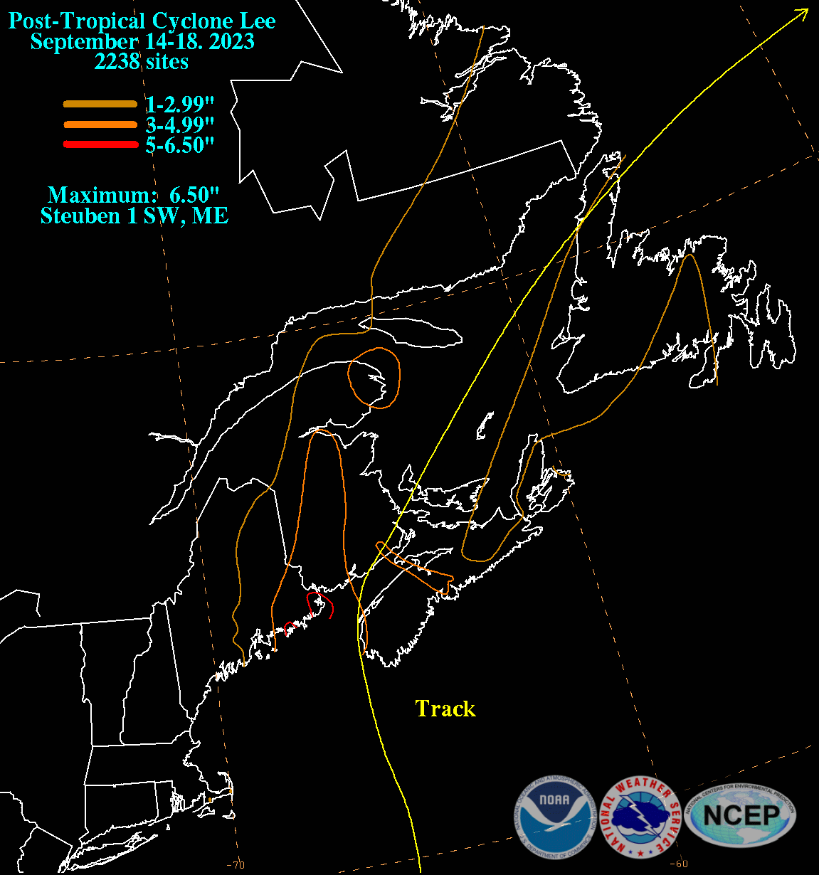
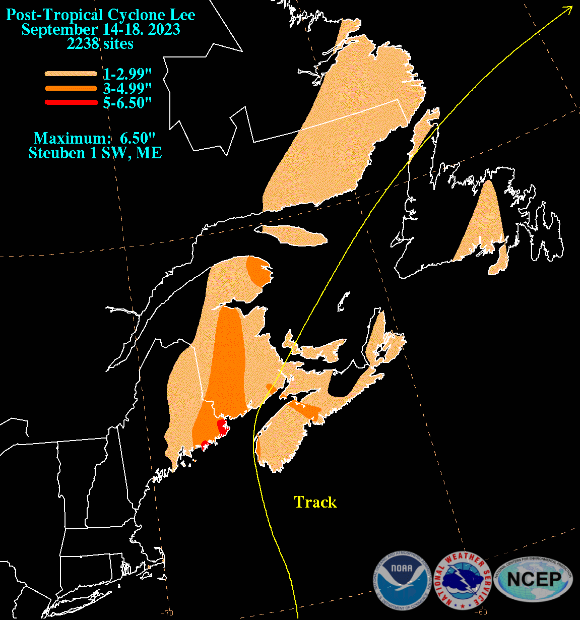
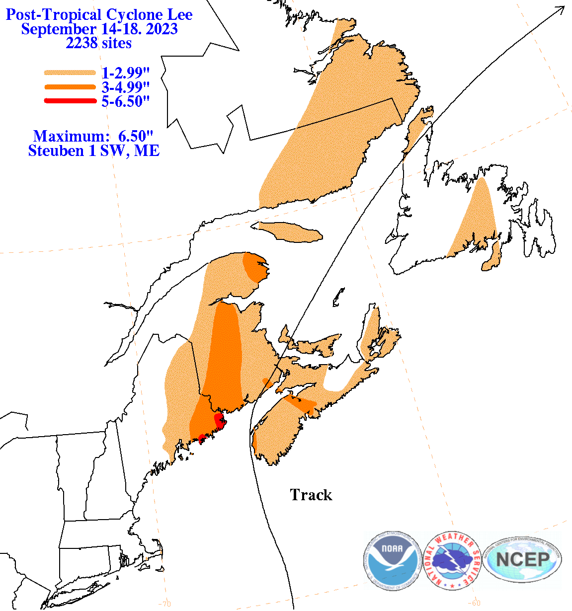
The graphics below show the storm total rainfall for Lee, which used rain gage information from National Weather Service River Forecast Centers, xMACIS2, National Weather Service Forecast Offices, and CoCoRAHS.
 |
 |
 |